Doonside, KwaZulu-Natal
| Doonside | |
|---|---|
 Doonside | |
|
Location within Durban 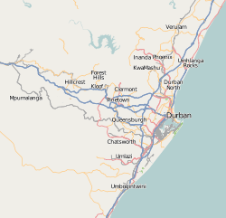 Doonside  Doonside Doonside (South Africa)  Doonside Doonside (Africa) | |
| Coordinates: 30°04′12″S 30°52′16″E / 30.070°S 30.871°ECoordinates: 30°04′12″S 30°52′16″E / 30.070°S 30.871°E | |
| Country | South Africa |
| Province | KwaZulu-Natal |
| Municipality | eThekwini |
| Main Place | Kingsburgh |
| Area[1] | |
| • Total | 1.06 km2 (0.41 sq mi) |
| Population (2011)[1] | |
| • Total | 2,596 |
| • Density | 2,400/km2 (6,300/sq mi) |
| Racial makeup (2011)[1] | |
| • Black African | 16.5% |
| • Coloured | 2.3% |
| • Indian/Asian | 4.8% |
| • White | 76.0% |
| • Other | 0.4% |
| First languages (2011)[1] | |
| • English | 57.9% |
| • Afrikaans | 34.3% |
| • Zulu | 5.0% |
| • Other | 2.7% |
| Time zone | UTC+2 (SAST) |
| Postal code (street) | 4126 |
| PO box | 4135 |
| Area code | 031 |
Doonside is a small coastal resort on the banks of the Little Manzimtoti River in KwaZulu-Natal, South Africa. It is now part of eThekwini.
Holiday resort on the Indian Ocean some 30 km south-west of Durban, between Amanzimtoti and Illovo Beach. At first the siding was called Middleton, after its builder, but to avoid confusion with Middleton in the Cape the name was changed in 1910 to Doonside, after a house called Lorna Doone which overlooked the siding.[2]
References
- 1 2 3 4 "Sub Place Doonside". Census 2011.
- ↑ "Dictionary of Southern African Place Names (Public Domain)". Human Science Research Council. p. 141.
.svg.png)
This article is issued from
Wikipedia.
The text is licensed under Creative Commons - Attribution - Sharealike.
Additional terms may apply for the media files.