Tongaat
| Tongaat | |
|---|---|
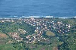 Aerial view of Tongaat | |
 Tongaat  Tongaat Tongaat (South Africa)  Tongaat Tongaat (Africa) | |
| Coordinates: 29°34′00″S 31°07′00″E / 29.56667°S 31.11667°ECoordinates: 29°34′00″S 31°07′00″E / 29.56667°S 31.11667°E | |
| Country | South Africa |
| Province | KwaZulu-Natal |
| Municipality | eThekwini |
| Established | 1945 |
| Area[1] | |
| • Total | 11.72 km2 (4.53 sq mi) |
| Population (2011)[1] | |
| • Total | 42,554 |
| • Density | 3,600/km2 (9,400/sq mi) |
| Racial makeup (2011)[1] | |
| • Black African | 41.1% |
| • Coloured | 1.2% |
| • Indian/Asian | 56.7% |
| • White | 0.4% |
| • Other | 0.5% |
| First languages (2011)[1] | |
| • English | 59.3% |
| • Zulu | 32.3% |
| • Xhosa | 3.6% |
| • S. Ndebele | 1.0% |
| • Other | 3.8% |
| Time zone | UTC+2 (SAST) |
| Postal code (street) | 4399 |
| PO box | 4400 |
| Area code | 032 |
Tongaat is a town in KwaZulu-Natal, South Africa, about 37 kilometres (23 mi) north of Durban and 28 kilometres (17 mi) south of Stanger. It now forms part of eThekwini Metropolitan Municipality, or Greater Durban area. Its population is mostly people of Indian descent. The area is home to the oldest Indian community in South Africa, having been where the first indentured Indian laborers settled in 1860 to work in the sugar-cane plantations.[2] Much of the architectural style in the town was the work of Ivan Mitford-Barberton,[3] and many buildings are in the Cape Dutch style of architecture.
History
Tongaat was established in 1945 and its name was taken from the name of the river which passes by the town:The name of the river, derived from Zulu, is said to mean
| “ | 'it is important to us' or 'you are important because of us', referring to legends involving reaction to a denigrating remark in the first instance, and to Shaka's magnanimous view of a tribe he had just made subservient to him[4] | ” |
In 2017 plans were made for the restoration of the historic railway station building.[5]
Commerce
The town is home to the headquarters of Tongaat Hulett Sugar.[6] Maidstone Sugar Mill, one of the country's first mills, completed in 1850 is nearby.
Sibudu Cave
Sibudu Cave, a cave shelter on the Tongaat River is an important Middle Stone Age site occupied, with some gaps, from 77,000 years ago to 38,000 years ago.[7][8][9][10][11]
Places of worship
Mosques
- Railway Street Mosque.[lower-alpha 1]
- The Habibia Soofie Musjid in Gandhi's Hill, which is over 100 years old.[lower-alpha 2]
Churches
- The Anglican church of All Saints can be found in the historic Tongaat Sugar Company village of Maidstone.[lower-alpha 3]
- St. John's Anglican Church in Hambanathi.[lower-alpha 4]
- Apostolic Faith Mission of South Africa Church in High Street.[lower-alpha 5]
- Tongaat Baptist Church in Buffelsdale.[lower-alpha 6]
- Sacred Heart Catholic Church, Sundial.[lower-alpha 7]
- The Tongaat South Methodist Church, which was opened on 26 September 1979.[lower-alpha 8]
- Westbrook Methodist Church.[lower-alpha 9]
Temples
- The Jugannath Puri Temple which is a provincial heritage site was built in 1901 by Pandit Shrikishan Maharaj.[lower-alpha 10]
- Sri Siva Soobramaniar Temple also known as the Brake Village Temple in Hospital Hill Road, Brake Village[lower-alpha 11] hosts South Africa's largest Kavadi Attam festival,[12]
- The Vishwaroop Temple and Dharmashala was established in 1903. The temple hall is named after Gopal Krishna Gokhale who visited Tongaat and the temple during his visit to South Africa on advice from Mohandas Karamchand Gandhi.[lower-alpha 12]
- Tongaat South Vishnu Temple in Marigold Place, Chelmsford[lower-alpha 13]
- Shree Veeraboga Emperumal Temple at 483 Gopalall Hurbans Road, Gandhis Hill[lower-alpha 14]
- Sandfields Siva Subramaniar Temple[lower-alpha 15]
Notable people
- Ansuyah Ratipul Singh, medical doctor and writer is commemorated with a statue[13] in the Amanzinyama Gardens located at 29°34′13″S 31°07′23″E / 29.570409°S 31.122945°E.
- Cecil Pullan, cricketer
- Colin Munro, cricketer
- Katharine Saunders, botanical illustrator
- Prenelan Subrayen, cricketer
- Quarraisha Abdool Karim, scientist was born here in 1960.[14]
- Thandeka Zulu, actress and musician
- Thomas Hassall, Australian politician
- Two-Boys Gumede, footballer
Notes
- ↑ Railway Street Mosque is located at 29°34′16″S 31°07′07″E / 29.571111°S 31.118506°E
- ↑ The Habibia Soofie Musjid is located at 29°33′54″S 31°07′10″E / 29.565127°S 31.119413°E
- ↑ All Saints Church, Maidstone is located at 29°32′38″S 31°08′13″E / 29.544015°S 31.136883°E
- ↑ St. John's Anglican Church is located at 29°33′14″S 31°07′23″E / 29.553927°S 31.123011°E
- ↑ The AFM church is located at29°34′26″S 31°07′05″E / 29.573789°S 31.118044°E
- ↑ Tongaat Baptist Church is located at 29°34′43″S 31°05′48″E / 29.578487°S 31.096609°E
- ↑ The Sacred Heart church is located at29°33′25″S 31°07′36″E / 29.556992°S 31.126747°E
- ↑ Methodist Church in Chelmsford Heights is located at 29°35′00″S 31°05′54″E / 29.583419°S 31.098256°E
- ↑ Westbrook Methodist Church is located at 29°35′37″S 31°09′48″E / 29.593612°S 31.163317°E
- ↑ The Jugannath Puri Temple is located at 29°34′30″S 31°06′40″E / 29.574978°S 31.111199°E
- ↑ Brake Village Temple is located at 29°34′32″S 31°07′14″E / 29.575437°S 31.120452°E
- ↑ The Vishwaroop Temple is located at 29°34′28″S 31°06′38″E / 29.574494°S 31.110447°E
- ↑ Tongaat South Vishnu Temple is located at 29°34′48″S 31°05′57″E / 29.580116°S 31.099204°E
- ↑ Shree Veeraboga Emperumal Temple is located at 29°33′46″S 31°07′18″E / 29.562832°S 31.121659°E
- ↑ Sandfields Siva Subramaniar Temple is located at 29°32′27″S 31°08′27″E / 29.540963°S 31.140891°E
References
- 1 2 3 4 "Main Place Tongaat". Census 2011.
- ↑ Watson 1960, p. 76, Ch 6.
- ↑ Watson 1960, p. 200.
- ↑ Raper 1989, p. 433.
- ↑ Hitchcock, Lynn (26 January 2017). "Former railway station revamp proposed". News24. Retrieved 2017-10-13.
- ↑ Chalmin 1990, p. 544.
- ↑ "Howiesons Poort may prove humans were 'home bodies' 58,000 years ago". businesslive.co.za. 6 October 2017. Retrieved 2017-10-13.
- ↑ "Local boy rewrites human history". North Coast Courier. 4 October 2017. Retrieved 2017-10-13.
- ↑ Troskie, Allan (12 August 2017). "Sibudu rock shelter set for heritage status?". North Coast Courier. Retrieved 2017-10-13.
- ↑ MNGOMA, NOSIPHO (15 April 2016). "Alien wars in Durban cave". Daily News. Durban. Retrieved 2017-10-13.
- ↑ BORKHATARIA, CECILE (10 October 2017). "When ancient humans began to 'settle down': Stone Age tools reveal people shifted from mobile lifestyle 58,000 years ago". Mail Online. Retrieved 2017-10-13.
- ↑ Harrison 2004, p. 81.
- ↑ "Dr Ansuyah Ratipul Singh". South African History Online. 17 February 2011. Retrieved 2017-10-13.
- ↑ Oppenheimer & Bayer 2007, p. 247.
- Chalmin, Philippe (1990). The Making of a Sugar Giant: Tate and Lyle, 1859-1989. Taylor & Francis. ISBN 978-3-7186-0434-0.
- Harrison, Philip (2004). South Africa's Top Sites: Spiritual. New Africa Books. ISBN 978-0-86486-564-9.
- Oppenheimer, Gerald M.; Bayer, Ronald (2007). Shattered Dreams: An Oral History of the South African AIDS Epidemic. Oxford University Press, USA. ISBN 978-0-19-530730-6.
- Raper, P. E. (1989). Dictionary of Southern African Place Names. J. Ball. ISBN 978-0-947464-04-2.
- Watson, Robert George Theodor (1960). Tongaati: An African Experiment. Hutchinson.
Further reading
- Hale, Emiline (1928). The thrills of Tiny Tongaat. Religious Tract Society.
- Reddy, E (1977). Religion and Rituals Amongst Hindus in Tongaat. University of Durban-Westville, Department of Anthropology. *Robert George Theodor, Watson (1960). Tongaati: an African experiment. Hutchinson.
- Petraglia, Michael D.; de la Peña, Paloma; Wadley, Lyn (2017). "Technological variability at Sibudu Cave: The end of Howiesons Poort and reduced mobility strategies after 62,000 years ago". PLOS ONE. 12 (10): e0185845. doi:10.1371/journal.pone.0185845. ISSN 1932-6203.
External links
- Vishwaroop Temple and Dharmashala
- Jugannath Puri Temple
- KZN: A Photographic and Historical Record
- Architectural Impact Assessment for properties affected by the proposed Tongaat Hulett uShukela Highway Project, Tongaat, eThekwini Metropolitan Council
.svg.png)