Glenwood, KwaZulu-Natal
| Glenwood, Durban | |
|---|---|
 Glenwood, Durban | |
|
Location within Durban 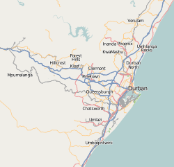 Glenwood, Durban  Glenwood, Durban Glenwood, Durban (South Africa)  Glenwood, Durban Glenwood, Durban (Africa) | |
| Coordinates: 29°53′S 30°59′E / 29.883°S 30.983°ECoordinates: 29°53′S 30°59′E / 29.883°S 30.983°E | |
| Country | South Africa |
| Province | KwaZulu-Natal |
| Municipality | eThekwini |
| Main Place | Durban |
| Area[1] | |
| • Total | 1.66 km2 (0.64 sq mi) |
| Population (2001) | |
| • Total | 5,617[1] |
| Racial makeup (2001) | |
| • Black African | 21.2% |
| • Coloured | 2.35% |
| • Indian/Asian | 6.2% |
| • White | 70.3% |
| First languages (2001) | |
| • English | 75.1% |
| • Zulu | 15.4% |
| • Afrikaans | 4.6% |
| • Xhosa | 2.7% |
| Time zone | UTC+2 (SAST) |
| Postal code (street) | 4001 |
| Area code | 031 |
Glenwood is a suburb on the lower Berea in Durban, KwaZulu-Natal, South Africa.
Schools in the area include Glenwood High School, Glenwood Preparatory School (formerly Parkview Primary School), Glenwood Junior Primary School, Open Air School, Penzance Primary School, St. Henry's Marist Brothers' College and Durban Girls' High School.
References
- 1 2 "Sub Place Glenwood". Census 2001.
.svg.png)
This article is issued from
Wikipedia.
The text is licensed under Creative Commons - Attribution - Sharealike.
Additional terms may apply for the media files.