Umbilo, Durban
| Umbilo | |
|---|---|
 Umbilo | |
|
Location within Durban 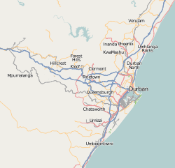 Umbilo  Umbilo Umbilo (South Africa)  Umbilo Umbilo (Africa) | |
| Coordinates: 29°53′11″S 30°58′40″E / 29.88639°S 30.97778°ECoordinates: 29°53′11″S 30°58′40″E / 29.88639°S 30.97778°E | |
| Country | South Africa |
| Province | KwaZulu-Natal |
| Municipality | eThekwini |
| Main Place | Durban |
| Area[1] | |
| • Total | 3.01 km2 (1.16 sq mi) |
| Population (2001) | |
| • Total | 11,311[1] |
| Racial makeup (2001) | |
| • Black African | 30.6% |
| • Coloured | 4.8% |
| • Indian/Asian | 8.3% |
| • White | 56.3% |
| First languages (2001) | |
| • English | 64.4% |
| • Zulu | 23.2% |
| • Afrikaans | 6.4% |
| • Xhosa | 3.0% |
| • Other | 3.0% |
| Time zone | UTC+2 (SAST) |
| Postal code (street) | 4001 |
| PO box | 4075 |
| Area code | 031 |
Umbilo is a central suburb of Durban, KwaZulu-Natal, South Africa.
The name is taken from the Umbilo River that flows through Pinetown and Queensburgh via the Umbilo canal and eventually into Natal Bay at Bayhead. Also written as Mbilo, it is of Zulu origin, meaning "boiling".
References
- 1 2 "Sub Place Umbilo". Census 2001.
.svg.png)
This article is issued from
Wikipedia.
The text is licensed under Creative Commons - Attribution - Sharealike.
Additional terms may apply for the media files.