La Lucia
| La Lucia | |
|---|---|
 La Lucia | |
|
Location within Durban 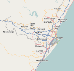 La Lucia  La Lucia La Lucia (South Africa)  La Lucia La Lucia (Africa) | |
| Coordinates: 29°45′00″S 31°03′29″E / 29.750°S 31.058°ECoordinates: 29°45′00″S 31°03′29″E / 29.750°S 31.058°E | |
| Country | South Africa |
| Province | KwaZulu-Natal |
| Municipality | eThekwini |
| Main Place | Umhlanga, KwaZulu-Natal |
| Area[1] | |
| • Total | 4.11 km2 (1.59 sq mi) |
| Population (2011)[1] | |
| • Total | 6,414 |
| • Density | 1,600/km2 (4,000/sq mi) |
| Racial makeup (2011)[1] | |
| • Black African | 16.8% |
| • Coloured | 2.5% |
| • Indian/Asian | 19.8% |
| • White | 59.4% |
| • Other | 1.4% |
| First languages (2011)[1] | |
| • English | 80.3% |
| • Zulu | 8.2% |
| • Afrikaans | 6.2% |
| • Xhosa | 1.1% |
| • Other | 4.2% |
| Time zone | UTC+2 (SAST) |
| Postal code (street) | 4051 |
| PO box | 4159 |
La Lucia is a suburb within Umhlanga, KwaZulu-Natal located in the northern area of Durban, in the KwaZulu-Natal province of South Africa. It was named after Lucia Michel. She and her husband Albert Michel founded the sugar cane farm La Lucia.
Education
Crawford College, La Lucia, established in 1999, is a large private school located in the suburb. La Lucia Junior Primary and Victory Christian Academy are also located in La Lucia.
Demographics
Many houses have been developed recently in La Lucia with the population growing substantially between 2001 and 2011. The population rose 121% from 2,899 to 6,414. Black Africans, Indians and Asians, saw an especially large increase in numbers.[1][2]
References
- 1 2 3 4 5 "Sub Place La Lucia". Census 2011.
- ↑ http://census2001.adrianfrith.com/place/57286002
.svg.png)
This article is issued from
Wikipedia.
The text is licensed under Creative Commons - Attribution - Sharealike.
Additional terms may apply for the media files.