Westville, KwaZulu-Natal
| Westville | |
|---|---|
 Westville | |
|
Location within Durban 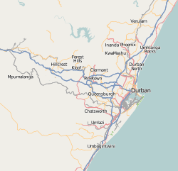 Westville  Westville Westville (South Africa)  Westville Westville (Africa) | |
| Coordinates: 29°49′52″S 30°55′30″E / 29.831°S 30.925°ECoordinates: 29°49′52″S 30°55′30″E / 29.831°S 30.925°E | |
| Country | South Africa |
| Province | KwaZulu-Natal |
| Municipality | eThekwini |
| Area[1] | |
| • Total | 30.76 km2 (11.88 sq mi) |
| Population (2011)[1] | |
| • Total | 30,508 |
| • Density | 990/km2 (2,600/sq mi) |
| Racial makeup (2011)[1] | |
| • Black African | 32.5% |
| • Coloured | 2.6% |
| • Indian/Asian | 22.1% |
| • White | 42.0% |
| • Other | 0.7% |
| First languages (2011)[1] | |
| • English | 72.2% |
| • Zulu | 17.3% |
| • Afrikaans | 5.4% |
| • Xhosa | 1.9% |
| • Other | 3.2% |
| Time zone | UTC+2 (SAST) |
| Postal code (street) | 3629 |
| PO box | 3630 |
Westville is an area west of Durban, and a formerly independent town, in the eThekwini Metropolitan Municipality, South Africa. Westville is situated 10 km inland from the Durban CBD.
Westville is also central to several main townships, namely Cato Manor, Clermont and Chesterville. Considered one of Durban's wealthier suburbs, Westville has in recent years been the target of a high concentration of house break-ins (burglaries) and car hijackings. This has led to many streets in the suburbs being gated by private security companies.
History
It was laid out on the farm Westville (named in honour of Martin West, the first British lieutenant-governor of Natal)[2] and formed in 1847. It developed from a settlement of German immigrants who arrived in 1848, and was proclaimed a borough in 1956. before being incorporated into eThekwini as part of the post-apartheid reorganization of South Africa's municipalities.
Education
Schools situated in Westville include Westville Boys' High School, Westville Girls' High School, Atholl Heights Primary School, Berea West Junior Primary School, Berea West Senior Primary School, Pitlochry Primary School, Westville Senior Primary and the Deutsche Schule Durban. Higher education centres include a 2-square-kilometre campus of University of KwaZulu-Natal (formerly the University of Durban-Westville) and Varsity College (Westville campus).
Specialist schools such as The International Hotel School, based at the Westville Hotel and The Fusion Cooking School can also be found in Westville.
Religion
There are several churches in Westville, including the Westville Catholic Church, Our Lady of Lourdes, situated in the town centre, the Methodist Church, the Westville Baptist Church,[3] St Elizabeth's Anglican Church and OneCity Church,[4] who meet at the Westville Country Club. The major mosque in Westville is Habibia Soofie Masjid, located opposite Westville Boys High School. It is a Soofie mosque.[5]
Prison
Westville Prison is one of the largest prisons in the country and the only prison located in the Durban area.
Shopping centres
Westville has three notable shopping centres:
- Westwood Mall, situated close to the University of KwaZulu-Natal, Westville campus
- Westville Mall
- The Pavilion Mall, the largest shopping centre in Westville and the second largest in the Durban area, after Gateway Theatre of Shopping
Attractions
Tourist attractions include Westville's Palmiet Nature Reserve which has 15 km of guided and self-guided trails. Further afield tourists can experience the evergreen Western Inland Route and KwaZulu's regional attractions, including The Drakensberg (Barrier of Spears) Battlefields Tours, Game Reserves and Zululand are within a 2–3-hour drive. A large Anglo-German Historical Route exists with numerous churches, museums and grave sites depicting the early settlement struggles of the early Colonial Days.
References
- 1 2 3 4 "Main Place Westville". Census 2011.
- ↑ "Dictionary of Southern African Place Names (Public Domain)". Human Science Research Council. p. 473.
- ↑ "Home - WBC". www.WestvilleBaptist.co.za. Retrieved 15 June 2017.
- ↑ "WELCOME". one city. Retrieved 15 June 2017.
- ↑ "SA Qur'anic Institutions Database". Retrieved 27 August 2011.
.svg.png)