Tubo, Abra
| Tubo | ||
|---|---|---|
| Municipality | ||
| Municipality of Tubo | ||
| ||
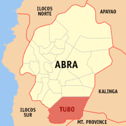 Map of Abra with Tubo highlighted | ||
.svg.png) Tubo Location within the Philippines | ||
| Coordinates: 17°16′N 120°44′E / 17.26°N 120.73°ECoordinates: 17°16′N 120°44′E / 17.26°N 120.73°E | ||
| Country |
| |
| Region | Cordillera Administrative Region (CAR) | |
| Province | Abra | |
| District | Lone District | |
| Barangays | 10 (see Barangays) | |
| Government [1] | ||
| • Type | Sangguniang Bayan | |
| • Mayor | Guilbert P. Ballangan | |
| • Electorate | 3,378 voters (2016) | |
| Area [2] | ||
| • Total | 409.87 km2 (158.25 sq mi) | |
| Population (2015 census)[3] | ||
| • Total | 5,699 | |
| • Density | 14/km2 (36/sq mi) | |
| Time zone | UTC+8 (PST) | |
| ZIP code | 2814 | |
| PSGC | 140126000 | |
| IDD : area code | +63 (0)74 | |
| Climate type | Tropical rainforest climate | |
| Income class | 4th municipal income class | |
| Revenue (₱) | 82,584,530.47 (2016) | |
| Native languages |
Itneg language Ilocano Tagalog | |

Tubo, officially the Municipality of Tubo, (Ilokano: Ili ti Tubo; Tagalog: Bayan ng Tubo), is a 4th class municipality in the province of Abra, Philippines. According to the 2015 census, it has a population of 5,699 people.[3]
The municipality was created on June 17, 1967 from the former municipal district of the same name, through Republic Act 5161.[4]
History
The inhabitants belong to the Maeng tribe and speak the dialect of the same name. There is however one barangay, Tabacda, that speaks a different dialect. This is because they are believed to have originated from Kalinga and Mountain Province. Everyone can however understand and speak the common evolving dialect called Maeng together with those of Luba and parts of Villavicioa of the Province of Abra and likewise in the other municipalities of the Province of Ilocos Sur, who refer themselves as the Bago tribe.
Agriculture is the main source of livelihood but various industries are starting to grow.
All barangays and their respective sitios do now have dirt roads leading to them but can still become accessible via trails permanently established even during the Spanish era. Electricity is available except in only one barangay and two sitios. The relative nearness of the three barangays of Dilong,Tubtuba and Alangtin to the Province of Ilocos Sur provided them the privilege of being served by ISECO while all others remaining are served by ABRECO.
Geography
Tubo is located at 17°16′N 120°44′E / 17.26°N 120.73°E.
According to the Philippine Statistics Authority, the municipality has a land area of 409.87 square kilometres (158.25 sq mi) [2] constituting 9.84% of the 4,165.25-square-kilometre- (1,608.21 sq mi) total area of Abra.
It is situated approximately 55 kilometres (34 mi) from the provincial capital Bangued, and is at the southern tip of Abra. The town is bounded on the west by Ilocos Sur and Luba, Abra, north by Boliney, east by Kalinga and Mountain Province, and south by Mountain Province and Ilocos Sur.
Tubo can be reached through various routes. Coming from Bangued, the place can be reached by passing through the towns of Peñarrubia-Bucay-Manabo and Luba. It could also be reached via Candon-San Emilio and Tagudin-Quirino of the nearby province of Ilocos Sur, or via Besao of Mountain Province or Kalinga. Unfortunately, no road links exist herein.
Barangays
Tubo is politically subdivided into 10 barangays.[5]
| PSGC | Barangay | Population | ±% p.a. | |||
|---|---|---|---|---|---|---|
| 2015[3] | 2010[6] | |||||
| 140126001 | Alangtin | 9.7% | 552 | 650 | −3.06% | |
| 140126002 | Amtuagan | 8.6% | 492 | 494 | −0.08% | |
| 140126003 | Dilong | 14.3% | 814 | 818 | −0.09% | |
| 140126004 | Kili | 7.3% | 414 | 426 | −0.54% | |
| 140126005 | Poblacion (Mayabo) | 10.2% | 581 | 582 | −0.03% | |
| 140126006 | Supo | 13.4% | 762 | 732 | 0.77% | |
| 140126010 | Tabacda | 5.1% | 289 | 246 | 3.11% | |
| 140126007 | Tiempo | 14.8% | 843 | 800 | 1.00% | |
| 140126008 | Tubtuba | 7.8% | 442 | 491 | −1.98% | |
| 140126009 | Wayangan | 8.9% | 510 | 480 | 1.16% | |
| Total | 5,699 | 5,719 | −0.07% | |||
The 10 barangays are grouped into three (3) zones:
- Zone 1: Poblacion (Mayabo), Wayangan and Supo
- Zone 2: Tiempo, Kili, Tabacda and Amtuagan
- Zone 3: Alangtin-Batayan, Tubtuba and Dilong
Demographics
| Population census of Tubo | ||
|---|---|---|
| Year | Pop. | ±% p.a. |
| 1918 | 2,022 | — |
| 1939 | 3,041 | +1.96% |
| 1948 | 1,981 | −4.65% |
| 1960 | 4,198 | +6.46% |
| 1970 | 4,386 | +0.44% |
| 1975 | 4,018 | −1.74% |
| 1980 | 4,985 | +4.41% |
| 1990 | 4,589 | −0.82% |
| 1995 | 4,344 | −1.02% |
| 2000 | 5,044 | +3.25% |
| 2007 | 5,588 | +1.42% |
| 2010 | 5,719 | +0.85% |
| 2015 | 5,699 | −0.07% |
| Source: Philippine Statistics Authority[3][6][7][8] | ||
In the 2015 census, Tubo had a population of 5,699.[3] The population density was 14 inhabitants per square kilometre (36/sq mi).
References
- ↑ "Municipality". Quezon City, Philippines: Department of the Interior and Local Government. Retrieved 31 May 2013.
- 1 2 "Province: Abra". PSGC Interactive. Quezon City, Philippines: Philippine Statistics Authority. Retrieved 12 November 2016.
- 1 2 3 4 5 Census of Population (2015). "Cordillera Administrative Region (CAR)". Total Population by Province, City, Municipality and Barangay. PSA. Retrieved 20 June 2016.
- ↑ "Republic Act No. 5161 - An Act Creating the Municipality of Tubo in the Province of Abra". Chan Robles Virtual Law Library. 17 June 1967. Retrieved 17 February 2016.
- ↑ "Municipal: Tubo, Abra". PSGC Interactive. Quezon City, Philippines: Philippine Statistics Authority. Retrieved 8 January 2016.
- 1 2 Census of Population and Housing (2010). "Cordillera Administrative Region (CAR)". Total Population by Province, City, Municipality and Barangay. NSO. Retrieved 29 June 2016.
- ↑ Censuses of Population (1903–2007). "Cordillera Administrative Region (CAR)". Table 1. Population Enumerated in Various Censuses by Province/Highly Urbanized City: 1903 to 2007. NSO.
- ↑ "Province of Abra". Municipality Population Data. Local Water Utilities Administration Research Division. Retrieved 17 December 2016.
External links
| Wikimedia Commons has media related to Tubo, Abra. |
Places adjacent to Tubo, Abra | |
|---|---|
Bangued (capital) | |
| Municipalities | |
| Barangays | |