Malibcong, Abra
| Malibcong | |
|---|---|
| Municipality | |
| Municipality of Malibcong | |
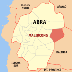 Map of Abra with Malibcong highlighted | |
.svg.png) Malibcong Location within the Philippines | |
| Coordinates: 17°34′N 120°59′E / 17.56°N 120.99°ECoordinates: 17°34′N 120°59′E / 17.56°N 120.99°E | |
| Country |
|
| Region | Cordillera Administrative Region (CAR) |
| Province | Abra |
| District | Lone District |
| Barangays | 12 (see Barangays) |
| Government [1] | |
| • Type | Sangguniang Bayan |
| • Mayor | Benido G. Bacuyag |
| • Electorate | 2,856 voters (2016) |
| Area [2] | |
| • Total | 283.17 km2 (109.33 sq mi) |
| Population (2015 census)[3] | |
| • Total | 3,428 |
| • Density | 12/km2 (31/sq mi) |
| Time zone | UTC+8 (PST) |
| ZIP code | 2820 |
| PSGC | 140115000 |
| IDD : area code | +63 (0)74 |
| Climate type | Tropical rainforest climate |
| Income class | 5th municipal income class |
| Revenue (₱) | 72,788,927.50 (2016) |
| Native languages |
Itneg language Ilocano Tagalog |
Malibcong, officially the Municipality of Malibcong, (Ilokano: Ili ti Malibcong; Tagalog: Bayan ng Malibcong), is a 5th class municipality in the province of Abra, Philippines. According to the 2015 census, it has a population of 3,428 people.[3]
Geography
Malibcong is located at 17°34′N 120°59′E / 17.56°N 120.99°E.
According to the Philippine Statistics Authority, the municipality has a land area of 283.17 square kilometres (109.33 sq mi) [2] constituting 6.80% of the 4,165.25-square-kilometre- (1,608.21 sq mi) total area of Abra.
Barangays
Malibcong is politically subdivided into 12 barangays.[4]
| PSGC | Barangay | Population | ±% p.a. | |||
|---|---|---|---|---|---|---|
| 2015[3] | 2010[5] | |||||
| 140115001 | Bayabas | 6.0% | 206 | 218 | −1.07% | |
| 140115002 | Binasaran | 5.0% | 172 | 191 | −1.98% | |
| 140115003 | Buanao | 7.9% | 270 | 345 | −4.56% | |
| 140115004 | Dulao | 6.0% | 205 | 223 | −1.59% | |
| 140115005 | Duldulao | 9.0% | 307 | 362 | −3.09% | |
| 140115006 | Gacab | 11.9% | 408 | 433 | −1.13% | |
| 140115007 | Lat-ey | 6.0% | 204 | 203 | 0.09% | |
| 140115008 | Malibcong (Poblacion) | 15.1% | 516 | 567 | −1.78% | |
| 140115009 | Mataragan | 13.8% | 474 | 526 | −1.96% | |
| 140115010 | Pacgued | 6.9% | 235 | 229 | 0.49% | |
| 140115011 | Taripan | 5.2% | 177 | 232 | −5.02% | |
| 140115012 | Umnap | 7.4% | 254 | 278 | −1.70% | |
| Total | 3,428 | 3,807 | −1.98% | |||
Demographics
| Population census of Malibcong | ||
|---|---|---|
| Year | Pop. | ±% p.a. |
| 1939 | 1,648 | — |
| 1948 | 1,676 | +0.19% |
| 1960 | 2,163 | +2.15% |
| 1970 | 3,158 | +3.85% |
| 1975 | 2,817 | −2.27% |
| 1980 | 3,108 | +1.98% |
| 1990 | 3,494 | +1.18% |
| 1995 | 3,870 | +1.93% |
| 2000 | 3,806 | −0.36% |
| 2007 | 3,354 | −1.73% |
| 2010 | 3,807 | +4.72% |
| 2015 | 3,428 | −1.98% |
| Source: Philippine Statistics Authority[3][5][6][7] | ||
In the 2015 census, Malibcong had a population of 3,428.[3] The population density was 12 inhabitants per square kilometre (31/sq mi).
The Itneg tribe can be found in Malibcong and they speak a sub-dialect of Banao Itneg language, and Ilocano. There are three dialects in malibcong: Banao, Gubang and Mabaka.
References
- ↑ "Municipality". Quezon City, Philippines: Department of the Interior and Local Government. Retrieved 31 May 2013.
- 1 2 "Province: Abra". PSGC Interactive. Quezon City, Philippines: Philippine Statistics Authority. Retrieved 12 November 2016.
- 1 2 3 4 5 Census of Population (2015). "Cordillera Administrative Region (CAR)". Total Population by Province, City, Municipality and Barangay. PSA. Retrieved 20 June 2016.
- ↑ "Municipal: Malibcong, Abra". PSGC Interactive. Quezon City, Philippines: Philippine Statistics Authority. Retrieved 8 January 2016.
- 1 2 Census of Population and Housing (2010). "Cordillera Administrative Region (CAR)". Total Population by Province, City, Municipality and Barangay. NSO. Retrieved 29 June 2016.
- ↑ Censuses of Population (1903–2007). "Cordillera Administrative Region (CAR)". Table 1. Population Enumerated in Various Censuses by Province/Highly Urbanized City: 1903 to 2007. NSO.
- ↑ "Province of Abra". Municipality Population Data. Local Water Utilities Administration Research Division. Retrieved 17 December 2016.
External links
| Wikimedia Commons has media related to Malibcong, Abra. |
Places adjacent to Malibcong, Abra | |
|---|---|
Bangued (capital) | |
| Municipalities | |
| Barangays | |