San Isidro, Abra
| San Isidro | |
|---|---|
| Municipality | |
| Municipality of San Isidro | |
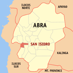 Map of Abra with San Isidro highlighted | |
.svg.png) San Isidro Location within the Philippines | |
| Coordinates: 17°28′N 120°36′E / 17.47°N 120.6°ECoordinates: 17°28′N 120°36′E / 17.47°N 120.6°E | |
| Country |
|
| Region | Cordillera Administrative Region (CAR) |
| Province | Abra |
| District | Lone District |
| Barangays | 9 (see Barangays) |
| Government [1] | |
| • Type | Sangguniang Bayan |
| • Mayor | Ernesto M. Pacsa Jr. |
| • Electorate | 3,063 voters (2016) |
| Area [2] | |
| • Total | 48.07 km2 (18.56 sq mi) |
| Population (2015 census)[3] | |
| • Total | 4,574 |
| • Density | 95/km2 (250/sq mi) |
| Time zone | UTC+8 (PST) |
| ZIP code | 2809 |
| PSGC | 140121000 |
| IDD : area code | +63 (0)74 |
| Climate type | Tropical rainforest climate |
| Income class | 5th municipal income class |
| Revenue (₱) | 158,455,186.02 (2016) |
| Native languages |
Itneg language Ilocano Tagalog |
San Isidro, officially the Municipality of San Isidro, (Ilokano: Ili ti San Isidro; Tagalog: Bayan ng San Isidro), is a 5th class municipality in the province of Abra, Philippines. According to the 2015 census, it has a population of 4,574 people.[3]
Geography
San Isidro is located at 17°28′N 120°36′E / 17.47°N 120.6°E.
According to the Philippine Statistics Authority, the municipality has a land area of 48.07 square kilometres (18.56 sq mi) [2] constituting 1.15% of the 4,165.25-square-kilometre- (1,608.21 sq mi) total area of Abra.
Barangays
San Isidro is politically subdivided into 9 barangays.[4]
| PSGC | Barangay | Population | ±% p.a. | |||
|---|---|---|---|---|---|---|
| 2015[3] | 2010[5] | |||||
| 140121001 | Cabayogan | 6.6% | 304 | 301 | 0.19% | |
| 140121002 | Dalimag | 15.0% | 687 | 767 | −2.08% | |
| 140121003 | Langbaban | 7.6% | 347 | 342 | 0.28% | |
| 140121004 | Manayday | 12.7% | 581 | 601 | −0.64% | |
| 140121007 | Pantoc | 9.3% | 425 | 422 | 0.13% | |
| 140121008 | Poblacion | 13.9% | 634 | 645 | −0.33% | |
| 140121010 | Sabtan-olo | 7.4% | 337 | 330 | 0.40% | |
| 140121012 | San Marcial | 13.5% | 619 | 769 | −4.05% | |
| 140121013 | Tangbao | 14.0% | 640 | 711 | −1.98% | |
| Total | 4,574 | 4,888 | −1.26% | |||
Demographics
| Population census of San Isidro | ||
|---|---|---|
| Year | Pop. | ±% p.a. |
| 1960 | 2,605 | — |
| 1970 | 3,098 | +1.75% |
| 1975 | 2,924 | −1.15% |
| 1980 | 3,087 | +1.09% |
| 1990 | 3,744 | +1.95% |
| 1995 | 3,842 | +0.49% |
| 2000 | 4,293 | +2.41% |
| 2007 | 4,647 | +1.10% |
| 2010 | 4,888 | +1.86% |
| 2015 | 4,574 | −1.26% |
| Source: Philippine Statistics Authority[3][5][6][7] | ||
In the 2015 census, San Isidro had a population of 4,574.[3] The population density was 95 inhabitants per square kilometre (250/sq mi).
References
- ↑ "Municipality". Quezon City, Philippines: Department of the Interior and Local Government. Retrieved 31 May 2013.
- 1 2 "Province: Abra". PSGC Interactive. Quezon City, Philippines: Philippine Statistics Authority. Retrieved 12 November 2016.
- 1 2 3 4 5 Census of Population (2015). "Cordillera Administrative Region (CAR)". Total Population by Province, City, Municipality and Barangay. PSA. Retrieved 20 June 2016.
- ↑ "Municipal: San Isidro, Abra". PSGC Interactive. Quezon City, Philippines: Philippine Statistics Authority. Retrieved 8 January 2016.
- 1 2 Census of Population and Housing (2010). "Cordillera Administrative Region (CAR)". Total Population by Province, City, Municipality and Barangay. NSO. Retrieved 29 June 2016.
- ↑ Censuses of Population (1903–2007). "Cordillera Administrative Region (CAR)". Table 1. Population Enumerated in Various Censuses by Province/Highly Urbanized City: 1903 to 2007. NSO.
- ↑ "Province of Abra". Municipality Population Data. Local Water Utilities Administration Research Division. Retrieved 17 December 2016.
External links
| Wikimedia Commons has media related to San Isidro, Abra. |
Places adjacent to San Isidro, Abra | ||||||||||
|---|---|---|---|---|---|---|---|---|---|---|
| ||||||||||
Bangued (capital) | |
| Municipalities | |
| Barangays | |
This article is issued from
Wikipedia.
The text is licensed under Creative Commons - Attribution - Sharealike.
Additional terms may apply for the media files.