Daguioman, Abra
| Daguioman | ||
|---|---|---|
| Municipality | ||
| Municipality of Daguioman | ||
| ||
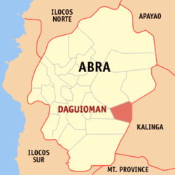 Map of Abra with Daguioman highlighted | ||
.svg.png) Daguioman Location within the Philippines | ||
| Coordinates: 17°28′N 120°56′E / 17.46°N 120.93°ECoordinates: 17°28′N 120°56′E / 17.46°N 120.93°E | ||
| Country |
| |
| Region | Cordillera Administrative Region (CAR) | |
| Province | Abra | |
| District | Lone District | |
| Barangays | 4 (see Barangays) | |
| Government [1] | ||
| • Type | Sangguniang Bayan | |
| • Mayor | Salma Q. Padilla | |
| • Electorate | 1,291 voters (2016) | |
| Area [2] | ||
| • Total | 114.37 km2 (44.16 sq mi) | |
| Population (2015 census)[3] | ||
| • Total | 2,088 | |
| • Density | 18/km2 (47/sq mi) | |
| Time zone | UTC+8 (PST) | |
| ZIP code | 2816 | |
| PSGC | 140105000 | |
| IDD : area code | +63 (0)74 | |
| Climate type | Tropical rainforest climate | |
| Income class | 5th municipal income class | |
| Revenue (₱) | 51,091,356.58 (2016) | |
| Native languages |
Itneg language Ilocano Tagalog | |

Daguioman, officially the Municipality of Daguioman, (Ilokano: Ili ti Daguioman; Tagalog: Bayan ng Daguioman), is a 5th class municipality in the province of Abra, Philippines. According to the 2015 census, it has a population of 2,088 people.[3]
Geography
Daguioman is located at 17°28′N 120°56′E / 17.46°N 120.93°E.
According to the Philippine Statistics Authority, the municipality has a land area of 114.37 square kilometres (44.16 sq mi) [2] constituting 2.75% of the 4,165.25-square-kilometre- (1,608.21 sq mi) total area of Abra.
Barangays
Daguioman is politically subdivided into 4 barangays.[4]
| PSGC | Barangay | Population | ±% p.a. | |||
|---|---|---|---|---|---|---|
| 2015[3] | 2010[5] | |||||
| 140105001 | Ableg | 10.2% | 213 | 175 | 3.81% | |
| 140105002 | Cabaruyan | 23.9% | 500 | 412 | 3.75% | |
| 140105003 | Pikek | 19.6% | 410 | 313 | 5.27% | |
| 140105004 | Tui (Poblacion) | 46.2% | 965 | 815 | 3.27% | |
| Total | 2,088 | 1,715 | 3.82% | |||
Demographics
| Population census of Daguioman | ||
|---|---|---|
| Year | Pop. | ±% p.a. |
| 1939 | 596 | — |
| 1948 | 666 | +1.24% |
| 1960 | 1,003 | +3.47% |
| 1970 | 1,050 | +0.46% |
| 1975 | 1,124 | +1.38% |
| 1980 | 1,254 | +2.21% |
| 1990 | 1,413 | +1.20% |
| 1995 | 1,475 | +0.81% |
| 2000 | 1,748 | +3.71% |
| 2007 | 1,916 | +1.27% |
| 2010 | 1,715 | −3.95% |
| 2015 | 2,088 | +3.82% |
| Source: Philippine Statistics Authority[3] [5] [6] [7] | ||
In the 2015 census, Daguioman had a population of 2,088.[3] The population density was 18 inhabitants per square kilometre (47/sq mi). Daguioman is the home of the Banao tribe of Itneg.
References
- ↑ "Municipality". Quezon City, Philippines: Department of the Interior and Local Government. Retrieved 31 May 2013.
- 1 2 "Province: Abra". PSGC Interactive. Quezon City, Philippines: Philippine Statistics Authority. Retrieved 12 November 2016.
- 1 2 3 4 5 Census of Population (2015). "Cordillera Administrative Region (CAR)". Total Population by Province, City, Municipality and Barangay. PSA. Retrieved 20 June 2016.
- ↑ "Municipal: Daguioman, Abra". PSGC Interactive. Quezon City, Philippines: Philippine Statistics Authority. Retrieved 8 January 2016.
- 1 2 Census of Population and Housing (2010). "Cordillera Administrative Region (CAR)". Total Population by Province, City, Municipality and Barangay. NSO. Retrieved 29 June 2016.
- ↑ Censuses of Population (1903–2007). "Cordillera Administrative Region (CAR)". Table 1. Population Enumerated in Various Censuses by Province/Highly Urbanized City: 1903 to 2007. NSO.
- ↑ "Province of Abra". Municipality Population Data. Local Water Utilities Administration Research Division. Retrieved 17 December 2016.
External links
| Wikimedia Commons has media related to Daguioman, Abra. |
Places adjacent to Daguioman, Abra | |
|---|---|
Bangued (capital) | |
| Municipalities | |
| Barangays | |