San Quintin, Abra
| San Quintin | |
|---|---|
| Municipality | |
| Municipality of San Quintin | |
 Downtown area | |
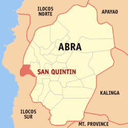 Map of Abra with San Quintin highlighted | |
.svg.png) San Quintin Location within the Philippines | |
| Coordinates: 17°32′N 120°31′E / 17.54°N 120.52°ECoordinates: 17°32′N 120°31′E / 17.54°N 120.52°E | |
| Country |
|
| Region | Cordillera Administrative Region (CAR) |
| Province | Abra |
| District | Lone District |
| Barangays | 6 (see Barangays) |
| Government [1] | |
| • Type | Sangguniang Bayan |
| • Mayor | Amador B. Diaz |
| • Electorate | 4,166 voters (2016) |
| Area [2] | |
| • Total | 66.59 km2 (25.71 sq mi) |
| Population (2015 census)[3] | |
| • Total | 5,438 |
| • Density | 82/km2 (210/sq mi) |
| Time zone | UTC+8 (PST) |
| ZIP code | 2808 |
| PSGC | 140123000 |
| IDD : area code | +63 (0)74 |
| Climate type | Tropical rainforest climate |
| Income class | 5th municipal income class |
| Revenue (₱) | 64,468,717.62 (2016) |
| Native languages |
Itneg language Ilocano Tagalog |
San Quintin, officially the Municipality of San Quintin, (Ilokano: Ili ti San Quintin; Tagalog: Bayan ng San Quintin), is a 5th class municipality in the province of Abra, Philippines. According to the 2015 census, it has a population of 5,438 people.[3]
The town is known for the Tugot ni Angalo, believed to be the footprint of the giant who was the first man in Abra mythology.[4]
Geography
San Quintin is located at 17°32′N 120°31′E / 17.54°N 120.52°E.
According to the Philippine Statistics Authority, the municipality has a land area of 66.59 square kilometres (25.71 sq mi) [2] constituting 1.60% of the 4,165.25-square-kilometre- (1,608.21 sq mi) total area of Abra.
Barangays
San Quintin is politically subdivided into 6 barangays.[5]
| PSGC | Barangay | Population | ±% p.a. | |||
|---|---|---|---|---|---|---|
| 2015[3] | 2010[6] | |||||
| 140123001 | Labaan | 17.9% | 973 | 882 | 1.89% | |
| 140123002 | Palang | 10.4% | 564 | 589 | −0.82% | |
| 140123003 | Pantoc | 13.0% | 709 | 676 | 0.91% | |
| 140123004 | Poblacion | 14.2% | 771 | 741 | 0.76% | |
| 140123005 | Tangadan | 26.0% | 1,415 | 1,362 | 0.73% | |
| 140123006 | Villa Mercedes | 18.5% | 1,006 | 983 | 0.44% | |
| Total | 5,438 | 5,233 | 0.73% | |||
Demographics
| Population census of San Quintin | ||
|---|---|---|
| Year | Pop. | ±% p.a. |
| 1903 | 877 | — |
| 1918 | 2,152 | +6.17% |
| 1939 | 2,239 | +0.19% |
| 1948 | 1,518 | −4.23% |
| 1960 | 2,495 | +4.23% |
| 1970 | 3,259 | +2.70% |
| 1975 | 3,374 | +0.70% |
| 1980 | 3,574 | +1.16% |
| 1990 | 4,293 | +1.85% |
| 1995 | 4,999 | +2.89% |
| 2000 | 5,130 | +0.56% |
| 2007 | 5,341 | +0.56% |
| 2010 | 5,233 | −0.74% |
| 2015 | 5,438 | +0.73% |
| Source: Philippine Statistics Authority[3][6][7][8] | ||
In the 2015 census, San Quintin had a population of 5,438.[3] The population density was 82 inhabitants per square kilometre (210/sq mi).
Products
San Quintin's main products include rice, corn, tobacco, mango and freshwater fish.
References
- ↑ "Municipality". Quezon City, Philippines: Department of the Interior and Local Government. Retrieved 31 May 2013.
- 1 2 "Province: Abra". PSGC Interactive. Quezon City, Philippines: Philippine Statistics Authority. Retrieved 12 November 2016.
- 1 2 3 4 5 Census of Population (2015). "Cordillera Administrative Region (CAR)". Total Population by Province, City, Municipality and Barangay. PSA. Retrieved 20 June 2016.
- ↑ http://www.edmaration.com/2012/10/tugot-ni-angalo.html
- ↑ "Municipal: San Quintin, Abra". PSGC Interactive. Quezon City, Philippines: Philippine Statistics Authority. Retrieved 8 January 2016.
- 1 2 Census of Population and Housing (2010). "Cordillera Administrative Region (CAR)". Total Population by Province, City, Municipality and Barangay. NSO. Retrieved 29 June 2016.
- ↑ Censuses of Population (1903–2007). "Cordillera Administrative Region (CAR)". Table 1. Population Enumerated in Various Censuses by Province/Highly Urbanized City: 1903 to 2007. NSO.
- ↑ "Province of Abra". Municipality Population Data. Local Water Utilities Administration Research Division. Retrieved 17 December 2016.
External links
| Wikimedia Commons has media related to San Quintin, Abra. |
Places adjacent to San Quintin, Abra | |
|---|---|
Bangued (capital) | |
| Municipalities | |
| Barangays | |