Danglas, Abra
| Danglas | ||
|---|---|---|
| Municipality | ||
| Municipality of Danglas | ||
| ||
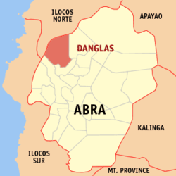 Map of Abra with Danglas highlighted | ||
.svg.png) Danglas Location within the Philippines | ||
| Coordinates: 17°41′N 120°40′E / 17.68°N 120.66°ECoordinates: 17°41′N 120°40′E / 17.68°N 120.66°E | ||
| Country |
| |
| Region | Cordillera Administrative Region (CAR) | |
| Province | Abra | |
| District | Lone District | |
| Barangays | 7 (see Barangays) | |
| Government [1] | ||
| • Type | Sangguniang Bayan | |
| • Mayor | Poyee Bernos | |
| • Electorate | 2,888 voters (2016) | |
| Area [2] | ||
| • Total | 156.02 km2 (60.24 sq mi) | |
| Population (2015 census)[3] | ||
| • Total | 4,192 | |
| • Density | 27/km2 (70/sq mi) | |
| Time zone | UTC+8 (PST) | |
| ZIP code | 2825 | |
| PSGC | 140106000 | |
| IDD : area code | +63 (0)74 | |
| Climate type | Tropical rainforest climate | |
| Income class | 5th municipal income class | |
| Revenue (₱) | 59,173,704.57 (2016) | |
| Native languages |
Itneg language Ilocano Tagalog | |

Danglas, officially the Municipality of Danglas, (Ilokano: Ili ti Danglas; Tagalog: Bayan ng Danglas), is a 5th class municipality in the province of Abra, Philippines. According to the 2015 census, it has a population of 4,192 people.[3]
Geography
Danglas is located at 17°41′N 120°40′E / 17.68°N 120.66°E.
According to the Philippine Statistics Authority, the municipality has a land area of 156.02 square kilometres (60.24 sq mi) [2] constituting 3.75% of the 4,165.25-square-kilometre- (1,608.21 sq mi) total area of Abra.
Barangays
Danglas is politically subdivided into 7 barangays.[4]
| PSGC | Barangay | Population | ±% p.a. | |||
|---|---|---|---|---|---|---|
| 2015[3] | 2010[5] | |||||
| 140106001 | Abaquid | 6.6% | 275 | 423 | −7.87% | |
| 140106003 | Cabaruan | 16.1% | 673 | 650 | 0.66% | |
| 140106004 | Caupasan (Poblacion) | 32.4% | 1,359 | 1,398 | −0.54% | |
| 140106005 | Danglas | 8.5% | 357 | 479 | −5.44% | |
| 140106006 | Nagaparan | 19.2% | 803 | 819 | −0.37% | |
| 140106007 | Padangitan | 9.9% | 417 | 502 | −3.47% | |
| 140106008 | Pangal | 7.3% | 308 | 463 | −7.47% | |
| Total | 4,192 | 4,734 | −2.29% | |||
Demographics
| Population census of Danglas | ||
|---|---|---|
| Year | Pop. | ±% p.a. |
| 1918 | 2,108 | — |
| 1939 | 1,794 | −0.77% |
| 1948 | 1,738 | −0.35% |
| 1960 | 2,475 | +2.99% |
| 1970 | 2,508 | +0.13% |
| 1975 | 2,572 | +0.51% |
| 1980 | 2,657 | +0.65% |
| 1990 | 3,042 | +1.36% |
| 1995 | 4,285 | +6.63% |
| 2000 | 4,144 | −0.71% |
| 2007 | 5,411 | +3.75% |
| 2010 | 4,734 | −4.75% |
| 2015 | 4,192 | −2.29% |
| Source: Philippine Statistics Authority[3] [5] [6] [7] | ||
In the 2015 census, Danglas had a population of 4,192.[3] The population density was 27 inhabitants per square kilometre (70/sq mi).
Economy
The economy of the municipality is heavily dependent on agriculture particularly palay, corn, vegetables and fruits. Other raw materials include rattan and bamboos.
References
- ↑ "Municipality". Quezon City, Philippines: Department of the Interior and Local Government. Retrieved 31 May 2013.
- 1 2 "Province: Abra". PSGC Interactive. Quezon City, Philippines: Philippine Statistics Authority. Retrieved 12 November 2016.
- 1 2 3 4 5 Census of Population (2015). "Cordillera Administrative Region (CAR)". Total Population by Province, City, Municipality and Barangay. PSA. Retrieved 20 June 2016.
- ↑ "Municipal: Danglas, Abra". PSGC Interactive. Quezon City, Philippines: Philippine Statistics Authority. Retrieved 8 January 2016.
- 1 2 Census of Population and Housing (2010). "Cordillera Administrative Region (CAR)". Total Population by Province, City, Municipality and Barangay. NSO. Retrieved 29 June 2016.
- ↑ Censuses of Population (1903–2007). "Cordillera Administrative Region (CAR)". Table 1. Population Enumerated in Various Censuses by Province/Highly Urbanized City: 1903 to 2007. NSO.
- ↑ "Province of Abra". Municipality Population Data. Local Water Utilities Administration Research Division. Retrieved 17 December 2016.
External links
| Wikimedia Commons has media related to Danglas, Abra. |
Places adjacent to Danglas, Abra | |
|---|---|
Bangued (capital) | |
| Municipalities | |
| Barangays | |