Peñarrubia, Abra
| Peñarrubia | ||
|---|---|---|
| Municipality | ||
| Municipality of Peñarrubia | ||
| ||
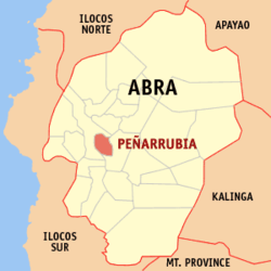 Map of Abra with Peñarrubia highlighted | ||
.svg.png) Peñarrubia Location within the Philippines | ||
| Coordinates: 17°34′N 120°39′E / 17.56°N 120.65°ECoordinates: 17°34′N 120°39′E / 17.56°N 120.65°E | ||
| Country |
| |
| Region | Cordillera Administrative Region (CAR) | |
| Province | Abra | |
| District | Lone District | |
| Founded | 1917 | |
| Barangays | 9 (see Barangays) | |
| Government [1] | ||
| • Type | Sangguniang Bayan | |
| • Mayor | Geraldine M. Balbuena | |
| • Electorate | 4,655 voters (2016) | |
| Area [2] | ||
| • Total | 38.29 km2 (14.78 sq mi) | |
| Population (2015 census)[3] | ||
| • Total | 6,640 | |
| • Density | 170/km2 (450/sq mi) | |
| Time zone | UTC+8 (PST) | |
| ZIP code | 2804 | |
| PSGC | 140117000 | |
| IDD : area code | +63 (0)74 | |
| Climate type | Tropical rainforest climate | |
| Income class | 6th municipal income class | |
| Revenue (₱) | 54,628,883.05 (2016) | |
| Native languages |
Itneg language Ilocano Tagalog | |

Peñarrubia, officially the Municipality of Peñarrubia, (Ilokano: Ili ti Peñarrubia; Tagalog: Bayan ng Peñarrubia), is a 6th class municipality in the province of Abra, Philippines. According to the 2015 census, it has a population of 6,640 people.[3]
Geography
Peñarrubia is located at 17°34′N 120°39′E / 17.56°N 120.65°E.
According to the Philippine Statistics Authority, the municipality has a land area of 38.29 square kilometres (14.78 sq mi) [2] constituting 0.92% of the 4,165.25-square-kilometre- (1,608.21 sq mi) total area of Abra.
Barangays
Peñarrubia is politically subdivided into 9 barangays.[4]
| PSGC | Barangay | Population | ±% p.a. | |||
|---|---|---|---|---|---|---|
| 2015[3] | 2010[5] | |||||
| 140117001 | Dumayco | 18.2% | 1,210 | 1,102 | 1.80% | |
| 140117002 | Lusuac | 14.5% | 962 | 1,053 | −1.71% | |
| 140117005 | Malamsit (Pau-Malamsit) | 9.3% | 618 | 640 | −0.66% | |
| 140117003 | Namarabar | 9.5% | 628 | 548 | 2.63% | |
| 140117004 | Patiao | 9.9% | 656 | 608 | 1.46% | |
| 140117006 | Poblacion | 15.0% | 995 | 994 | 0.02% | |
| 140117007 | Riang (Tiang) | 11.3% | 753 | 810 | −1.38% | |
| 140117008 | Santa Rosa | 5.8% | 384 | 382 | 0.10% | |
| 140117009 | Tattawa | 6.5% | 434 | 407 | 1.23% | |
| Total | 6,640 | 6,544 | 0.28% | |||
Demographics
| Population census of Peñarrubia | ||
|---|---|---|
| Year | Pop. | ±% p.a. |
| 1918 | 3,456 | — |
| 1939 | 2,295 | −1.93% |
| 1948 | 2,262 | −0.16% |
| 1960 | 3,117 | +2.71% |
| 1970 | 3,955 | +2.41% |
| 1975 | 3,737 | −1.13% |
| 1980 | 4,096 | +1.85% |
| 1990 | 4,893 | +1.79% |
| 1995 | 5,048 | +0.59% |
| 2000 | 5,515 | +1.91% |
| 2007 | 6,443 | +2.17% |
| 2010 | 6,544 | +0.57% |
| 2015 | 6,640 | +0.28% |
| Source: Philippine Statistics Authority[3][5][6][7] | ||
In the 2015 census, Peñarrubia had a population of 6,640.[3] The population density was 170 inhabitants per square kilometre (440/sq mi).
Government
Antonio Amasi Domes-ag was OIC Mayor of the town in 1989-1992, then elected as mayor in 1992-1995, and again for the term 1995-1998. He was replaced by his wife Lovelyn Domes-ag in 1998-2001 and 2001-2004. The election of 2004 became controversial in the whole nation when both husband and wife ran for mayoralty candidate. Antonio Domes-ag was proclaimed as the winner. In the May 2007 election, incumbent Vice Mayor Geraldine Mamsaang-Balbuena won in a matter of one vote against Antonio A. Domes-ag.
The present municipal mayor is still Jane Mamsaang-Cecilia.
References
- ↑ "Municipality". Quezon City, Philippines: Department of the Interior and Local Government. Retrieved 31 May 2013.
- 1 2 "Province: Abra". PSGC Interactive. Quezon City, Philippines: Philippine Statistics Authority. Retrieved 12 November 2016.
- 1 2 3 4 5 Census of Population (2015). "Cordillera Administrative Region (CAR)". Total Population by Province, City, Municipality and Barangay. PSA. Retrieved 20 June 2016.
- ↑ "Municipal: Peñarrubia, Abra". PSGC Interactive. Quezon City, Philippines: Philippine Statistics Authority. Retrieved 8 January 2016.
- 1 2 Census of Population and Housing (2010). "Cordillera Administrative Region (CAR)". Total Population by Province, City, Municipality and Barangay. NSO. Retrieved 29 June 2016.
- ↑ Censuses of Population (1903–2007). "Cordillera Administrative Region (CAR)". Table 1. Population Enumerated in Various Censuses by Province/Highly Urbanized City: 1903 to 2007. NSO.
- ↑ "Province of Abra". Municipality Population Data. Local Water Utilities Administration Research Division. Retrieved 17 December 2016.
External links
| Wikimedia Commons has media related to Peñarrubia, Abra. |
Bangued (capital) | |
| Municipalities | |
| Barangays | |