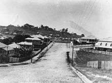
Grange, Queensland
| Grange Brisbane, Queensland | |||||||||||||||
|---|---|---|---|---|---|---|---|---|---|---|---|---|---|---|---|
| Population | 4,163 (2011 census)[1] | ||||||||||||||
| • Density | 2,190/km2 (5,670/sq mi) | ||||||||||||||
| Postcode(s) | 4051 | ||||||||||||||
| Area | 1.9 km2 (0.7 sq mi) | ||||||||||||||
| Location | 7 km (4 mi) from Brisbane CBD | ||||||||||||||
| LGA(s) |
City of Brisbane (Enoggera Ward;[2] Marchant Ward)[3] | ||||||||||||||
| State electorate(s) | |||||||||||||||
| Federal Division(s) | Brisbane | ||||||||||||||
| |||||||||||||||
Grange is an inner-northern suburb of Brisbane, capital of the Australian state of Queensland.[4] It is located 5 kilometres (3 mi) north of the central business district, on the southern side of Kedron Brook. It is sometimes referred to as The Grange.
History
Prior to the arrival of European settlers, the Grange area consisted of areas of open grassland and thinly wooded plains. Urban development of the area commenced in 1903 with the subdivision of T. K. Peate's property into "the Grange Estate". The name of the suburb is derived from that of Peate's property: "Grange" is believed to be an Old English word meaning granary.[4][5]
Many houses in the suburb are of the Queenslander architectural style.
The Grange Library opened in 1979 and had a major refurbishment in 2014.[6]
Heritage listings
Heritage-listed sites in Grange include:
- Primrose Street: Wilston State School[7]
Demographics
In the 2011 census, Grange recorded a population of 4,163 people, 51.7% female and 48.3% male.
The median age of the Grange population was 36 years of age, 1 year below the Australian median.
78.9% of people living in Grange were born in Australia, compared to the national average of 69.8%; the next most common countries of birth were England 4.3%, New Zealand 3.4%, Italy 0.9%, Scotland 0.7%, United States of America 0.7%.
90.4% of people spoke only English at home; the next most common languages were 1.3% Italian, 0.6% Mandarin, 0.5% German, 0.5% French, 0.3% Hindi.
Amenities
The Brisbane City Council operates a public library at 79 Evelyn Street.[8]
Sporting clubs
Grange Thistle Soccer Club was founded in 1919. It was formerly known as the Thistle Football Club until 1961 and has played at Lanham Park, Grange since 1930.[9]
The Wilston Grange Australian Football Club has represented the suburb at Australian rules football since 1945.[10]
For 70 years the Grange Club (Grange Bowls and Community Club Inc.) has represented the suburb in lawn bowls.[11]
See also
References
- ↑ Australian Bureau of Statistics (31 October 2012). "Grange, Qld (State Suburb)". 2011 Census QuickStats. Retrieved 25 October 2013.

- ↑ "Enoggera Ward". Brisbane City Council. Brisbane City Council. Archived from the original on 5 March 2017. Retrieved 12 March 2017.
- ↑ "Marchant Ward". Brisbane City Council. Brisbane City Council. Archived from the original on 12 March 2017. Retrieved 12 March 2017.
- 1 2 "Grange (entry 44888)". Queensland Place Names. Queensland Government. Retrieved 21 June 2015.
- ↑ Suburb Profile: Grange Archived 20 August 2006 at the Wayback Machine. Jenkins, L. 2000, BRISbites - Suburban Sites. Retrieved 17 September 2006.
- ↑ "Public Libraries Statistical Bulletin 2016-17" (PDF). Public Libraries Connect. State Library of Queensland. November 2017. p. 11. Archived (PDF) from the original on 30 January 2018. Retrieved 30 January 2018.
- ↑ "Wilston State School (entry 602855)". Queensland Heritage Register. Queensland Heritage Council. Retrieved 9 February 2018.
- ↑ "Library opening hours and locations". Brisbane City Council. 3 January 2018. Archived from the original on 30 January 2018. Retrieved 30 January 2018.
- ↑ "THISTLE FOOTBALL CLUB". The Telegraph (17, 900). Queensland, Australia. 19 April 1930. p. 13. Retrieved 5 July 2017 – via National Library of Australia.
- ↑ "Wilston Grange Australian Football Club". Retrieved 2 March 2018.
- ↑ "The Grange Club". Archived from the original on 25 May 2017. Retrieved 2 March 2018.
External links
| Wikimedia Commons has media related to Grange, Queensland. |
- University of Queensland: Queensland Places: Grange
- "Grange". BRISbites. Brisbane City Council. Archived from the original on 20 July 2008.
- "Grange". Our Brisbane. Brisbane City Council. Archived from the original on 5 April 2008.
Coordinates: 27°25′23″S 153°00′54″E / 27.423°S 153.015°E