Taisnières-sur-Hon
| Taisnières-sur-Hon | ||
|---|---|---|
| Commune | ||
 | ||
| ||
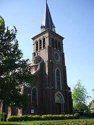
 Taisnières-sur-Hon Location within Hauts-de-France region  Taisnières-sur-Hon | ||
| Coordinates: 50°19′11″N 3°50′12″E / 50.3197°N 3.8367°ECoordinates: 50°19′11″N 3°50′12″E / 50.3197°N 3.8367°E | ||
| Country | France | |
| Region | Hauts-de-France | |
| Department | Nord | |
| Arrondissement | Avesnes-sur-Helpe | |
| Canton | Aulnoye-Aymeries | |
| Intercommunality | Bavaisis | |
| Government | ||
| • Mayor (2008–2014) | Jean-Paul Legrand | |
| Area1 | 16.22 km2 (6.26 sq mi) | |
| Population (1999)2 | 912 | |
| • Density | 56/km2 (150/sq mi) | |
| Time zone | UTC+1 (CET) | |
| • Summer (DST) | UTC+2 (CEST) | |
| INSEE/Postal code | 59584 /59570 | |
| Elevation |
118–157 m (387–515 ft) (avg. 149 m or 489 ft) | |
|
1 French Land Register data, which excludes lakes, ponds, glaciers > 1 km2 (0.386 sq mi or 247 acres) and river estuaries. 2 Population without double counting: residents of multiple communes (e.g., students and military personnel) only counted once. | ||
Taisnières-sur-Hon is a commune in the Nord department in northern France.
Heraldry
.svg.png) |
The arms of Taisnières-sur-Hon are blazoned : Gules, 2 keys in saltire addorsed Or. (Hon-Hergies, Moustier-en-Fagne and Taisnières-sur-Hon use the same arms.) |
See also
- Battle of Malplaquet, which took place near the hamlet of Malplaquet, on the territory of the commune, in 1709
- Communes of the Nord department
References
| Wikimedia Commons has media related to Taisnières-sur-Hon. |
This article is issued from
Wikipedia.
The text is licensed under Creative Commons - Attribution - Sharealike.
Additional terms may apply for the media files.