Pecquencourt
| Pecquencourt | ||
|---|---|---|
| Commune | ||
 | ||
| ||
 Pecquencourt Location within Hauts-de-France region  Pecquencourt | ||
| Coordinates: 50°22′41″N 3°12′59″E / 50.3781°N 3.2164°ECoordinates: 50°22′41″N 3°12′59″E / 50.3781°N 3.2164°E | ||
| Country | France | |
| Region | Hauts-de-France | |
| Department | Nord | |
| Arrondissement | Douai | |
| Canton | Sin-le-Noble | |
| Intercommunality | CC Cœur d'Ostrevent | |
| Government | ||
| • Mayor (2013–2014) | Joël PIERRACHE | |
| Area1 | 9.6 km2 (3.7 sq mi) | |
| Population (1999)2 | 6,361 | |
| • Density | 660/km2 (1,700/sq mi) | |
| Time zone | UTC+1 (CET) | |
| • Summer (DST) | UTC+2 (CEST) | |
| INSEE/Postal code | 59456 /59146 | |
| Elevation |
16–27 m (52–89 ft) (avg. 20 m or 66 ft) | |
|
1 French Land Register data, which excludes lakes, ponds, glaciers > 1 km2 (0.386 sq mi or 247 acres) and river estuaries. 2 Population without double counting: residents of multiple communes (e.g., students and military personnel) only counted once. | ||
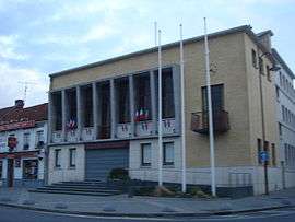
Pecquencourt is a commune in the Nord department in northern France.
Heraldry
_Nord-France.svg.png) |
The arms of Pecquencourt are blazoned : Azure semy de lys Or, a stag argent. (Capelle, Loffre, Neuville-Saint-Rémy, Pecquencourt, and Vred use the same arms.) |
Sister cities

See also
References
- ↑ "Partnerstädte". Sondershausen. Retrieved 4 May 2014.
| Wikimedia Commons has media related to Pecquencourt. |
| Authority control |
|---|
This article is issued from
Wikipedia.
The text is licensed under Creative Commons - Attribution - Sharealike.
Additional terms may apply for the media files.