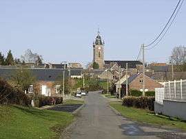
Catillon-sur-Sambre
| Catillon-sur-Sambre | ||
|---|---|---|
| Commune | ||
 | ||
| ||
 Catillon-sur-Sambre Location within Hauts-de-France region  Catillon-sur-Sambre | ||
| Coordinates: 50°04′26″N 3°38′35″E / 50.0739°N 3.6431°ECoordinates: 50°04′26″N 3°38′35″E / 50.0739°N 3.6431°E | ||
| Country | France | |
| Region | Hauts-de-France | |
| Department | Nord | |
| Arrondissement | Cambrai | |
| Canton | Le Cateau-Cambrésis | |
| Intercommunality | Caudrésis–Catésis | |
| Government | ||
| • Mayor (2008–2014) | Philippe Ducroux | |
| Area1 | 13.03 km2 (5.03 sq mi) | |
| Population (2009)2 | 846 | |
| • Density | 65/km2 (170/sq mi) | |
| Time zone | UTC+1 (CET) | |
| • Summer (DST) | UTC+2 (CEST) | |
| INSEE/Postal code | 59137 /59360 | |
| Elevation | 133–167 m (436–548 ft) | |
|
1 French Land Register data, which excludes lakes, ponds, glaciers > 1 km2 (0.386 sq mi or 247 acres) and river estuaries. 2 Population without double counting: residents of multiple communes (e.g., students and military personnel) only counted once. | ||
Catillon-sur-Sambre is a commune of the Nord department in northern France.
Heraldry
_Nord-France.svg.png) |
The arms of Catillon-sur-Sambre are blazoned : Gules, a castle argent charged on its door with the letter K sable. |
See also
References
| Wikimedia Commons has media related to Catillon-sur-Sambre. |
This article is issued from
Wikipedia.
The text is licensed under Creative Commons - Attribution - Sharealike.
Additional terms may apply for the media files.