Quérénaing
| Quérénaing | ||
|---|---|---|
| Commune | ||
 | ||
| ||
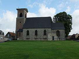
 Quérénaing Location within Hauts-de-France region  Quérénaing | ||
| Coordinates: 50°17′16″N 3°30′52″E / 50.2878°N 3.5144°ECoordinates: 50°17′16″N 3°30′52″E / 50.2878°N 3.5144°E | ||
| Country | France | |
| Region | Hauts-de-France | |
| Department | Nord | |
| Arrondissement | Valenciennes | |
| Canton | Aulnoy-lez-Valenciennes | |
| Intercommunality | CA Valenciennes Métropole | |
| Government | ||
| • Mayor (2008–2014) | Michel François | |
| Area1 | 4.32 km2 (1.67 sq mi) | |
| Population (1999)2 | 814 | |
| • Density | 190/km2 (490/sq mi) | |
| Time zone | UTC+1 (CET) | |
| • Summer (DST) | UTC+2 (CEST) | |
| INSEE/Postal code | 59480 /59269 | |
| Elevation |
71–102 m (233–335 ft) (avg. 87 m or 285 ft) | |
|
1 French Land Register data, which excludes lakes, ponds, glaciers > 1 km2 (0.386 sq mi or 247 acres) and river estuaries. 2 Population without double counting: residents of multiple communes (e.g., students and military personnel) only counted once. | ||
Quérénaing is a commune in the Nord department in northern France.
Heraldry
_Nord-France.svg.png) |
The arms of Quérénaing are blazoned : Or, a cross engrailed gules. (Artres, Bettrechies, Cerfontaine, Denain, Eth, Lesquin, Obies, Quérénaing, Semousies, Wambrechies and Warlaing use the same arms.) |
See also
References
| Wikimedia Commons has media related to Quérénaing. |
This article is issued from
Wikipedia.
The text is licensed under Creative Commons - Attribution - Sharealike.
Additional terms may apply for the media files.