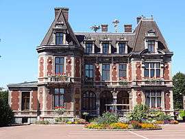
Phalempin
| Phalempin | ||
|---|---|---|
| Commune | ||
 | ||
| ||
 Phalempin Location within Hauts-de-France region  Phalempin | ||
| Coordinates: 50°31′03″N 3°01′02″E / 50.5175°N 3.0172°ECoordinates: 50°31′03″N 3°01′02″E / 50.5175°N 3.0172°E | ||
| Country | France | |
| Region | Hauts-de-France | |
| Department | Nord | |
| Arrondissement | Lille | |
| Canton | Annœullin | |
| Intercommunality | CC Pévèle-Carembault | |
| Government | ||
| • Mayor (2008–2014) | Thierry Lazaro | |
| Area1 | 7.93 km2 (3.06 sq mi) | |
| Population (2006)2 | 4,390 | |
| • Density | 550/km2 (1,400/sq mi) | |
| Time zone | UTC+1 (CET) | |
| • Summer (DST) | UTC+2 (CEST) | |
| INSEE/Postal code | 59462 /59133 | |
| Elevation |
24–65 m (79–213 ft) (avg. 60 m or 200 ft) | |
|
1 French Land Register data, which excludes lakes, ponds, glaciers > 1 km2 (0.386 sq mi or 247 acres) and river estuaries. 2 Population without double counting: residents of multiple communes (e.g., students and military personnel) only counted once. | ||
Phalempin is a commune in the Nord department in northern France.
Heraldry
_Nord-France.svg.png) |
The arms of Phalempin are blazoned : Gules, a chief Or. (La Neuville, Fresnes-sur-Escaut, Ostricourt, Phalempin and Sainghin-en-Weppes use the same arms.) |
See also
References
| Wikimedia Commons has media related to Phalempin. |
This article is issued from
Wikipedia.
The text is licensed under Creative Commons - Attribution - Sharealike.
Additional terms may apply for the media files.