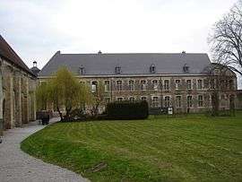
Les Rues-des-Vignes
| Les Rues-des-Vignes | ||
|---|---|---|
| Commune | ||
 | ||
| ||
 Les Rues-des-Vignes Location within Hauts-de-France region  Les Rues-des-Vignes | ||
| Coordinates: 50°05′43″N 3°14′25″E / 50.0953°N 3.2403°ECoordinates: 50°05′43″N 3°14′25″E / 50.0953°N 3.2403°E | ||
| Country | France | |
| Region | Hauts-de-France | |
| Department | Nord | |
| Arrondissement | Cambrai | |
| Canton | Le Cateau-Cambrésis | |
| Intercommunality | Vallée de Vinchy | |
| Government | ||
| • Mayor (2008–2014) | Marcel Duchemin | |
| Area1 | 17.85 km2 (6.89 sq mi) | |
| Population (2010)2 | 697 | |
| • Density | 39/km2 (100/sq mi) | |
| Time zone | UTC+1 (CET) | |
| • Summer (DST) | UTC+2 (CEST) | |
| INSEE/Postal code | 59517 /59258 | |
| Elevation |
62–146 m (203–479 ft) (avg. 103 m or 338 ft) | |
|
1 French Land Register data, which excludes lakes, ponds, glaciers > 1 km2 (0.386 sq mi or 247 acres) and river estuaries. 2 Population without double counting: residents of multiple communes (e.g., students and military personnel) only counted once. | ||
.svg.png)
Les Rues-des-Vignes (called Vinchy in the Middle Ages) is a commune in the Nord department in northern France.
Vinchy was the site of a famous battle of the then-rising Charles Martel in spring 717.
See also
References
| Wikimedia Commons has media related to Les Rues-des-Vignes. |
This article is issued from
Wikipedia.
The text is licensed under Creative Commons - Attribution - Sharealike.
Additional terms may apply for the media files.