Willies, Nord
| Willies | ||
|---|---|---|
| Commune | ||
 | ||
| ||
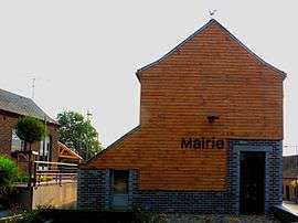
 Willies Location within Hauts-de-France region  Willies | ||
| Coordinates: 50°07′18″N 4°05′56″E / 50.1217°N 4.0989°ECoordinates: 50°07′18″N 4°05′56″E / 50.1217°N 4.0989°E | ||
| Country | France | |
| Region | Hauts-de-France | |
| Department | Nord | |
| Arrondissement | Avesnes-sur-Helpe | |
| Canton | Fourmies | |
| Intercommunality | Sud Avesnois | |
| Government | ||
| • Mayor (2014-2020) | Laurent Méresse | |
| Area1 | 4.14 km2 (1.60 sq mi) | |
| Population (2014)2 | 156 | |
| • Density | 38/km2 (98/sq mi) | |
| Time zone | UTC+1 (CET) | |
| • Summer (DST) | UTC+2 (CEST) | |
| INSEE/Postal code | 59661 /59740 | |
| Elevation |
162–230 m (531–755 ft) (avg. 168 m or 551 ft) | |
|
1 French Land Register data, which excludes lakes, ponds, glaciers > 1 km2 (0.386 sq mi or 247 acres) and river estuaries. 2 Population without double counting: residents of multiple communes (e.g., students and military personnel) only counted once. | ||
Willies is a commune in the Nord department in northern France. It is 10 km (6.2 mi) southeast of Maubeuge.
Heraldry
_Nord-France.svg.png) |
The arms of Willies are blazoned : Gules, 2 fesses embattled counterembattled argent, overall on a canton Gules, 3 pales vair and a chief Or. (Baives and Willies use the same arms.) |
See also
References
| Wikimedia Commons has media related to Willies. |
This article is issued from
Wikipedia.
The text is licensed under Creative Commons - Attribution - Sharealike.
Additional terms may apply for the media files.