West-Cappel
| West-Cappel | ||
|---|---|---|
| Commune | ||
 | ||
| ||
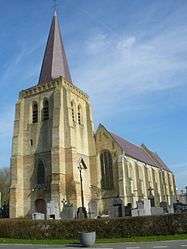
 West-Cappel Location within Hauts-de-France region  West-Cappel | ||
| Coordinates: 50°55′47″N 2°30′22″E / 50.9297°N 2.5061°ECoordinates: 50°55′47″N 2°30′22″E / 50.9297°N 2.5061°E | ||
| Country | France | |
| Region | Hauts-de-France | |
| Department | Nord | |
| Arrondissement | Dunkerque | |
| Canton | Wormhout | |
| Intercommunality | CC Hauts de Flandre | |
| Government | ||
| • Mayor (2014-2020) | André Figoureux | |
| Area1 | 7.57 km2 (2.92 sq mi) | |
| Population (2014)2 | 562 | |
| • Density | 74/km2 (190/sq mi) | |
| Demonym(s) | West-Cappelois (es) | |
| Time zone | UTC+1 (CET) | |
| • Summer (DST) | UTC+2 (CEST) | |
| INSEE/Postal code | 59657 /59380 | |
| Elevation |
6–27 m (20–89 ft) (avg. 22 m or 72 ft) | |
|
1 French Land Register data, which excludes lakes, ponds, glaciers > 1 km2 (0.386 sq mi or 247 acres) and river estuaries. 2 Population without double counting: residents of multiple communes (e.g., students and military personnel) only counted once. | ||
West-Cappel is a commune in the Nord department in northern France.
Politics
Presidential Elections 2nd Round
| Election | Winning Candidate | Party | % | |
|---|---|---|---|---|
| 2017 | Marine Le Pen | FN | 51.12 | |
| 2012 | Nicolas Sarkozy | UMP | 60.77 | |
| 2007 | Nicolas Sarkozy | UMP | 58.56 | |
| 2002 | Jacques Chirac | RPR | 75.68 | |
Heraldry
.svg.png) |
The arms of West-Cappel are blazoned : Argent, a bend fusil gules. (probably not heraldically significantly different from Noordpeene) |
See also
References
| Wikimedia Commons has media related to West-Cappel. |
This article is issued from
Wikipedia.
The text is licensed under Creative Commons - Attribution - Sharealike.
Additional terms may apply for the media files.