Tōhoku, Aomori
| Tōhoku 東北町 | |||
|---|---|---|---|
| Town | |||
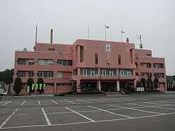 Tōhoku Town Hall | |||
| |||
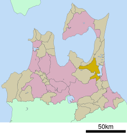 Location of Tōhoku in Aomori Prefecture | |||
 Tōhoku | |||
| Coordinates: 40°43′41″N 141°15′28″E / 40.72806°N 141.25778°ECoordinates: 40°43′41″N 141°15′28″E / 40.72806°N 141.25778°E | |||
| Country | Japan | ||
| Region | Tōhoku | ||
| Prefecture | Aomori Prefecture | ||
| District | Kamikita | ||
| Area | |||
| • Total | 326.50 km2 (126.06 sq mi) | ||
| Population (January 1, 2017) | |||
| • Total | 18,217 | ||
| • Density | 55.8/km2 (145/sq mi) | ||
| Time zone | UTC+9 (Japan Standard Time) | ||
| - Tree | Red Pine | ||
| - Flower | Sakura | ||
| - Bird | Swan | ||
| Phone number | 0176-56-3111 | ||
| Address | 4-32-484 Kamikita-Minami, Tohoku-machi, Kamikita-gun, Aomori-ken 039-2492 | ||
| Website | http://www.town.tohoku.lg.jp/ | ||


Tōhoku (東北町 Tōhoku-machi) is a town located in Aomori Prefecture, Japan. As of 31 January 2017, the town had an estimated population of 18,217, and a population density of 55.8 persons per km² in 7,216 households.[1] The total area of the town is 326.50 square kilometres (126.06 sq mi).
Geography
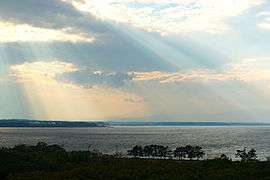
Tōhoku is located in north-central Aomori Prefecture, bordering on the west shore of Lake Ogawara. The town has a cold maritime climate characterized by cool short summers and long cold winters with heavy snowfall (Köppen climate classification Cfa). The average annual temperature in Tōhoku is 9.8 °C. The average annual rainfall is 1217 mm with September as the wettest month.The temperatures are highest on average in August, at around 22.5 °C, and lowest in January, at around -2.1 °C.[2]
Neighbouring municipalities
Demographics
Per Japanese census data,[3] the population of Tōhoku has steadily declined over the past 40 years.
| Census Year | Population |
|---|---|
| 1970 | 23,588 |
| 1980 | 22,587 |
| 1990 | 21,553 |
| 2000 | 20,591 |
| 2010 | 19,105 |
History
During the Edo period, the area around Tōhoku was controlled by the Nambu clan of Morioka Domain, becoming part of the territories of Shichinohe Domain in the latter half of the Edo period. In the post-Meiji Restoration cadastral reform of April 1, 1889, Katchi (甲地村 Katchi-mura) was created. It was elevated to town status on November 1, 1963, at which time it was renamed to its present name. The neighboring town of Kamikita merged with Tōhoku on March 31, 2005.
Economy
The economy of Tōhoku is heavily dependent on an agriculture, based primarily on production of nagaimo, daikon and carrots as well as lake fish, including smelt, icefish and shijimi.
Education
Tōhoku has seven public elementary schools and two public middle schools operated by the town government. The town does not have a high school.
Transportation
Railway
- Aoimori Railway Company - Aoimori Railway Line
Highway
Noted people from Tōhoku
- Masato Shibata - jockey
- Yoshitomi Shibata – jockey
- Takemi Sasaki - jockey
- Mitsuru Fukikoshi - actor
References
External links
![]()
- Official Website (in Japanese)