Inakadate, Aomori
| Inakadate 田舎館村 | |||
|---|---|---|---|
| Village | |||
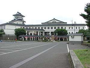 Inakadate Village Hall | |||
| |||
 Location of Inakadate in Aomori Prefecture | |||
 Inakadate | |||
| Coordinates: 40°37′52.1″N 140°33′08″E / 40.631139°N 140.55222°ECoordinates: 40°37′52.1″N 140°33′08″E / 40.631139°N 140.55222°E | |||
| Country | Japan | ||
| Region | Tōhoku | ||
| Prefecture | Aomori | ||
| District | Minamitsugaru | ||
| Area | |||
| • Total | 22.35 km2 (8.63 sq mi) | ||
| Population (November 30, 2017) | |||
| • Total | 7,985 | ||
| • Density | 360/km2 (930/sq mi) | ||
| Time zone | UTC+9 (Japan Standard Time) | ||
| Phone number | 0172-58-2111 | ||
| Address | 1 Nakatsuji, Inakadate-mura, Minamitsugaru-gun, Aomori-ken 038-1113 | ||
| Website | Official website | ||


Inakadate (田舎館村 Inakadate-mura) is a village in Aomori Prefecture, Japan. As of 30 November 2017, the village has an estimated population of 7,985 in 2,736 households [1], and a population density of 362 persons per km². The total area of the village is 22.35 square kilometres (8.63 sq mi).
Geography
Inakadate occupies the flatlands within Minamitsugaru District of south-central Aomori. The village has a cold humid continental climate (Köppen Dfb) characterized by warm short summers and long cold winters with heavy snowfall. The average annual temperature in Inakadate is 10.5 °C. The average annual rainfall is 1294 mm with September as the wettest month.The temperatures are highest on average in August, at around 24.1 °C, and lowest in January, at around -1.9 °C.[2]
Neighbouring municipalities
Demographics
Per Japanese census data,[3] the population of Inakadate has decreased steadily over the past 40 years.
| Census Year | Population |
|---|---|
| 1970 | 10,062 |
| 1980 | 10,053 |
| 1990 | 9,370 |
| 2000 | 8,835 |
| 2010 | 8,153 |
History
During the Edo period, the area around Inakadate was controlled by the Tsugaru clan of Hirosaki Domain. After the Meiji Restoration, it became part of Minamitsugaru District. On April 1, 1889, Inakadate was proclaimed as a village. On April 1, 1955, it annexed neighboring Kodaji Village, but lost a portion of its territory to Onoe Town on October 1, 1956.
Economy
The economy of Inakadate is heavily dependent on agriculture, notably rice and horticulture.
Education
Inakadate has one public elementary school and one public junior high school operated by the village government. The village does not have a high school.
Transportation
Railway
Highway
Local attractions
- Tareyanagi Site, a Yayoi-period ruin and National Historic Site
Art stimulus
In 1993, as part of a revitalization effort, Inakadate began creating rice paddy art, murals of art using rice paddy fields.[4]
The people were looking for a way to revitalize their village. Archaeology showed that rice had been grown in the area for more than 2000 years.[5] To honor this history, the villagers started a rice field behind the town hall. The villagers cultivated and used four different types[5] of heirloom and modern strains of rice to create a giant picture in the field. To allow viewing of the whole picture, a mock castle tower 22 meters high was erected at the village office.[5] In 2006, more than 200,000 people visited the village to see the art.[5]
Notable people from Inakadate
- Tochinoumi Teruyoshi, sumo wrestler
References
- ↑ Inakadate village official home page (in Japanese)
- ↑ Inakadate climate data
- ↑ Inakadate population statistics
- ↑ "Bizarre spectacle of the giant crop murals covering rice fields in Japan". Daily Mail. 2009-07-09. Retrieved 22 February 2010.
- 1 2 3 4 Hani, Yoko (2007-08-26). "Homegrown art". The Japan Times. Retrieved 22 February 2010.
External links
| Wikimedia Commons has media related to Inakadate, Aomori. |
- Official website (in Japanese)
- Enchanting Murals bring Japan's farm to life' September 3rd, 2017, NTRJournal