Fujisaki, Aomori
| Fujisaki 藤崎町 | |||
|---|---|---|---|
| Town | |||
 Fujisaki Town Hall | |||
| |||
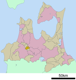 Location of Fujisaki in Aomori Prefecture | |||
 Fujisaki | |||
| Coordinates: 40°39′21.8″N 140°30′10.1″E / 40.656056°N 140.502806°ECoordinates: 40°39′21.8″N 140°30′10.1″E / 40.656056°N 140.502806°E | |||
| Country | Japan | ||
| Region | Tōhoku | ||
| Prefecture | Aomori | ||
| District | Minamitsugaru | ||
| Area | |||
| • Total | 37.29 km2 (14.40 sq mi) | ||
| Population (December 31, 2017) | |||
| • Total | 15,172 | ||
| • Density | 410/km2 (1,100/sq mi) | ||
| Time zone | UTC+9 (Japan Standard Time) | ||
| - Tree | Apple | ||
| - Flower | Wisteria | ||
| - Bird | Swan | ||
| Phone number | 0172-75-3111 | ||
| Address | 1-1 Toyota-chō, Fujisaki-machi, Minamitsugaru-gun, Aomori-ken 038-3892 | ||
| Website | Official website | ||


Fujisaki (藤崎町 Fujisaki-machi) is a town in Aomori Prefecture, Japan. As of 1 September 2016, the town had an estimated population of 15,172 in 5943 households [1], and a population density of 410 persons per km². The total area of the town is 37.29 square kilometres (14.40 sq mi).[2]
Geography
Fujisaki occupies the flatlands within Minamitsugaru District of south-central Aomori. The town has a cold humid continental climate (Köppen Dfb) characterized by warm short summers and long cold winters with heavy snowfall. The average annual temperature in Fujisaki is 10.6 °C. The average annual rainfall is 1288 mm with September as the wettest month.The temperatures are highest on average in August, at around 24.0 °C, and lowest in January, at around -1.8 °C.[3]
Neighbouring municipalities
Demographics
Per Japanese census data,[4] the population of Fujisaki has decreased steadily over the past 40 years.
| Census Year | Population |
|---|---|
| 1970 | 18,355 |
| 1980 | 17,787 |
| 1990 | 17,139 |
| 2000 | 16,858 |
| 2010 | 16,021 |
History
During the Edo period, the area around Fujisaki was controlled by the Tsugaru clan of Hirosaki Domain. After the Meiji Restoration, it became part of Minamitsugaru District. On May 20, 1923, Fujisaki attained town status. On February 1, 1955, Fujisaki merged with neighboring Junisato Village. It annexed a portion of Itayanagi Village on August 10, 1956. On January 1, 2006, it merged with the neighboring town of Tokiwa. On September 1, 2007, a portion of the Namioka part of Aomori left Aomori and merged into Fujisaki.[5]
Economy
The economy of Fujisaki is heavily dependent on agriculture, notably rice and horticulture. The Fuji apple was developed here[6]
Education
Fujisaki has three public elementary schools and two public junior high schools operated by the town government, and one public high school operated by the Aomori Prefectural Board of Education.
Transportation
Rail
.svg.png)
Highways
Notable people from Fujisaki
- Taro Kimura, politician (1965-2017)
References
- ↑ official town home page (in Japanese)
- ↑ "詳細データ 青森県藤崎町". 市町村の姿 グラフと統計でみる農林水産業 (in Japanese). Ministry of Agriculture, Forestry and Fisheries. 2016. Retrieved 13 July 2017.
- ↑ Fujisaki climate data
- ↑ Fujisaki population statistics
- ↑ "広報あおもり平成19年9月15日号PDF版" (PDF). Aomori official website (in Japanese). Aomori City. 19 September 2007. Retrieved 10 September 2011.
- ↑ The Research Station moved to Morioka later; now National Agriculture and Food Research Organization, National Institute of Fruit Tree Science 果樹試験場リンゴ研究部 http://www.naro.affrc.go.jp/fruit/kin/apple/017785.html
External links
| Wikimedia Commons has media related to Fujisaki, Aomori. |
- Official website (in Japanese)