South Bromley, Poplar
| South Bromley | |
|---|---|
.jpg) Bromley Hall, Blackwall Tunnel Approach Road | |
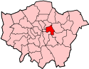
 South Bromley South Bromley shown within Greater London | |
| OS grid reference | TQ375805 |
| • Charing Cross | 5.5 mi (8.9 km) W |
| London borough | |
| Ceremonial county | Greater London |
| Region | |
| Country | England |
| Sovereign state | United Kingdom |
| Post town | LONDON |
| Postcode district | E14 |
| Dialling code | 020 |
| Police | Metropolitan |
| Fire | London |
| Ambulance | London |
| EU Parliament | London |
| UK Parliament | |
| London Assembly | |
South Bromley is a locality of Poplar in London, located in the London Borough of Tower Hamlets and is part of the Lower Lea Valley, however the name is little-used and since the opening of the Limehouse Cut in 1770, southern Bromley was geographically separated as a result and thereafter develop it own identity. It over time grew to be more associated with Poplar which was much more accessible. Today South Bromley southern end is in the process of being redeveloped into the Aberfeldy Village.[1]
History
The small Tudor period Bromley Hall was built in the late 15th century as the manor house of Lower Bromley. The house was radically remodeled soon after 1700 and over the following centuries served as a calico printing works, gentleman’s seat, gunpowder factory, charity home and a carpet warehouse.[2]
The construction in 1770 of a short canal called the Limehouse Cut separated the southern Bromley from Bromley proper and the locality thereafter evolved as an extension of Poplar. During the 19th century, factories were established beside Bow Creek with workers housing build around it and focusing on the church of St Michael and All Angels, which has since been converted to flats. Between 1864 and 1885 David McIntosh laid out compact but sturdy terraces to the east of St Leonard’s Road, some of which survive today. Abbott Road date from the 1870s and is named after John Abbott.
South Bromley railway station on the North London Railway between Bow and Poplar (East India Dock Road) stations opened in 1884, the name stems from the fact the area to the east was once part of South Bromley, while the west was in Poplar.[3]
The area around Aberfeldy Street was heavily bombed during the Second World War and subsequently redeveloped into the Aberfeldy Estate in 1947.[4] This was followed by South Bromley being further isolated when the East Cross Route when opened in the 1960s, from the 1950s to the 1970s the London County Council and later Greater London developed more flats, many of which have since been demolished.[1]
The area including the Aberfeldy Estate suffered from severe social disadvantage with high levels of unemployment, low incomes, poor health and anti-social behavior problems till the early 2010s.[5]
Geography
Neighbouring areas of London. | ||||||||||
|---|---|---|---|---|---|---|---|---|---|---|
| ||||||||||
South Bromley begins on the south bank of the Limehouse Cut as a narrow strip between the River Lea, East Cross Route southward until East India Dock Road.
Governance
As with the whole of Greater London, the Lord-Lieutenant of Greater London Ken Olisa is the official representative for the Crown for South Bromley but has no political role or hold an office in any political party and is purely an honorary titular position.
South Bromley is in the constituency of Poplar and Limehouse, represented in the House of Commons of the UK Parliament since 2010 by Jim Fitzpatrick of the Labour Party.
The locality is covered entirely by the Lansbury Ward and is represented on the Tower Hamlets London Borough Council by Rajib Ahmed (Labour) and Ohid Ahmed (Aspire) since 2015. [6]
Amenities
The historical Bromley Hall is an early Tudor period manor house that was first built in what was then just Bromley around 1485, it is thought to be the oldest brick house in London. It is owned by Leaside Regeneration who is proposing to use the ground floor for a permanent exhibition on the hall, the manor and the Tudors. They hope to also provide a meeting room, presentation materials and access to elements of the internal structure. These consist of a staircase, an original Tudor arched oak doorframe and the remains of the cellars of a structure pre-dating Bromley Hall itself.[7]
Culture, arts and media
Bow Arts Studios has two studios, called the Aberfeldy Street Studios, which are converted out of two street front shops on Aberfeldy Street, the studios are designed to provide affordable working space for artists, designer makers or a public facing arts group.[8]
Education
The Culloden Primary Academy is a primary school located to the west of Aberfeldy Street on Dee Street and governed by the Paradigm Trust.[9]
Transport
South Bromley is well connected by London Buses routes, 309 on Abbot Road and 115, N15, N550, N551 on East India Dock Road and D8 on the Blackwall Northern Approach.
There are no National Rail, London Underground or Docklands Light Railway stations in the area. However there was a station that opened in 1884 called South Bromley (now in Poplar) on the North London line but was closed in 1944 after bomb damage in the Blitz cut off the railway east of Dalston Junction railway station.[10]
References
- ↑ "Leaside Regeneration, the sustainable regeneration company for East London". 2006-05-14. Archived from the original on 2006-05-14. Retrieved 2017-05-26.
- ↑ Chronology of London Railways by H.V.Borley page 81
- ↑ "Aberfeldy Estate — Levitt Bernstein". www.levittbernstein.co.uk.
- ↑ https://www.towerhamlets.gov.uk/Documents/Planning-and-building-control/Aberfeldy_SoR_140616.pdf
- ↑ https://www.towerhamlets.gov.uk/Documents/Borough_statistics/Ward_profiles/Lansbury-FINAL-10062014.pdf
- ↑ http://www.british-history.ac.uk/survey-london/vol1/pp17-18
- ↑ "Aberfeldy Street Studios - Bow Arts". www.bowarts.org.
- ↑ "Contact us - Culloden Primary Academy".
- ↑ Chronology of London Railways by H.V.Borley page 81