Cubitt Town
| Cubitt Town | |
|---|---|
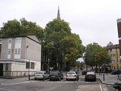 Christ Church, viewed from Glengarnock Avenue | |
 Cubitt Town Cubitt Town shown within Greater London | |
| OS grid reference | TQ385795 |
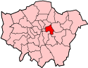
| London borough | |
| Ceremonial county | Greater London |
| Region | |
| Country | England |
| Sovereign state | United Kingdom |
| Post town | LONDON |
| Postcode district | E14 |
| Dialling code | 020 |
| Police | Metropolitan |
| Fire | London |
| Ambulance | London |
| EU Parliament | London |
| UK Parliament | |
| London Assembly | |
Cubitt Town is a district on the Isle of Dogs in London, Greater London, England. It is on the east of the Isle, facing Greenwich across the River Thames. To the west is Millwall, to the southwest is North Greenwich, to the northwest Canary Wharf and to the north, across the Blue Bridge, Blackwall. It is in Blackwall & Cubitt Town Ward of Tower Hamlets London Borough Council.
History
It is named after William Cubitt, Lord Mayor of London (1860–1862), who was responsible for the development of the housing and amenities of the area in the 1840s and 1850s, mainly to house the growing population of workers in the local docks, shipbuilding yards and factories.[1] As it grew, Cubitt also created many local businesses employing manual labourers as well as the streets of housing to accommodate them.
Shipbuilding
For many years this area was home to a number of shipbuilders, such as Westwood, Baillie, Samuda Brothers, J & W Dudgeon and Yarrow Shipbuilders. Noteworthy ships launched here included
- HMS Prince Albert, the first British warship designed to carry her main armament in gun turrets.
Other industries
The businesses included those involved in cement, pottery and brick production. Asphalt production was another growth industry, coinciding with the growth, development, and industrialisation of areas throughout the British Isles. In Cubitt Town, the Pyrimont Wharf was developed in 1861 by the Asphalte de Seyssel Company of Thames Embankment (later known as the Seyssel Asphalte Company or Seyssel Pyrimont Asphalte Company), with asphalt production taken over in the 1870s by Claridge's Patent Asphalte Company.[1][2]
Housing
Estates in the area include:
- New Union Wharf Estate - East Thames Housing
- Samuda Estate - One Housing
- St John's Estate - One Housing
- Amsterdam Road - Private
- Millennium Wharf - Private
The area is a mix of old east London working-class communities transplanted into 1960s and 1970s high-rise estates and the middle-class workers in the Canary Wharf complex attracted by relatively low prices for riverside living, plus less recent Bangladeshi and East Asian immigrant populations.
Learning and education
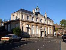
A public library was financed by Andrew Carnegie and built by C. Harrold Norton, being completed in 1905.[3] Will Crooks, the then Mayor of Poplar had attended a meeting at the Guildhall, where Carnegie had promised to fund public libraries. Crooks was able to get a commitment form him to pay for two libraries, this one in Cubitt Town and another in Bromley by Bow. Carnegie agreed to provide £15,000 for both together. The total expense for this building was £6,805 13s 10d, which included some neighbouring land which originally served as a public garden before providing space for an extension to be used a meeting hall and erected in 1962.[3]
The building is currently owned by the Tower Hamlets London Borough Council as part of their library service.[4]
Schools
Primary schools
- Cubitt Town School
- St Luke's School
Secondary school
Recreation
Cubitt town is home to a number of recreational facilities:
- St John's Park
- Millwall Park
- Island Gardens
- Mudchute, an urban farm described by the local authority as the largest urban farm in Europe[5]
Transport
Metro
The nearest stations are Crossharbour and Island Gardens on the Docklands Light Railway, both opened on the 31 August 1987.
Buses
- Current
135 (Old Street - Crossharbour) since 2008[6], 277 (Highbury - Crosshabour) since 2016.[7], D6 (Ash Grove - Crossharbour) since 1989[8], D7 (Mile End - Poplar via Island Gardens and Canary Wharf) since 1989[9], D8 (Stratford - Crossharbour) since 1991[10], N550 (Trafalgar Square - Canning Town) since 2008.
- Previous
106 (Finsbury Park - Crossharbour) from 1983 to 1989, replaced by D6[11], N50 (Trafalgar Square - Gallons Reach Retail Park) from 1995 to 2008, replaced by N550[12]
Roads
Cubitt Town is connected to the National Road Network by the north-south Manchester Road A1206.
Cycling & walking
Access across the River Thames is by the Greenwich Foot Tunnel and the National Cycle Route 1 to the west (which also uses the Greenwich Foot Tunnel).
Nearest places
References
- 1 2 Hobhouse, Hermione (General Editor) (1994). "British History Online". 'Cubitt Town: Riverside area: from Newcastle Drawdock to Cubitt Town Pier', Survey of London: volumes 43 and 44: Poplar, Blackwall and Isle of Dogs. pp. 528–532 (see text at refs 507 & 510). Retrieved 8 November 2009.
- ↑ Plymouth Wharf Residents Association. "History of Plymouth and Pyrimont Wharf areas". Retrieved 15 December 2009.
- 1 2 "Cubitt Town: The inland area". British History Online. Institute of Historical Research.
- ↑ "Cubitt Town Library". Idea Library Learning Information. Retrieved 20 December 2015.
- ↑ "Mudchute Park and Farm". London Borough of Tower Hamlets. Archived from the original on 27 September 2013. Retrieved 25 September 2013.
- ↑ http://www.londonbuses.co.uk/_routes/current/135.html%5Bpermanent+dead+link%5D
- ↑ http://www.londonbuses.co.uk/_routes/current/277.html
- ↑ "London Buses Route D6". londonbuses.co.uk. Retrieved 28 July 2016.
- ↑ "London Bus Route D7". londonbuses.co.uk. Retrieved 28 July 2016.
- ↑ "London Bus Route D8". londonbuses.co.uk. Retrieved 28 July 2016.
- ↑ "London Bus Route 106". londonbuses.co.uk. Retrieved 28 July 2016.
- ↑ "London Buses Route N50". londonbuses.co.uk. Retrieved 28 July 2016.