West Drayton
| West Drayton | |
|---|---|
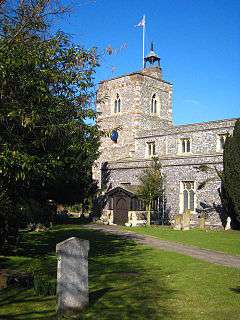 St Martin's church | |
 West Drayton West Drayton shown within Greater London | |
| Population | 14,370 (2011)[1] |
| OS grid reference | TQ065795 |
| • Charing Cross | 14.8 mi (23.8 km) E |
| London borough | |
| Ceremonial county | Greater London |
| Region | |
| Country | England |
| Sovereign state | United Kingdom |
| Post town | WEST DRAYTON |
| Postcode district | UB7 |
| Dialling code | 01895 |
| Police | Metropolitan |
| Fire | London |
| Ambulance | London |
| EU Parliament | London |
| UK Parliament | |
| London Assembly | |
West Drayton is a suburban town in the London Borough of Hillingdon, England with a station on the Great Western main line from London Paddington. It was part of the Yiewsley and West Drayton Urban District of Middlesex, which became part of Greater London in 1965. The settlement is centred close to the Colne Valley regional park 2 1⁄2 miles (4 km) north (and north-west respectively) of terminals 5 and 1 to 3 of London's largest airport.
Traditionally West Drayton covers 3.4 square kilometres (1.3 sq mi) and currently the electoral ward, drawn for fair representation by three members of the Council, containing the name is similarly sized, however the post town is much larger and takes in Yiewsley on the north side of the railway line as well as Harmondsworth and Sipson to the south.[2][3]
Living in the ward were 14,370 people according to the 2011 Census;[1] the vast majority of the housing is mid-20th century. In 1901 the population of the civil parish was 984.[2]
Geography

The London Borough of Hillingdon is split by the Great Western Railway and the Grand Union Canal, both of which run east-west. West Drayton is generally south of this divide and Yiewsley to the north. It is northwest of junction 4 of the M4 motorway (Heathrow Airport spur), which intersects with the A408 (for Stockley Business Park), north for Uxbridge, and it terminates south at Heathrow Airport itself. The nearby A3044 goes through Harmondsworth to the south.
West Drayton railway station provides rail links on the First Great Western service from Paddington station in London to Reading and Bristol. There is a Primary School.[4]. The local secondary school is Stockley Academy on Falling Lane. The former Evelyns Community School was demolished in order to make way for the Academy.
West Drayton has at its heart in the west of the parish a conservation area, The Green, along which are many buildings protected under UK law by grade II and II* listing — residential and commercial.
History
In 939 the area was known as Draegtun. Tun/ton is cognate with the later form town, but originally implied any kind of farmstead of more than one family. Dray is cognate with draught (as in draft horse/a dray) implying a portage/slope used for dragging loads, or simply notable use of the dragged plough, quite possibly given about 13 other examples in England simply land under till. It is recorded as Draitone in the 1086 Domesday Book, and as Westdrayton in 1465.[5]
In the 1086 Domesday Book, West Drayton was assessed at ten hides with land suitable for six ploughs.[6]
The former RAF West Drayton was host to a military air traffic control (ATC) centre co-located with the civil London Area and Terminal Control Centre (LATCC), but these functions have been relocated to Swanwick), with the last ATC functions ending in January 2008.
The site was redeveloped for housing.
Local economy

Historically, employment was commonly connected to agriculture, the railway yards and the canal. In the modern day, West Drayton has a mixture of tradespeople, airport workers, construction workers and commuters in office professions or public utilities such as schools and hospitals. Its housing hosts people with a range of incomes, with relatively large areas built aesthetically in keeping with existing housing by the local authority. It has rapid connectivity to the M4 and thereafter to the M25 and motorways north-west and south-west. Related local roads link to Heathrow Airport and to Stockley Business Park.
A new shopping complex is soon to be built in the town centre. A community radio station, 91.8 Hayes FM, serves the area, as does the commercial station Time 106.6.[7] The European broadcaster Viasat also has its studios and playout centre here.
Guoman Hotel Management (UK) Limited has its head office in the Thistle London Heathrow in West Drayton.[8][9]
The Stockley Close Industrial Estate includes a British Midland International office.[10][11] In July 1999 Sir Michael Bishop formally opened the British Midland Training Centre at Stockley Close.[12] Other tenants in the estate include Almirall, BP, British Airways, HP Enterprise Services (originally Electronic Data Systems, or EDS), and Marks & Spencer.[11] Waterside, the head office of British Airways, is in Harmondsworth, near West Drayton.[13]
Sports
The local football team is West Drayton Explorers, whose home ground is on Sipson Recreation Ground, Sipson Way.
Another notable team are Draytonians FC founded by John Booth, Robert Booth, Wayne Carter and Ryan Campbell. 2 x WMSFL Premier Champions.
The district has many canal paths and trails suitable for cycling.
Demography
As of the 2011 census, 57% of the population was White British.[14] Living in the ward were 14,370 people according to the 2011 Census;[1] the vast majority of the housing is mid-20th century.
The decennial censuses between 1801 and 1901 each show a rise in population and a low population density. From 1801 when the population of the almost identically sized ecclesiastical parish (civil parishes were invented later in the 19th century) was 515; to 1901 when the population of the civil parish was 984.[2]
Notable people
- Ronnie Wood, guitarist in rock bands The Rolling Stones and Faces (band), was born in West Drayton
- Blues singer Art Wood (1937-2006), brother of Ronnie, was born in West Drayton
- Actor Julian Rhind-Tutt was born in West Drayton
- William Paget (1572-1629), adventurer of the London Company, is buried in West Drayton
- Character actor Moore Marriott (1885-1949) was born in West Drayton
- Publisher Sir Allen Lane, most famously known for Penguin Books. Lived at The Mill House, West Drayton.
References
- 1 2 3 "Usual resident population". NOMIS. Office for National Statistics. 2011. Retrieved 6 May 2013.
- 1 2 3 838 acres. 'Table of population, 1801-1901', in A History of the County of Middlesex: Volume 2, General ed. William Page (London, 1911), pp. 112-120. British History Online http://www.british-history.ac.uk/vch/middx/vol2/pp112-120 [accessed 25 May 2018].
- ↑ https://www.hillingdon.gov.uk/article/7629/Facts-and-statistics-about-the-London-Borough-of-Hillingdon
- ↑ West Drayton primary school
- ↑ Mills, A. D.: A Dictionary of British Place-Names (Oxford University Press, 2003)
- ↑ Hopkins, Heather (April 2009). "An Archaeological Desk-Based Assessment for Inland Homes" (PDF). London Borough of Hillingdon. Retrieved 30 May 2011.
- ↑ Ofcom-licences webpages, UK Government, accessed 2018-05-01
- ↑ "Corporate Office." Thistle Hotels. Retrieved on 28 December 2011. "The corporate office is based at Thistle London Heathrow and is situated across opposite the main reception adjacent to the Conference Centre"
- ↑ "Thistle London Heathrow." Thistle Hotels. Retrieved on 28 December 2011. "Bath Road, Longford West Drayton UB7 0EQ"
- ↑ "bmi’s company rewards." British Midland International. Retrieved on 28 December 2011. "Stockley Close, West Drayton, Middlesex, UB7 9BL"
- 1 2 "British Midland Airways Limited Stockley Close, West Drayton Near Heathrow, London." KingSturge. Retrieved on 28 December 2011.
- ↑ "the nineties Archived 10 June 2012 at the Wayback Machine.." British Midland International. Retrieved on 28 December 2011.
- ↑ "Benefits and features." British Airways. Retrieved on 14 February 2011. "The promoters are British Airways Plc, Waterside, PO Box 365, Harmondsworth, West Drayton, UB7 0GA."
- ↑ Services, Good Stuff IT. "West Drayton - UK Census Data 2011". UK Census Data. Retrieved 10 April 2018.
External links
| Wikimedia Commons has media related to West Drayton. |
- UB7 local website
- Southlands Arts Centre website
- British History - West Drayton
- Uxbridge & Hillingdon Times - local newspaper
- Yiewsley and West Drayton Band
- Library
- Diners Lounge