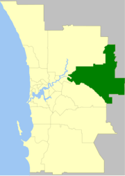
Shire of Mundaring
| Shire of Mundaring Western Australia | |||||||||||||||
|---|---|---|---|---|---|---|---|---|---|---|---|---|---|---|---|
 | |||||||||||||||
| Population | 38,157 (2016 census)[1] | ||||||||||||||
| • Density | 59.167/km2 (153.243/sq mi) | ||||||||||||||
| Established | 1903 | ||||||||||||||
| Area | 644.9 km2 (249.0 sq mi) | ||||||||||||||
| Mayor | John Daw | ||||||||||||||
| Council seat | Mundaring | ||||||||||||||
| Region | Eastern Metropolitan Perth Darling Scarp | ||||||||||||||
| State electorate(s) | Darling Range, Kalamunda, Midland, Swan Hills | ||||||||||||||
| Federal Division(s) | Hasluck, Pearce | ||||||||||||||
|
| |||||||||||||||
| Website | Shire of Mundaring | ||||||||||||||
| |||||||||||||||
The Shire of Mundaring is a local government area in eastern metropolitan Perth, the capital of Western Australia. The Shire covers an area of 645 square kilometres (249 sq mi) and had a population of approximately 38,000 as at the 2016 Census.
History
The Greenmount Road District was created on 17 April 1903. On 29 March 1934, it was renamed Mundaring. On 1 July 1961, it became the Shire of Mundaring after enactment of the Local Government Act 1960.[2]
Statistics
Mundaring Shire has published the following statistics for the period 1994-2006:[3]
- Population: 35,097
- Area: 643.32 km²
- Rateable area: 205.91 km²
- Rateable properties: 13,600
- Revenue: A$17.4M
- Vested reserves: 104.60 km²
- Forests and National Parks: 238.30 km²
Wards
The shire is divided into four wards.
- West Ward (three councillors)
- South Ward (three councillors)
- Central Ward (three councillors)
- East Ward (three councillors)
National Parks
The Shire contains three national parks and numerous nature reserves:
Trails
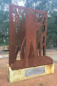
The Volunteer, art piece on the Railway Reserves Heritage Trail, Parkerville
The Shire is recognised for its natural environment and has numerous walk and ride trails:
- Bibbulmun Track
- C Y O'Connor Trail
- Eagle View Walk Trail
- Forsyths Mill Mountain Bike Track
- Kep Track
- Lake Leschenaultia Trails
- Munda Biddi Trail
- Railway Reserves Heritage Trail
- Weir View Walk
Suburbs and localities
Population
| Year | Population |
|---|---|
| 1911 | 2,716 |
| 1921 | 3,296 |
| 1933 | 4,975 |
| 1947 | 6,072 |
| 1954 | 7,619 |
| 1961 | 8,104 |
| 1966 | 8,925 |
| 1971 | 12,018 |
| 1976 | 16,867 |
| 1981 | 20,786 |
| 1986 | 24,415 |
| 1991 | 29,184 |
| 1996 | 31,462 |
| 2001 | 33,281 |
| 2006 | 35,095 |
| 2011 | 36,529 |
| 2016 | 38,157 |
Presidents and chairmen
References
- ↑ Australian Bureau of Statistics (27 June 2017). "Mundaring (S)". 2016 Census QuickStats. Retrieved 26 November 2017.

- ↑ WA Electoral Commission, Municipality Boundary Amendments Register (release 3.0), 31 July 2007.
- ↑ Mundaring Shire Council. "Population & Area". Archived from the original on 2006-02-19. Retrieved 2006-04-01.
External links
This article is issued from
Wikipedia.
The text is licensed under Creative Commons - Attribution - Sharealike.
Additional terms may apply for the media files.