Shire of Harvey
| Shire of Harvey Western Australia | |||||||||||||||
|---|---|---|---|---|---|---|---|---|---|---|---|---|---|---|---|
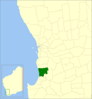 Location in Western Australia | |||||||||||||||
| Population | 26,553 (2016 census)[1] | ||||||||||||||
| • Density | 15.3637/km2 (39.7917/sq mi) | ||||||||||||||
| Established | 1894 | ||||||||||||||
| Area | 1,728.3 km2 (667.3 sq mi) | ||||||||||||||
| Shire President | Tania Jackson | ||||||||||||||
| Council seat | Harvey | ||||||||||||||
| Region | South West, Outer Bunbury | ||||||||||||||
| State electorate(s) | Murray-Wellington | ||||||||||||||
| Federal Division(s) | Forrest | ||||||||||||||
 | |||||||||||||||
| Website | Shire of Harvey | ||||||||||||||
| |||||||||||||||
The Shire of Harvey is a local government area of Western Australia. It is located in the state's South West region, approximately 140 km south of Perth, and includes some of Bunbury's northern suburbs. The shire covers an area of 1,728 km² and had a population of approximately 26,500 as at the 2016 Census. Around 12% of the population are of Southern or Eastern European origin.
It contains three large towns, Harvey, Australind and Brunswick Junction and a number of smaller towns. The shire office is located on Uduc Road, Harvey, and an administration centre is open at Mulgara Street, Australind.
History
From 1871, the Harvey district was controlled by the Wellington Road Board. The Brunswick Board was gazetted in December 1894 and the first election was held on 11 February 1895. It was not until 1909 that the name was changed to Harvey Road District. On 1 July 1961, it became the Shire of Harvey.
Wards
The shire does not have Wards, although is represented by Councillors from all around the Shire
The Shire President is Cr Tania Jackson.
Towns and localities
The Shire of Harvey contains the following towns and localities:
|
Population
| Year | Population |
|---|---|
| 1911 | 3,646 |
| 1921 | 3,950 |
| 1933 | 5,367 |
| 1947 | 5,589 |
| 1954 | 6,731 |
| 1961 | 6,834 |
| 1966 | 6,543 |
| 1971 | 6,460 |
| 1976 | 6,704 |
| 1981 | 8,027 |
| 1986 | 9,609 |
| 1991 | 12,367 |
| 1996 | 14,714 |
| 2001 | 17,224 |
| 2006 | 19,556 |
| 2011 | 23,237 |
| 2016 | 27,029 |
The ABS provides a breakdown for the Australind suburban area (Part A) and the remainder of the Shire (Part B):
| Year | Part A | Part B |
|---|---|---|
| 1991 | 5,816 | 6,551 |
| 1996 | 7,570 | 7,144 |
| 2001 | 9,574 | 7,650 |
| 2006 | 11,537 | 8,019 |
| 2011 | 14,779 | 8,455 |
References
- ↑ Australian Bureau of Statistics (27 June 2017). "Harvey (S)". 2016 Census QuickStats. Retrieved 26 November 2017.
