City of Greater Geraldton
| City of Greater Geraldton Western Australia | |||||||||||||||
|---|---|---|---|---|---|---|---|---|---|---|---|---|---|---|---|
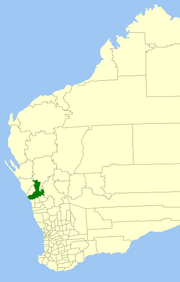 Location in Western Australia | |||||||||||||||
| Population | 40,448 (2013 est)[1] | ||||||||||||||
| • Density | 3.20368/km2 (8.29748/sq mi) | ||||||||||||||
| Established | 2011 | ||||||||||||||
| Area | 12,625.5 km2 (4,874.7 sq mi) | ||||||||||||||
| Council seat | Geraldton | ||||||||||||||
| Region | Mid West | ||||||||||||||
| State electorate(s) | Geraldton | ||||||||||||||
| Federal Division(s) | Durack | ||||||||||||||
|
| |||||||||||||||
| Website | City of Greater Geraldton | ||||||||||||||
| |||||||||||||||
The City of Greater Geraldton is a local government area in the Mid West region of Western Australia, 424 kilometres (263 mi) north of the state capital, Perth on the Indian Ocean. It covers an area of 12,625.5 square kilometres (4,874.7 sq mi), and its seat of government is the town of Geraldton.
It was established on 1 July 2011 following the amalgamation of the Shire of Mullewa and the City of Geraldton-Greenough, itself a product of a 2007 amalgamation between the City of Geraldton and Shire of Greenough.
History
City of Geraldton
Geraldton was proclaimed as a municipal district on 21 February 1871. On 1 July 1961, it became a town under the new Local Government Act 1960. On 22 April 1988, Geraldton attained city status.[2]
Shire of Greenough
The Greenough and Geraldton Road Boards — the latter not to be confused with the Geraldton Municipality — were proclaimed on 24 January 1871. Initially, Greenough included all of Murchison, which split away on 3 August 1875 and Mullewa, which formed on 11 August 1911. In 1951, Geraldton and Greenough road boards merged, and on 1 July 1961 became the Shire of Geraldton-Greenough under the new Local Government Act 1960. On 19 March 1965, it was renamed the Shire of Greenough.[2]
City of Geraldton-Greenough
A recommendation was made to the Minister for Local Government by the Local Government Advisory Board in August 2006 to amalgamate the Shire of Greenough with the City of Geraldton.
The Greenough electors successfully petitioned for a referendum to determine whether amalgamation should proceed. This was held on 2 December 2006, and with a participation rate of 28.74%, a majority of 80% voted against the proposal.[3] However, under the Local Government Act 1995 (clause 10 of Schedule 2.1) as the vote did not attract 50% of registered voters, it did not meet the requirements for a valid poll.[4]
The Liberal government, elected in mid-2008, announced its intentions to amalgamate local governments around the state in line with reforms undertaken elsewhere in Australia. Ultimately, the plan did not succeed, but a number of local governments commenced negotiations for voluntary mergers. One such group included the City, the Shire of Chapman Valley and the Shire of Mullewa. In February 2010, Chapman Valley decided not to proceed, citing community opposition.[5][6] In December 2010, the Local Government Advisory Board approved the merger.[7] Polls were held in both municipalities, with 72.61% of voters in Geraldton-Greenough and 83.23% of voters in Mullewa voting against the merger.[8] However, both polls failed to reach the minimum 50% required to be a valid poll, and the City of Greater Geraldton came into being on 1 July 2011.
Until the October 2011 elections, the council was administered by five commissioners, led by Ron Yuryevich, the mayor of City of Kalgoorlie-Boulder, and including Ian Carpenter, the mayor of the former City and Nino Messina, the mayor of the former Shire.[9]
Wards
The City is divided into seven wards, each with two councillors, plus a directly elected mayor to serve the entire district.[10]
- Champion Bay Ward – contains Beresford, Spalding and Webberton
- Chapman Ward – contains Bluff Point, Drummond Cove, Glenfield, Sunset Beach and Waggrakine
- Port Ward – contains Geraldton itself, Beachlands and Mahomets Flats
- Tarcoola Ward – contains Mount Tarcoola, Tarcoola Beach and Wandina
- Willcock Ward – contains Karloo, Rangeway, Wonthella and part of Utakarra
- Hills Ward – contains the majority of the former City's land area, and includes the suburbs of Strathalbyn and Woorree
- Mullewa Ward – the entire former Shire of Mullewa.
Suburbs
Towns
- Cape Burney
- Drummond Cove
- Eradu
- Greenough
- Kojarena
- Minnenooka
- Moonyoonooka
- Mullewa
- Pindar
- Tardun
- Tenindewa
- Walkaway
- Wandanooka
- Wicherina
- Wilroy
- Wongoondy
- Woolgorong
Mayors
Population
The population of Greater Geraldton grew from 34,019 in 2001 to 39,311 in 2012, representing an increase of 15%. Unemployment in Greater Geraldton in September 2013 was estimated at 5.6%, compared to 4.7% in Western Australia and 5.6% nationally.[11] Greater Geraldton's population growth from 2012 to 2013 was 2.5% p.a.[12]
The historical populations of the area which formed Geraldton-Greenough were:
| Year | Population | Geraldton | Greenough | Mullewa |
|---|---|---|---|---|
| 1921 | 6,365 | 4,174 | 1,375 | 816 |
| 1933 | 8,162 | 4,984 | 1,556 | 1,622 |
| 1947 | 8,864 | 5,972 | 1,567 | 1,325 |
| 1954 | 11,337 | 8,309 | 1,371 | 1,657 |
| 1961 | 13,842 | 10,894 | 1,321 | 1,627 |
| 1966 | 15,544 | 12,125 | 1,594 | 1,825 |
| 1971 | 18,887 | 15,118 | 1,920 | 1,849 |
| 1976 | 22,501 | 17,663 | 2,979 | 1,859 |
| 1981 | 25,356 | 19,096 | 4,612 | 1,648 |
| 1986 | 27,176 | 19,923 | 5,798 | 1,455 |
| 1991 | 29,537 | 20,521 | 7,626 | 1,390 |
| 1996 | 31,237 | 19,724 | 10,337 | 1,176 |
| 2001 | 32,196 | 19,179 | 11,927 | 1,090 |
| 2006 | 33,372 | 18,916 | 13,545 | 911 |
References
- ↑ "3218.0 Regional Population Growth, Australia. Table 5. Estimated Resident Population, Local Government Areas, Western Australia". 3 April 2014. Retrieved 11 September 2014.
- 1 2 WA Electoral Commission, Municipality Boundary Amendments Register (release 2.0), 31 May 2003.
- ↑ Western Australian Electoral Commission (2 December 2006). "Greenough – Voting in Person Referendum". Archived from the original on 30 August 2007. Retrieved 28 April 2007.
- ↑ Local Government Advisory Board (December 2006). "Inquiry Reports – Geraldton Greenough Inquiry Report". Archived from the original on 15 May 2009. Retrieved 28 April 2007.
- ↑ "Local mergers 'doomed from beginning'". ABC News. 24 February 2010. Retrieved 26 July 2011.
- ↑ "Councils push ahead with merger deal". ABC News. 2 March 2011. Retrieved 26 July 2011.
- ↑ Local Government Advisory Board (December 2010). "Assessment of the Proposals for Amalgamation and Boundary Amendments involving the City of Geraldton-Greenough and the Shires of Mullewa and Chapman Valley". Archived from the original on 2011-02-20. Retrieved 26 July 2011.
- ↑ Western Australian Electoral Commission (16 April 2011). Mullewa and Geraldton-Greenough results. Accessed 26 July 2011.
- ↑ City of Greater Geraldton. "Commissioners". Retrieved 26 July 2011.
- ↑ "Local Government Act 1995 – City of Geraldton-Greenough (Creation) Order 2007" (PDF). Western Australia Government Gazette. 30 March 2007. pp. 2007:1458–1468.
- ↑ "6202.0 – Labour Force, Australia, Sep 2013". www.abs.gov.au. Australian Bureau of Statistics. Retrieved 28 February 2014.
- ↑ "Australian Bureau of Statistics, Regional Population Growth, Cat. 3218.0 (Released on 30 August 2013". www.abs.gov.au. Australian Bureau of Statistics. Retrieved 28 February 2014.