Shire of Brookton
| Shire of Brookton Western Australia | |||||||||||||||
|---|---|---|---|---|---|---|---|---|---|---|---|---|---|---|---|
 Brookton from the west | |||||||||||||||
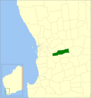 Location in Western Australia | |||||||||||||||
| Population | 992 (2013 est)[1] | ||||||||||||||
| • Density | 0.6194/km2 (1.6042/sq mi) | ||||||||||||||
| Established | 1906 | ||||||||||||||
| Area | 1,601.6 km2 (618.4 sq mi) | ||||||||||||||
| Mayor | Barry Coote | ||||||||||||||
| Council seat | Brookton | ||||||||||||||
| Region | Wheatbelt | ||||||||||||||
| State electorate(s) | Wagin | ||||||||||||||
| Federal Division(s) | O'Connor | ||||||||||||||
|
| |||||||||||||||
| Website | Shire of Brookton | ||||||||||||||
| |||||||||||||||
The Shire of Brookton is a local government area in the Wheatbelt region of Western Australia, about 140 kilometres (87 mi) southeast of Perth, the state capital. The Shire covers an area of 1,602 square kilometres (619 sq mi) and its seat of government is the town of Brookton.
The local economy, worth approximately $25 million per year to the state economy, is based on agriculture - predominantly cereal grains and sheep.[2]
History
On 10 September 1906, the Brookton Road Board met for the first time after Mr Samuel Williams led a move by local landowners to break away from the Beverley Road District. On 1 July 1961, it became the Shire of Brookton under the Local Government Act 1960.[3]
Wards
The shire presently is undivided and has 7 councillors. Prior to the 2009 local government election, it was divided into three wards as follows:
- Central Ward (5 councillors)
- West Ward (2 councillors)
- East Ward (2 councillors)
Towns
Population
| Year | Population |
|---|---|
| 1921 | 1,149 |
| 1933 | 1,188 |
| 1947 | 934 |
| 1954 | 1,376 |
| 1961 | 1,319 |
| 1966 | 1,341 |
| 1971 | 1,272 |
| 1976 | 1,181 |
| 1981 | 1,214 |
| 1986 | 1,093 |
| 1991 | 1,018 |
| 1996 | 908 |
| 2001 | 957 |
| 2006 | 978 |
References
- ↑ "3218.0 Regional Population Growth, Australia. Table 5. Estimated Resident Population, Local Government Areas, Western Australia". 3 April 2014. Retrieved 11 September 2014.
- ↑ Agriculture WA (July 2000). "Agriculture Statistical Overview 96/97 - Shire of Brookton" (PDF). Archived from the original (PDF) on 2006-09-17. Retrieved 2006-11-15.
- ↑ WA Electoral Commission, Municipality Boundary Amendments Register (release 3.0), 31 May 2007.
External links
![]()