City of Melville
| City of Melville Western Australia | |||||||||||||||
|---|---|---|---|---|---|---|---|---|---|---|---|---|---|---|---|
 | |||||||||||||||
| Population | 98,083 (2016 census)[1] | ||||||||||||||
| • Density | 1,860.10/km2 (4,817.6/sq mi) | ||||||||||||||
| Established | 1900 | ||||||||||||||
| Area | 52.73 km2 (20.4 sq mi) | ||||||||||||||
| Mayor | Russell Aubrey | ||||||||||||||
| Council seat | Booragoon | ||||||||||||||
| Region | South Metropolitan Perth | ||||||||||||||
| State electorate(s) | Willagee, Alfred Cove, Bateman, Fremantle, Riverton | ||||||||||||||
| Federal Division(s) | Tangney, Fremantle | ||||||||||||||
 | |||||||||||||||
| Website | City of Melville | ||||||||||||||
| |||||||||||||||
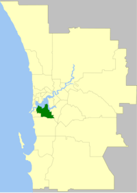
The City of Melville is a local government area in the southern suburbs of the Western Australian capital city of Perth, east of the port city of Fremantle and about 12 kilometres (7.5 mi) south of Perth's central business district. The City covers an area of 52.73 square kilometres (20.36 sq mi) and had a population of about 98,000 as at the 2016 Census.
History
Melville was originally established on 14 December 1900 as the East Fremantle Road District under the Roads Boards Act 1871. It was renamed Melville six months later. In 1923, it received a large amount of land from Jandakot Road District when that entity was abolished.[2]
On 1 July 1961, it became a shire following the enactment of the Local Government Act 1960. The Shire of Melville was declared a town on 28 September 1962,[3] and a city on 3 May 1968.[4]
The City of Melville maintains 463 km of roads and 2.10 km² of parks and gardens.
Wards
The City is divided into six wards, each of two councillors. Each councillor serves a four-year term, and half-elections are held every two years. The mayor is directly elected.
- Applecross-Mt Pleasant Ward
- Bicton-Attadale Ward
- Bullcreek-Leeming Ward
- City Ward
- Palmyra-Melville-Willagee Ward
- University Ward
Suburbs
- Alfred Cove
- Applecross
- Ardross
- Attadale
- Bateman
- Bicton
- Booragoon
- Brentwood
- Bull Creek
- Kardinya
- Leeming *
- Melville
- Mount Pleasant
- Murdoch
- Myaree
- Palmyra
- Willagee
- Winthrop
(* indicates suburb partially located within City)
Indigenous sites of significance
There are several significant Noongar sites within the City of Melville precinct.[5][6]
- Niergarup
- Quaada gabee
- Jenalup
- Dyoondalup
- Marradungup
- Wireless Hill
Population
| Year | Population |
|---|---|
| 1911 | 565 |
| 1921 | 2,360 |
| 1933 | 4,628 |
| 1947 | 7,547 |
| 1954 | 19,810 |
| 1961 | 39,207 |
| 1966 | 47,887 |
| 1971 | 52,976 |
| 1976 | 54,384 |
| 1981 | 61,211 |
| 1986 | 67,131 |
| 1991 | 84,369 |
| 1996 | 88,422 |
| 2001 | 90,264 |
| 2006 | 93,003 |
| 2011 | 95,700 |
Mayors
Sports
Local sporting clubs include:
References
Notes
- ↑ Australian Bureau of Statistics (27 June 2017). "Melville (C)". 2016 Census QuickStats. Retrieved 26 November 2017.

- ↑ WA Electoral Commission, Municipality Boundary Amendments Register (release 3.0), 31 July 2007.
- ↑ "Local Government Act, 1960. Declaration as a Town. Provisions Concerning Elections. (per L.G. 433/62)". Western Australia Government Gazette. 28 September 1962. p. 1962:2680–2681.
- ↑ "Local Government Act, 1960–1967. Order in Council". Western Australia Government Gazette. 3 May 1968. p. 1968:1245.
- ↑ "Aboriginal History in the City of Melville". City of Melville. Archived from the original on 4 March 2016. Retrieved 19 July 2015.
- ↑ "Sites of Cultural Significance in the City of Melville". City of Melville. Archived from the original on 4 March 2016. Retrieved 19 July 2015.
Bibliography