Shire of Collie
| Shire of Collie Western Australia | |||||||||||||||
|---|---|---|---|---|---|---|---|---|---|---|---|---|---|---|---|
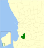 Location in Western Australia | |||||||||||||||
| Population | 8,798 (2016 census)[1] | ||||||||||||||
| • Density | 5.1423/km2 (13.3186/sq mi) | ||||||||||||||
| Established | 1900 | ||||||||||||||
| Area | 1,710.9 km2 (660.6 sq mi) | ||||||||||||||
| Mayor | Sarah Stanley | ||||||||||||||
| Council seat | Collie | ||||||||||||||
| Region | South West | ||||||||||||||
| State electorate(s) | Collie-Preston | ||||||||||||||
| Federal Division(s) | Forrest | ||||||||||||||
|
| |||||||||||||||
| Website | Shire of Collie | ||||||||||||||
| |||||||||||||||
The Shire of Collie is a local government area in the South West region of Western Australia, about 60 kilometres (37 mi) east of Bunbury and about 200 kilometres (124 mi) south of the state capital, Perth. The Shire covers an area of 1,711 square kilometres (661 sq mi), and its seat of government is the town of Collie.
History
The Collie Road District was gazetted in 1900, and a separate Municipal District to manage the affairs of the town of Collie was gazetted a year later. On 2 March 1951, they amalgamated to form the Collie Coalfields Road District. On 1 July 1961, following the enactment of the Local Government Act, the district was reconstituted as the Shire of Collie.[2]
Wards
The shire is no longer divided into wards and the eleven councillors sit at large.
Towns
Notable councillors
- John Ewing, Collie Roads Board chairman 1905; also a state MP
- Herbert Wells, mayor of Collie 1908–1909, 1911–1913; later a state MP
- Bob Pike, Collie Shire Council 1957–1970, shire president 1962–1970; later a state MP
References
- ↑ Australian Bureau of Statistics (27 June 2017). "Collie (S)". 2016 Census QuickStats. Retrieved 1 December 2017.

- ↑ WA Electoral Commission, Municipality Boundary Amendments Register (release 3.0), 31 May 2007.