Shire of Perenjori
| Shire of Perenjori Western Australia | |||||||||||||||
|---|---|---|---|---|---|---|---|---|---|---|---|---|---|---|---|
.jpg) Perenjori Shire Hall & Offices, 2018 | |||||||||||||||
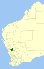 Location in Western Australia | |||||||||||||||
| Population | 924 (2013 est)[1] | ||||||||||||||
| • Density | 0.11115/km2 (0.28788/sq mi) | ||||||||||||||
| Area | 8,313.0 km2 (3,209.7 sq mi) | ||||||||||||||
| President | Laurie Butler | ||||||||||||||
| Council seat | Perenjori | ||||||||||||||
| Region | Mid West | ||||||||||||||
| State electorate(s) | Moore | ||||||||||||||
| Federal Division(s) | Durack | ||||||||||||||
|
| |||||||||||||||
| Website | Shire of Perenjori | ||||||||||||||
| |||||||||||||||
The Shire of Perenjori is a local government area in the Mid West region of Western Australia, about 360 kilometres (224 mi) north of the state capital, Perth. The Shire covers an area of 8,313 square kilometres (3,210 sq mi), and its seat of government is the town of Perenjori.
History
On 2 June 1916, the Perenjori-Morawa Road District was proclaimed on land previously managed by the Upper Irwin road board. On 27 April 1928 it split into the Perenjori and Morawa Road Districts. On 1 July 1961, Perenjori became a shire under the Local Government Act 1960.[2]
On 18 September 2009, the Shires of Mingenew, Three Springs, Morawa and Perenjori announced their intention to amalgamate. A formal agreement was signed five days later, and the name Billeranga was later chosen.[3] However, by February 2011, community pressure had led to the negotiations stalling, and on 16 April 2011, voters from the Shire of Perenjori defeated the proposal at a referendum.[4][5]
Wards
The Shire is divided into five wards:
- Perenjori Ward (three councillors)
- Caron Ward (one councillor)
- Latham/Caron Ward (two councillors)
- Bowgada Ward (two councillors)
- Maya Ward (1 councillor)
Towns and localities
Population
| Year | Population |
|---|---|
| 1933 | 1,275 |
| 1947 | 956 |
| 1954 | 1,277 |
| 1961 | 1,311 |
| 1966 | 1,311 |
| 1971 | 1,204 |
| 1976 | 1,167 |
| 1981 | 1,005 |
| 1986 | 823 |
| 1991 | 772 |
| 1996 | 684 |
| 2001 | 600 |
| 2006 | 528 |
References
- ↑ "3218.0 Regional Population Growth, Australia. Table 5. Estimated Resident Population, Local Government Areas, Western Australia". 3 April 2014. Retrieved 11 September 2014.
- ↑ WA Electoral Commission, Municipality Boundary Amendments Register (release 2.0), 31 May 2003.
- ↑ "Mid-West councils to amalgamate". ABC Online. 18 September 2009.
- ↑ Kennedy, Jane (25 February 2011). "Shire merges hit stalling point". ABC Midwest. Retrieved 26 May 2012.
- ↑ "Perenjori amalgamation not to proceed". Mid West News. 18 April 2011. Retrieved 26 May 2012.