Sete Pedras
 Sete Pedras Location within São Tomé Island | |
| Geography | |
|---|---|
| Location | Southeast of the island of Príncipe, São Tomé and Príncipe near Ribeira Peixe |
| Coordinates | 0°02′20″N 6°37′21″E / 0.0388°N 6.62261°ECoordinates: 0°02′20″N 6°37′21″E / 0.0388°N 6.62261°E |
| Administration | |
| Demographics | |
| Population | 0 |
| Pop. density | 0 /km2 (0 /sq mi) |
| Additional information | |
| Stratovolcano | |
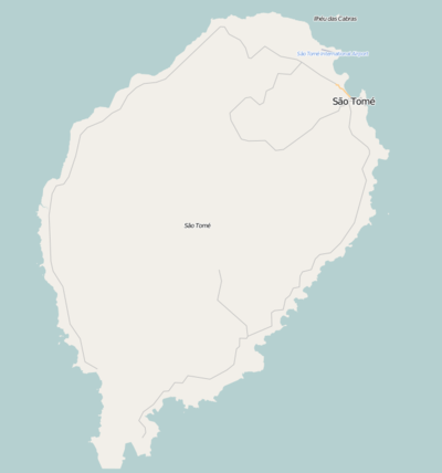
Sete Pedras is an islet in the Gulf of Guinea and is one of the smaller islands of São Tomé and Príncipe.[1] The islet is under 5 km southeast of the southernmost portion of the island of São Tomé with the closest landmass at Ponta Haleia to the west, northwest are its nearest islet Ilhéu Quixibá, a few kilometers to the south is the equator.. The name is Portuguese for Seven Stomes (rarely as Rocks) which still exists today and are divided into four large and 11 small rocks. Also its length is 690x440 m, it has a triangular shape. It is one of the very small areas in the nation where vegetation does not exist. During the Ice Age, it formed the southeastern part the island of São Tomé up to around 8,000 and 7,000 BC.
In its earlier maps, the rocky islets were thought to be north of the equator, it was mentioned as "Seven Steen" (Modern Dutch: Zieven Steen) in the 1665 map by Johannes Vingboons.[2] and the 1780 map by A. Dalrymple and mentioned as "Seven Stones".[3] From the 19th century, the equator was slightly mapped slightly south, in 1922 the equator became slightly further south as its correct marking would be at Ilhéu das Rolas.
The only fauna prevalent in the island are birds and some marine creatures including molluscs. Other fauna are fishes and coral surrounding the islets.
References
- ↑ Ilhéu Quixibá
- ↑ 1665 map of the island of Saint Thomas (now São Tomé) by Johannes Vingboons, now at the Dutch National Archive
- ↑ 1780 map of the island of Saint Thomas (now São Thomé) by T. Harmar and A. Dalrymple, now at the French National Library
| Communities | 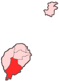 | |
|---|---|---|
| Geographical features |
| |
| Landmarks and hotels | ||
| Culture | ||
| Major islands | |
|---|---|
| Minor islands and islets | |