Ilhéu de Santana
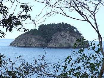 Ilhéu de Santana, seen from São Tomé Island | |
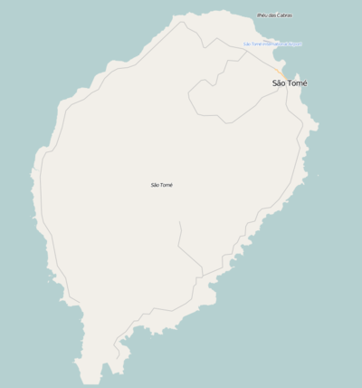 Ilhéu de Santana Location on São Tomé Island | |
| Geography | |
|---|---|
| Location | east of São Tomé near the town of Santana |
| Administration | |
| Demographics | |
| Population | 0 |
| Pop. density | 0 /km2 (0 /sq mi) |
Ilhéu de Santana is an island in the Gulf of Guinea and is one of the smaller islands of São Tomé and Príncipe. The islet is located just off the east coast of the island of São Tomé near the town of Santana in Cantagalo District. Ilhéu de Santana is uninhabited. Since 2012, it is the only island outside Príncipe being part of the Príncipe Biosphere Reserve dominating the marine portions.
History
During the Ice Age when the sea level was 130 meters lower than the present day, it formed a part of the island of São Tomé and was a hill, thousands of years ago, the hill separated from the island and became a current islet.
As with the island, the islet was discovered by Portuguese explorers João de Santarém and Pêro Escobar between 1469 and 1471 on Saint Thomas' feast day.
The islet were mentioned in the 1616 map by Jodocus Hondius[1] Later maps mentioned that was thought to be in the Southern Hemisphere, it was mentioned as "Sint Anne" in the 1665 map by Johannes Vingboons.[2]and as "Saint Anna" the 1780 map by A. Dalrymple as well as "Cabor" and "Postillion's Cap" (Postillion's Cape, Cabo de Postilhão).[3] From the 19th century, it would be fully mapped as in the Northern Hemisphere.
References
- ↑ 1616 map of the island of Saint Thomas (now São Tomé) by Jodocus Hondius, now at the French National Library
- ↑ 1665 map of the island of Saint Thomas (now São Tomé) by Johannes Vingboons, now at the Dutch National Archive
- ↑ 1780 map of the island of Saint Thomas (now São Thomé) by T. Harmar and A. Dalrymple, now at the French National Library
| Communities | 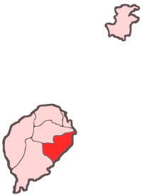 | |
|---|---|---|
| Geographical features | ||
| Sports facilities and complexes |
| |
| Culture | ||
| Major islands | |
|---|---|
| Minor islands and islets | |