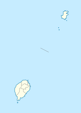
Pedra da Galé
 Pedra da Galé Location off Príncipe Island | |
| Geography | |
|---|---|
| Location | North of the island of Príncipe, São Tomé and Príncipe near Bom Bom |
| Coordinates | 1°43′31″N 7°22′49″E / 1.7254°N 7.3802°ECoordinates: 1°43′31″N 7°22′49″E / 1.7254°N 7.3802°E |
| Administration | |
| Demographics | |
| Population | 0 |
| Pop. density | 0 /km2 (0 /sq mi) |
| Additional information | |
| Stratovolcano | |
Pedra da Galé is an uninhabited tiny islet in the Gulf of Guinea and is one of the smaller islands of São Tomé and Príncipe.[1]
The islet is located 3,7 km NNW of the island of Príncipe at the area of Bom Bom and the islet is the northernmost portion of São Tomé and Príncipe.
The islet measures 180 meters from SSE to NNW and its width ranges from 28 meters in the south to 48 meters to the north. The entire terrain is completely barren. The islet was formed out of a probably separate volcanic vent. During the Ice Age, it was slightly larger.
The islet is not inhabited by humans. Fauna dominate the island, only birds are the island's fauna, other fauna are in the sea surrounding the islet including fishes and crustaceans.
Since 2012, the islet forms a part of the Island of Príncipe Biosphere Reserve which includes Ilhéu dos Mosteiros, Bom Bom and most of the shallow waters to the north down to about 100 meters below sea level.
References
- ↑ Pedra da Galé at Wikimapia
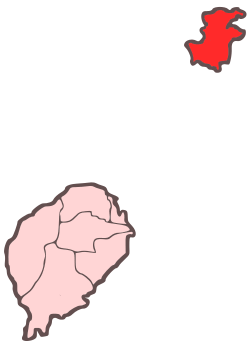
Autonomous Region of Príncipe/Pagué District | ||
|---|---|---|
| Communities |
|  |
| Geographical features | ||
| Buildings | ||
| Football | ||
| Major islands | |
|---|---|
| Minor islands and islets | |