Ponta Baleia
| Ponta Baleia | |
|---|---|
| Village | |
 Ponta Baleia Location on São Tomé Island | |
| Coordinates: 0°02′18″N 6°32′51″E / 0.0382°N 6.5476°ECoordinates: 0°02′18″N 6°32′51″E / 0.0382°N 6.5476°E | |
| Country |
|
| Province | São Tomé |
| District | Caué |
| Population (2008) | |
| • Total | 145 |
| Time zone | UTC+0 (UTC) |
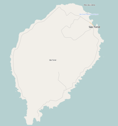
Ponta Baleia is a headland, one of the island's southernmost and a settlement in the south of Caué District on São Tomé Island in São Tomé and Príncipe. Its population is 145 (2008 est.),[1] The locality is located nearly southeast of Vila Malanza and south of Monte Mário and is on National Route 2 (EN2).
Population history
| Historical population | ||
|---|---|---|
| Year | Pop. | ±% |
| 2001 (census) | 127 | — |
| 2008 (estimate) | 145 | +14.2% |
Description
Both the point and the settlement are named after whales which are founded inside the ocean in deep areas and still does in the present day.
West of Ponta Baleia is the small bay known as Baía de Iago Iago (then as Iago-Iago) whose etymology is Angolan, on the opposite side is Porto Alegre. 4 km south is the equator. East of the point area marks the eastern end of Canal das Rolas which dominates south of the headland and the rest of the ocean.
Ponta Baleia is the only port offering a small non-motor ferry route with Ilhéu das Rolas, as motor vehicles are not allowed on the islet.
History
In its earlier maps, the equator was thought to be marked close to the headland in the 1665 map by Johannes Vingboons.[2] and nearby the headland in the 1780 map by A. Dalrymple and also mentioned it as "Joegande".[3] Ponta Baleia is mentioned in a 1902 map in a modern spelling form and its equator was thought to be slightly south at the channel until its correct marking in 1918 would be at Ilhéu das Rolas.
Economy
Agriculture is the dominant industry as well as fishing. Cocoa and coffee has been the dominant crop and covers most the whole village's and area's production.
Nature
Birds, amphibians and insects including moths, butterflies and beetles are founded in the area especially upland. In the marine portion by the point and up to the area of Canal das Rolas are rich in sea fauna including fishes, sea plants, crabs, corals and mollusks (molluscs), notably pyrams and sea snails.
A barnacle species, Conopea fidelis is founded in the waters near the village and its surroundings, it was first described there.[4] Also founded is the gorgonian Muriceopsis tuberculata.
References
- ↑ INE, Evolução da população São-Tomense por localidades, 2001/2007-08
- ↑ 1665 map of the island of Saint Thomas (now São Tomé) by Johannes Vingboons, now at the Dutch National Archive
- ↑ 1780 map of the island of Saint Thomas (now São Thomé) by T. Harmar and A. Dalrymple, now at the French National Library
- ↑ Carrison-Stone, D., Van Syoc, R., Williams, G. & Simison, W.B. 2013. Two new species of the gorgonian inhabiting barnacle, Conopea (Crustacea, Cirripedia, Thoracica), from the Gulf of Guinea. ZooKeys 270: 1–20.
| Communities | 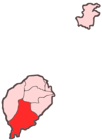 | |
|---|---|---|
| Geographical features |
| |
| Landmarks and hotels | ||
| Culture | ||