Mountain Home (Santa Clara County, California)
| Mountain Home | |
|---|---|
| Populated Place | |
 Mountain Home Location in the United States | |
| Coordinates: 37°07′16″N 121°47′45″W / 37.12111°N 121.79583°WCoordinates: 37°07′16″N 121°47′45″W / 37.12111°N 121.79583°W | |
| Country |
|
| State |
|
| County | Santa Clara |
| Area | |
| • Total | 6.0 sq mi (16 km2) |
| • Land | 5.9 sq mi (15 km2) |
| • Water | 0.1 sq mi (0.3 km2) |
| Elevation | 928 ft (283 m) |
| Time zone | UTC-8 (PST) |
| • Summer (DST) | UTC-7 (PDT) |
| ZIP code | 95033, 95037 |
| Area code(s) | 408, 669 |
| GNIS feature ID | 1670815[1] |
Mountain Home is a sparsely populated area located on the eastern side of the Santa Cruz Mountains in unincorporated southwest Santa Clara County, California near Mount Chual and Rancho Canada del Oro Open Space Preserves. The Loma Fire burned about one half of the region in 2016.
Geography
The area is situated within the upper Llagas Creek watershed, bounded by Mount Chual and Rancho Canada del Oro Open Space Preserves toward the north, Loma Prieta Road on the west, Loma Chiquita Road on the south, and Twin Creeks Road on the east.[2] The region includes small communities along Casa Loma Road, Mt Chual Spur Road, and Twin Falls Road.[3]
The area is mostly mountain ridges with steep, sloping terrain and narrow canyons. The Berrocal Fault runs diagonally through the center of the area.[4][5]
Native vegetation ranges from a mixed conifer-oak woodland along the mountain ridges, to chaparral and coastal scrub along the slopes, to riparian flora along the canyon floors.
Climate
According to the Köppen climate classification system, Mountain Home has a warm-summer Mediterranean climate, abbreviated "Csb" on climate maps.
History
In 2016, the Loma Fire burned through approximately half the region, with multiple homes damaged or destroyed.[6]
References
- ↑ "Mountain Home". Geographic Names Information System. United States Geological Survey.
- ↑ Santa Clara Valley Open Space Authority. "Santa Clara Valley Open Space Authority and Water District Meeting, January 2017" (PDF). Retrieved 2017-07-11.
- ↑ CalFire. "Watershed Report, October 2016" (PDF). Retrieved 2017-07-11.
- ↑ USGS. "Report on Berrocal fault zone (Class A) No. 57, August 2000". Retrieved 2017-07-11.
- ↑ CC Cartography, Inc. "San Jose area faults map". Retrieved 2017-07-06.
- ↑ CalFire. "Final Report on Loma Fire, October 2016". Retrieved 2017-07-11.
Municipalities and communities of Santa Clara County, California, United States | ||
|---|---|---|
| Cities and towns | 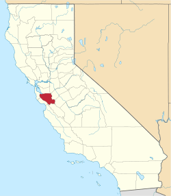 | |
| CDPs | ||
| Unincorporated communities | ||
| CCDs | ||
| Ghost towns | ||
| Bodies of water |
|  |
|---|---|---|
| Counties | ||
| Major cities | ||
| Cities and towns 100k–250k | ||
| Cities and towns 50k–99k | ||
| Cities and towns 25k-50k | ||
| Cities and towns 10k–25k |
| |
| Sub-regions | ||