Los Altos Hills, California
| Town of Los Altos Hills | ||
|---|---|---|
| Town in California | ||
 Westwind Community Barn | ||
| ||
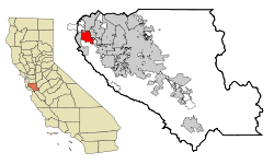 Location in Santa Clara County and the state of California | ||
 Los Altos Hills Location in the United States  Los Altos Hills Los Altos Hills (the US) | ||
| Coordinates: 37°22′17″N 122°8′15″W / 37.37139°N 122.13750°WCoordinates: 37°22′17″N 122°8′15″W / 37.37139°N 122.13750°W | ||
| Country |
| |
| State |
| |
| County |
| |
| Incorporated | January 27, 1956[1] | |
| Government | ||
| • Mayor | Gary Waldeck[2] | |
| Area[3] | ||
| • Total | 8.92 sq mi (23.11 km2) | |
| • Land | 8.92 sq mi (23.11 km2) | |
| • Water | 0.00 sq mi (0.00 km2) 0% | |
| Elevation | 292 ft (89 m) | |
| Population (2010) | ||
| • Total | 7,922 | |
| • Estimate (2016)[4] | 8,501 | |
| • Density | 952.60/sq mi (367.79/km2) | |
| Time zone | UTC-8 (PST) | |
| • Summer (DST) | UTC-7 (PDT) | |
| ZIP codes | 94022, 94024 | |
| Area code(s) | 650 | |
| FIPS code | 06-43294 | |
| GNIS feature ID | 1659746 | |
| Website | http://www.losaltoshills.ca.gov/ | |
Los Altos Hills (US: /lɔːs
The Los Altos Hills ZIP code 94022 appeared on the 2017 Forbes list of America's most expensive ZIP codes; 94022 was ranked the 3rd most expensive in the United States, with a median home price of $7,755,000.[5]
Strictly residential
Los Altos Hills has a ban on commercial zones, which was upheld by the California Court of Appeal (First District) in 1973.[6] The town's two retail commercial operations are the book store on the campus of Foothill College and the gift shop on the grounds of the Immaculate Heart Monastery of the Poor Clare Colettines. The town does not have a post office or library, with mail delivery provided from nearby Los Altos.
The town's zoning regulations require a minimum lot size of one acre (4,000 m²), setbacks from the property boundary, and easements for public pathways.[7][8] Landowners are limited to one primary dwelling per lot, which effectively bans multifamily housing; this ban and the minimum lot size were upheld as constitutional by the U.S. Court of Appeals for the Ninth Circuit in 1974.[9]
The town government contracts with Santa Clara County for police and fire services, making it a so-called "contract city" under California law.
The town is home to a monastery of the Immaculate Heart of the Poor Clare Colettines.
Geography
Los Altos Hills is located at 37°22′17″N 122°8′15″W / 37.37139°N 122.13750°W (37.371390, -122.137605).[10]
According to the United States Census Bureau, the town has a total area of 8.8 square miles (23 km2), all of it land.
The town is located in a group of small hills. Both the Altamont and Monte Vista Faults pass through the town.
Los Altos hills maintains a rural feel, similar to the likes of neighboring Woodside and Portola Valley (see: Strictly Residential). There are many open space preserves, such as Rancho San Antonio and Westwind Barn.
Demographics
| Historical population | |||
|---|---|---|---|
| Census | Pop. | %± | |
| 1960 | 3,412 | — | |
| 1970 | 6,871 | 101.4% | |
| 1980 | 7,421 | 8.0% | |
| 1990 | 7,514 | 1.3% | |
| 2000 | 7,902 | 5.2% | |
| 2010 | 7,922 | 0.3% | |
| Est. 2016 | 8,501 | [4] | 7.3% |
| U.S. Decennial Census[11] | |||
2010
The 2010 United States Census[12] reported that Los Altos Hills had a population of 7,922. The population density was 900.0 people per square mile (347.5/km²). The racial makeup of Los Altos Hills was 5,417 (68.4%) White, 37 (0.5%) African American, 4 (0.1%) Native American, 2,109 (26.6%) Asian, 8 (0.1%) Pacific Islander, 50 (0.6%) from other races, and 297 (3.7%) from two or more races. Hispanic or Latino of any race were 213 persons (2.7%).
The Census reported that 99.3% of the population lived in households and 0.7% lived in non-institutionalized group quarters.
There were 2,829 households, out of which 949 (33.5%) had children under the age of 18 living in them, 2,204 (77.9%) were opposite-sex married couples living together, 114 (4.0%) had a female householder with no husband present, 53 (1.9%) had a male householder with no wife present. There were 53 (1.9%) unmarried opposite-sex partnerships, and 19 (0.7%) same-sex married couples or partnerships. 359 households (12.7%) were made up of individuals and 210 (7.4%) had someone living alone who was 65 years of age or older. The average household size was 2.78. There were 2,371 families (83.8% of all households); the average family size was 3.02.
The population was spread out with 1,811 people (22.9%) under the age of 18, 342 people (4.3%) aged 18 to 24, 1,083 people (13.7%) aged 25 to 44, 2,848 people (36.0%) aged 45 to 64, and 1,838 people (23.2%) who were 65 years of age or older. The median age was 50.2 years. For every 100 females, there were 97.8 males. For every 100 females age 18 and over, there were 96.4 males.
There were 3,001 housing units at an average density of 341.0 per square mile (131.6/km²), of which 2,582 (91.3%) were owner-occupied, and 247 (8.7%) were occupied by renters. The homeowner vacancy rate was 1.2%; the rental vacancy rate was 4.2%. 7,162 people (90.4% of the population) lived in owner-occupied housing units and 707 people (8.9%) lived in rental housing units.
The median income for a household in the town was $219,485, and the median income for a family was $224,922. Males had a median income of $152,361 versus $89,216 for females. The per capita income for the town was $118,779. About 2.2% of families and 2.6% of the population were below the poverty line, including 0.7% of those under age 18 and 3.8% of those age 65 or over.
2000
As of the census[13] of 2000, there were 7,902 people, 2,740 households, and 2,339 families residing in the town. The population density was 917.2 people per square mile (353.9/km²). There were 2,816 housing units at an average density of 326.9 per square mile (126.1/km²). The racial makeup of the town was 74.94% White, 21.10% Asian, 0.59% African American, 0.09% Native American, 0.09% Pacific Islander, 0.46% from other races, and 2.73% from two or more races. Hispanic or Latino of any race were 2.15% of the population.
There were 2,740 households out of which 34.6% had children under the age of 18 living with them, 79.0% were married couples living together, 4.4% had a female householder with no husband present, and 14.6% were non-families. 10.5% of all households were made up of individuals and 4.9% had someone living alone who was 65 years of age or older. The average household size was 2.86 and the average family size was 3.02.
In the town the population was spread out with 23.6% under the age of 18, 4.0% from 18 to 24, 19.6% from 25 to 44, 35.8% from 45 to 64, and 17.0% who were 65 years of age or older. The median age was 47 years. For every 100 females, there were 97.4 males. For every 100 females age 18 and over, there were 94.2 males.
The median income for a household in the town was $143,570, and the median income for a family was $161,865. Males had a median income of $200,000+ versus $178,288 for females. The per capita income for the town was $92,840. About 1.2% of families and 1.9% of the population were below the poverty line, including 2.5% of those under age 18 and 2.0% of those age 65 or over.
Politics and government

The town of Los Altos Hills has a five-member elected city council. Several volunteer committees report to the city council, covering issues such as Open Space, Pathways, Environmental Initiatives, Education, Historical, Parks and Recreation, Community Relations Committee, Emergency Communications Committee, Environmental Design and Protection, Finance and Investment, Westwind Community Barn.
In the California State Legislature, Los Altos Hills is in the 13th Senate District, represented by Democrat Jerry Hill and in the 24th Assembly District, represented by Democrat Marc Berman.[14]
In the United States House of Representatives, Los Altos Hills is in California's 18th congressional district, represented by Democrat Anna Eshoo.[15]
Of 5,870 registered voters, 37% are Democrats, while 29% are Republicans according to the California Secretary of State.[16]
Education
Los Altos Hills is served by both the Palo Alto Unified School District (serving the northern part of the town) and the Los Altos School District (serving the southern part of the town). In 2008 the Los Altos School District reopened Gardner Bullis School, a public elementary (K-6) grade school in Los Altos Hills.
Ventana School is a private pre-school and elementary school modeled around the Reggio Emilia approach. Pinewood is a private coeducational K-12 school. The Pinewood School Upper Campus is also located in Los Altos Hills, serving students in grades 7-12.
Foothill College operated by the Foothill–De Anza Community College District is in the city. The college has the district's headquarters.[17]
Notable residents
- Adrienne Barbeau
- Sundar Pichai
- Barry Bonds
- John T. Chambers
- Steve Kirsch
- George M. Marcus (born 1941/42), billionaire real estate broker, founder of Marcus & Millichap[18]
- Yuri Milner
- Gordon Moore
- Becky Morgan (politician)
- Frank Quattrone
- Stephen Schott
- Wallace Stegner[19]
- Connie Young Yu
- Jerry Yang
- David Packard
- Max Thieriot
- Sergey Brin
References
- ↑ "California Cities by Incorporation Date". California Association of Local Agency Formation Commissions. Archived from the original (Word) on November 3, 2014. Retrieved August 25, 2014.
- ↑ "City Council". Town of Los Altos Hills. Retrieved December 29, 2014.
- ↑ "2016 U.S. Gazetteer Files". United States Census Bureau. Retrieved Jun 28, 2017.
- 1 2 "Population and Housing Unit Estimates". Retrieved June 9, 2017.
- ↑ Sharf, Samantha. "Full List: America's Most Expensive ZIP Codes 2017". Forbes. Retrieved 2017-12-12.
- ↑ Town of Los Altos Hills v. Adobe Creek Properties, Inc., 32 Cal.App.3d 488 (1973).
- ↑ Peraino, Kevin. "Gold in Them Thar Hills: Money isn't new to Los Altos. But this much new money is". Newsweek, 4 September 2000, p. 55.
- ↑ Los Altos Hills pathways map shows trails that dead-end or don't exist Archived 2006-10-30 at the Wayback Machine. April 20, 2005.
- ↑ Ybarra v. Town of Los Altos Hills, 503 F.2d 250, 254 (9th Cir. 1974).
- ↑ "US Gazetteer files: 2010, 2000, and 1990". United States Census Bureau. 2011-02-12. Retrieved 2011-04-23.
- ↑ "Census of Population and Housing". Census.gov. Retrieved June 4, 2015.
- ↑ "2010 Census Interactive Population Search: CA - Los Altos Hills town". U.S. Census Bureau. Retrieved July 12, 2014.
- ↑ "American FactFinder". United States Census Bureau. Retrieved 2008-01-31.
- ↑ "Statewide Database". UC Regents. Retrieved November 7, 2014.
- ↑ "California's 18th Congressional District - Representatives & District Map". Civic Impulse, LLC.
- ↑ CA Secretary of State – Report of Registration – February 10, 2017
- ↑ Foothill–De Anza Community College District website. Retrieved March 27, 2010.
- ↑ "George Marcus". Forbes.com. Retrieved April 30, 2017.
- ↑ "People". Los Altos Hills California. Retrieved June 6, 2016.
External links
- Official website

- Los Altos Town Crier – city newspaper
Municipalities and communities of Santa Clara County, California, United States | ||
|---|---|---|
| Cities and towns | 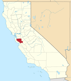 | |
| CDPs | ||
| Unincorporated communities | ||
| CCDs | ||
| Ghost towns | ||
| Bodies of water |
|  |
|---|---|---|
| Counties | ||
| Major cities | ||
| Cities and towns 100k–250k | ||
| Cities and towns 50k–99k | ||
| Cities and towns 25k-50k | ||
| Cities and towns 10k–25k |
| |
| Sub-regions | ||