Ren'ai, Nantou
Coordinates: 24°02′46.4″N 121°07′49.6″E / 24.046222°N 121.130444°E
| Ren'ai Township 仁愛鄉 | |
|---|---|
| Mountain indigenous township | |
 | |
 Ren'ai Township in Nantou County | |
| Location | Nantou County, Taiwan |
| Area | |
| • Total | 1,274 km2 (492 sq mi) |
| Population (July 2018) | |
| • Total | 15,914 |
| • Density | 12/km2 (32/sq mi) |
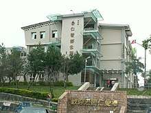
Ren'ai Town Hall
Ren'ai Township (Chinese: 仁愛鄉; pinyin: Rén'ài Xiāng; Wade–Giles: Jen2-ai4 Hsiang1) is a mountain indigenous township in Nantou County, Taiwan. It has a population total of 15,850 and an area of 1,273.5312 km2, making it the second largest township in the county after Xinyi Township. The major populations are aborigines of the Seediq, Atayal and Bunun peoples.
History
Ren'ai was hit by the 2013 Nantou earthquake on 27 March 2013.
Administrative divisions
- Nanfeng Village
- Datong Village
- Rongxing Village
- Chunyang Village
- Jingying Village
- Douda Village
- Gezuo Village
- Faxiang Village
- Lihang Village
- Cuihua Village
- Qinai Village
- Wanfeng Village
- Fazhi Village
- Zhongzheng Village
- Huzhu Village
- Xinsheng Village
Tourist attractions
External links
| Wikimedia Commons has media related to Renai Township, Nantou. |
Cities and townships of Nantou County | ||
|---|---|---|
| Cities | 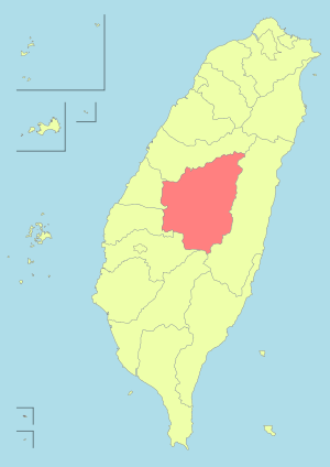 | |
| Urban townships | ||
| Rural townships | ||
| Mountain indigenous townships | ||
| Highland aboriginal Townships and Districts |
| 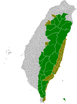 | ||||||||||||||||||||||||
|---|---|---|---|---|---|---|---|---|---|---|---|---|---|---|---|---|---|---|---|---|---|---|---|---|---|---|
| Plains aboriginal Townships and County-Controlled Cities |
| |||||||||||||||||||||||||
Note: On the map, "Highland aboriginal areas" are in green, and "Plains aboriginal areas" are in tan. | ||||||||||||||||||||||||||
This article is issued from
Wikipedia.
The text is licensed under Creative Commons - Attribution - Sharealike.
Additional terms may apply for the media files.