Grey County
| Grey County | |||
|---|---|---|---|
| County (upper-tier) | |||
| County of Grey | |||
| |||
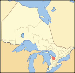 Location of Grey County | |||
| Coordinates: 44°20′N 80°40′W / 44.333°N 80.667°WCoordinates: 44°20′N 80°40′W / 44.333°N 80.667°W | |||
| Country |
| ||
| Province |
| ||
| Established | 1852 | ||
| County seat | Owen Sound | ||
| Subdivisions |
List
| ||
| Government | |||
| • Type | Upper Tier Municipal Government | ||
| Area[1] | |||
| • Land | 4,513.50 km2 (1,742.67 sq mi) | ||
| Population (2016) | |||
| • Total | 93,830 | ||
| • Density | 20.8/km2 (54/sq mi) | ||
| Time zone | UTC-5 (EST) | ||
| • Summer (DST) | UTC-4 (EDT) | ||
| Website | www.grey.ca | ||

Grey County is a county of the Canadian province of Ontario. The county seat is in Owen Sound. It is located in the subregion of Southern Ontario named Southwestern Ontario. Grey County is also a part of the Georgian Triangle. At the time of the Canada 2016 Census the population of the County was 93,830.[2]
Municipalities
Grey County consists of the following municipalities (in order of population):
| Municipality | 2016 Population[3] | Population Centres[4] |
|---|---|---|
| City of Owen Sound | 21,341 | Owen Sound |
| Municipality of West Grey | 12,518 | Durham |
| Municipality of Meaford | 10,991 | Meaford |
| Township of Georgian Bluffs | 10,479 | |
| Municipality of Grey Highlands | 9,804 | Markdale |
| Town of Hanover | 7,688 | Hanover |
| Township of Southgate | 7,354 | Dundalk |
| Town of The Blue Mountains | 7,025 | Thornbury |
| Township of Chatsworth | 6,630 | Chatsworth |
History
Origin and evolution
The first European settlement was in the vicinity of Collingwood or Meaford. Exploring parties arrived from York in 1825 by traveling from Holland Landing and down the Holland River into Lake Simcoe and Shanty Bay. From there they traveled by land to the Nottawasaga River into Georgian Bay and along the thickly wooded shore.
In 1837 the village of Sydenham was surveyed by Charles Rankin. In 1856 it was incorporated as the Town of Owen Sound with an estimated population of 2,000.
In 1840, the area became part of the new District of Wellington, and its territory formed the County of Waterloo for electoral purposes.[5][6] In 1849, Wellington District was abolished, and Waterloo County remained for municipal and judicial purposes.[7] The territory of the Bruce Peninsula became part of Waterloo in 1849,[8] but was later withdrawn and transferred to Bruce County in 1851.[9]
In January 1852, Waterloo County became the United Counties of Wellington, Waterloo and Grey.[10] Grey County was named in honour of the British Colonial Secretary's father, Charles Grey, 2nd Earl Grey, who was Prime Minister of the United Kingdom from 1830-1834.[11] Its territory was declared to consist of the following townships, together with part of the Indian Reserve on the Bruce Peninsula:[12]
- Artemisia
- Bentinck
- Collingwood
- Derby
- Egremont
- Euphrasia
- Glenelg
- Holland
- Melancthon
- Normanby
- Osprey
- Proton
- Saint Vincent
- Sullivan
- Sydenham
The Indian lands were later surveyed and became the townships of Keppel[13] and Sarawak.[14] A Provisional Municipal Council was organized for the County in April 1852, with the Town of Sydenham named as the county town.[15]
The new county of Waterloo was withdrawn in January 1853, and the remainder was renamed the United Counties of Wellington and Grey.[16] In January 1854, the United Counties was dissolved, and Wellington and Grey were separate counties for all purposes.[17]

In 1861-1862 the first gravel roads were constructed into Owen Sound at a cost of $300,000. The four colonization roads were:
- the Garafraxa Road running from Fergus to Owen Sound (now Highway 6);
- the Durham Road leading east and west from the village of Durham (formerly part of Highway 4, and now County Road 4);
- the Lake Shore Road from Collingwood to Owen Sound (now Highway 26); and
- the Toronto and Sydenham Road leading from Toronto to Owen Sound (now Highway 10).
Prior to the road building it often took two days to walk up to Owen Sound.[18]
In 1881, the township of Melancthon and the village of Shelburne were withdrawn from Grey and transferred to the new Dufferin County.[19][20]
On January 1, 2001, Grey County underwent a major reorganization. The majority of towns, villages, and townships were amalgamated, reducing the number of municipalities from 26 to 9. Only Owen Sound and Hanover were unaffected.[21]
Demographics
Grey County comprises a single Statistics Canada census division.
| Canada census – Grey County community profile | |||
|---|---|---|---|
| 2011 | 2006 | ||
| Population: | 92,568 (0.2% from 2006) | 92,411 (3.7% from 2001) | |
| Land area: | 4,513.21 km2 (1,742.56 sq mi) | 4,508.12 km2 (1,740.59 sq mi) | |
| Population density: | 20.5/km2 (53/sq mi) | 20.5/km2 (53/sq mi) | |
| Median age: | 44.4 (M: 43.4, F: 45.4) | ||
| Total private dwellings: | 46,481 | 44,387 | |
| Median household income: | $49,912 | ||
| References: 2011[22] 2006[23] earlier[24] | |||
See also
References
- ↑ Canada, Government of Canada, Statistics. "Census Profile, 2016 Census - Grey, County [Census division], Ontario and Northwest Territories [Territory]". www12.statcan.gc.ca.
- ↑ Canada, Government of Canada, Statistics. "Census Profile, 2016 Census - Grey, County [Census division], Ontario and Northwest Territories [Territory]". www12.statcan.gc.ca.
- ↑ Statistics Canada, Census Profile, 2016 Census: Ontario: Census subdivisions (municipalities)
- ↑ Statistics Canada, Census Profile, 2016 Census: Ontario: Population centres
- ↑ An Act erecting certain parts of the Counties of Halton and Simcoe into a new District, by the name of the District of Wellington, S.U.C. 1837 (1st Session), c. 116 , implemented by Proclamation of June 18, 1840
- ↑ Armstrong, Frederick H. (1985). Handbook of Upper Canadian Chronology. Toronto: Dundurn Press. p. 195. ISBN 0-919670-92-X.
- ↑ An Act for abolishing the Territorial Division of Upper-Canada into Districts, and for providing for temporary Unions of Counties for Judicial and other purposes, and for the future dissolutions of such Unions, as the increase of wealth and population may require, S.C. 12 Vic., c. 78, Sch. C
- ↑ An Act to divide the District of Huron, in the Province of Canada, and for other purposes therein mentioned, S.Prov.C. 1849, c. 96
- ↑ An Act to make certain alterations in the Territorial Divisions of Upper Canada, S.Prov.C. 1851, c. 5, Sch. A, par. 29
- ↑ S.Prov.C. 1851, c. 5, Sch. A and B
- ↑ Marsh, Edith L. (1931). A History of the County of Grey. Owen Sound: Fleming. p. 217.
- ↑ S.Prov.C. 1851, c. 5, Sch. A, par. 28
- ↑ Marsh, Edith Louise (1931). "XXII: The Township of Keppel, its villages and Griffiths Island". A History of the County of Grey. Owen Sound: Fleming.
- ↑ Marsh, Edith Louise (1931). "XXIII: The Township of Sarawak and its villages". A History of the County of Grey. Owen Sound: Fleming.
- ↑ "Proclamation". Canada Gazette (Extra): 2–3. 1 March 1852.
- ↑ "Proclamation". Canada Gazette. 12 (3): 75. 22 January 1853.
- ↑ "Proclamation". Canada Gazette. 13 (1): 2–3. 7 January 1854.
- ↑ The Orangeville Banner, March 8, 1951.
- ↑ An Act to separate the Town of Orangeville and certain Townships in the Counties of Wellington, Grey and Simcoe, from the said Counties, and to erect the same into the County of Dufferin, S.O. 1874 (2nd Sess.), c. 31
- ↑ An Act to confirm certain preliminary proceedings, and make further provision for the formation of the County of Dufferin, S.O. 1880, c. 37
- ↑ County of Grey - Municipal Amalgamations
- ↑ "2011 Community Profiles". Canada 2011 Census. Statistics Canada. July 5, 2013. Retrieved 2012-02-08.
- ↑ "2006 Community Profiles". Canada 2006 Census. Statistics Canada. March 30, 2011. Retrieved 2012-02-08.
- ↑ "2001 Community Profiles". Canada 2001 Census. Statistics Canada. February 17, 2012.
External links
| Wikimedia Commons has media related to Grey County, Ontario. |
Places adjacent to Grey County | |
|---|---|
| Regions | |
|---|---|
| Counties | |
| Districts | |
| Regional municipalities | |
| Single-tier municipalities | |
| Separated municipalities | |
| |