Couchiching 16A
| Couchiching 16A | |
|---|---|
| Indian reserve | |
| Couchiching Indian Reserve No. 16A | |
 | |
 Couchiching 16A | |
| Coordinates: 48°41′N 93°26′W / 48.683°N 93.433°WCoordinates: 48°41′N 93°26′W / 48.683°N 93.433°W | |
| Country |
|
| Province |
|
| District | Rainy River |
| First Nation | Couchiching |
| Area[1] | |
| • Land | 65.04 km2 (25.11 sq mi) |
| Population (2011)[1] | |
| • Total | 796 |
| • Density | 12.2/km2 (32/sq mi) |
| Website |
www.couchiching firstnation.com |
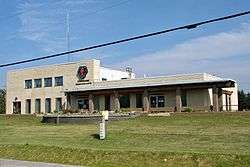
Couchiching 16A is a First Nations reserve near Fort Frances, Ontario. It is the main reserve of the Couchiching First Nation.
References
- 1 2 "Couchiching 16A census profile". 2011 Census of Population. Statistics Canada. Retrieved 27 May 2015.
Places adjacent to Couchiching 16A | ||||||||||
|---|---|---|---|---|---|---|---|---|---|---|
| ||||||||||
| Towns | 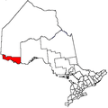 | |
|---|---|---|
| Townships | ||
| First Nations | ||
| Indian reserves |
| |
| Unorganized areas | ||
| Unincorporated communities | ||
| ||
This article is issued from
Wikipedia.
The text is licensed under Creative Commons - Attribution - Sharealike.
Additional terms may apply for the media files.