Northumberland County, Ontario
| Northumberland County | |
|---|---|
| County (upper-tier) | |
| County of Northumberland | |
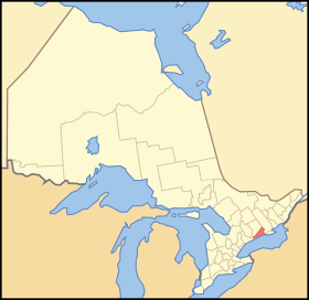 Location of Northumberland County within Ontario | |
| Coordinates: 44°07′N 78°02′W / 44.117°N 78.033°WCoordinates: 44°07′N 78°02′W / 44.117°N 78.033°W | |
| Country |
|
| Province |
|
| County seat | Cobourg |
| Municipalities |
List
|
| Government | |
| • Type | Upper tier municipal government |
| Population (2016)[1] | |
| • Total | 85,598 |
| Time zone | UTC-5 (EST) |
| • Summer (DST) | UTC-4 (EDT) |
| Website | www.northumberlandcounty.ca |
 |
| Map of Northumberland County, showing townships and main settlements.[2] |
Northumberland County is an upper tier level of municipal government situated on the north shore of Lake Ontario, east of Toronto in Central Ontario.
The Northumberland County headquarters are located in Cobourg, Ontario.
Municipalities
Northumberland County consists of seven municipalities (in population order):
- Town of Cobourg
- Municipality of Port Hope - originally part of Durham County
- Municipality (town) of Trent Hills
- Municipality (town) of Brighton
- Township of Hamilton
- Township of Alnwick/Haldimand
- Township of Cramahe
The Alderville First Nation is within the Northumberland census division but is independent of county administration.
Demographics
The numbers below are for the Northumberland census division and combine Northumberland County and the Alderville First Nation reserve.
| Canada census – Northumberland County, Ontario community profile | |||
|---|---|---|---|
| 2016 | 2011 | 2006 | |
| Population: | 85,598 (4.2% from 2011) | 82,126 (1.4% from 2006) | 80,963 (4.5% from 2001) |
| Land area: | 1,905.34 km2 (735.66 sq mi) | 1,902.97 km2 (734.74 sq mi) | |
| Population density: | 43.1/km2 (112/sq mi) | 42.5/km2 (110/sq mi) | |
| Median age: | 44.8 (M: 44.0, F: 45.6) | ||
| Total private dwellings: | 39,032 | 37,226 | 35,069 |
| Median household income: | |||
| References: 2016[3] 2011[4] 2006[5] earlier[6] | |||
Historic populations:[6]
- Population in 2001: 77,497
- Population in 1996: 74,437 (adjusted to 2001 boundaries)
Towns/Villages
History
Together with Durham County, it formed the Newcastle District from 1802 to 1849 and the United Counties of Northumberland and Durham from 1850 to 1973. Effective January 1, 1974, part of Durham County was merged with Ontario County to create the Regional Municipality of Durham. At that time, Northumberland reverted to a standalone county.
It was first aggressively settled by United Empire Loyalists fleeing the former 13 British American Colonies in the late 18th century. The Crown provided plots to the settlers for nominal sums (with the stipulation of making the land productive in a set number of years) or free to those who had served against the American Colonial Army. Following the War of 1812, many port towns, Port Hope and Cobourg in particular, became important centres for commercial activity and a landing point for European immigrants arriving on steamers.
Recreation
There are two provincial parks in Northumberland County: Presqu'ile Provincial Park in Brighton, and Ferris Provincial Park in Campellford.[7] There are also several other protected natural areas and forests, including Ganaraska Forest,[8] Northumberland County Forest, Goodrich-Loomis Conservation Area, and Peter’s Woods. Waterfront campsites and cottages are located along Lake Ontario and Rice Lake.
Northumberland County has various cycling, hiking and other outdoor trails. The Waterfront Trail along Lake Ontario passes through Northumberland County,[9] as does the Trans-Canada Trail.[10] The Northumberland portion of the Trans-Canada Trail spans from Hastings to Hoard’s Station in Campbellford, following an abandoned rail line. Halfway through Campbellford, the trail joins the 6 km long Rotary Trail situated alongside the Trent River. There are five signed bike routes: Glorious Ganaraska, Rice Lake Ramble, Shelter Valley, Presqu’ile Promise and Trent River Truckin'.[11] The Northumberland County Forest offers various trails available for hiking, cycling, horseback riding, ATVing, off-road motorcycling, cross-country skiing, snowmobiling, snowshoeing[12] as well as a 3.2km, accessible Universal Trail[13]. The Ganaraska Hiking Trail starts in Port Hope and goes north towards the Bruce Trail.[14]
There are three theaters in Northumberland County: the Westben in Campbellford, the Capitol Theatre in Port Hope, and the Park Theatre & Performing Arts Centre in Cobourg.[15] Festivals in Northumberland include the Warkworth Maple Syrup and Float Your Fanny Down the Ganny festivals in early spring, the Cobourg Sandcastle Festival and Incredible Edibles Festival in the summer, and the Cultivate Food and Vintage Film Festivals in the fall.[16]
See also
References
- ↑ "Northumberland County census profile". 2011 Census of Population. Statistics Canada. Retrieved 2012-03-22.
- ↑ Restructured municipalities - Ontario map #5 (Map). Restructuring Maps of Ontario. Ontario Ministry of Municipal Affairs and Housing. 2006. Retrieved March 21, 2018.
- ↑ "2016 Community Profiles". Canada 2016 Census. Statistics Canada. February 21, 2017.
- ↑ "2011 Community Profiles". Canada 2011 Census. Statistics Canada. July 5, 2013. Retrieved 2012-03-22.
- ↑ "2006 Community Profiles". Canada 2006 Census. Statistics Canada. March 30, 2011. Retrieved 2012-03-22.
- 1 2 "2001 Community Profiles". Canada 2001 Census. Statistics Canada. February 17, 2012.
- ↑ "Provincial Park Locator". Ontario Parks. Retrieved 22 November 2017.
- ↑ "Ganaraska Forest". Ganaraska Conservation. Ganaraska Region Conservation Authority. Retrieved 22 November 2017.
- ↑ "Interactive Map". Waterfront Trail. Retrieved 22 November 2017.
- ↑ "Explore The Map". The Great Trail. Retrieved 22 November 2017.
- ↑ "Cycling Routes and Trails". Northumberland Tourism. 2018-05-03. Retrieved 2018-07-11.
- ↑ "Forest Trails". northumberlandcounty.ca. Retrieved 2018-08-24.
- ↑ "Universal Trail". northumberlandcounty.ca. Retrieved 2018-08-24.
- ↑ "Trail Sections". Ganaraska Hiking Trail. Retrieved 22 November 2017.
- ↑ "Arts and Culture". Northumberland Arts and Culture. Retrieved 2018-07-11.
- ↑ "Northumberland Festivals | NorthumberlandNews.com". www.northumberlandnews.com. Retrieved 2018-07-11.
External links
| Wikimedia Commons has media related to Northumberland County, Ontario. |
- Northumberland County Northumberland County
- Northumberland Tourism Northumberland Tourism
- Northumberland Economic Development Northumberland Economic Development
- Northumberland Arts Council - lists all cultural events
- Northumberland News (Newspaper)
- Northumberland Today (Newspaper)
- NorthumberlandView.ca (News Website)
Places adjacent to Northumberland County, Ontario | ||||||||||
|---|---|---|---|---|---|---|---|---|---|---|
| ||||||||||
| Regions | |
|---|---|
| Counties | |
| Districts | |
| Regional municipalities | |
| Single-tier municipalities | |
| Separated municipalities | |
| |