Kawartha Lakes
| Kawartha Lakes | |||
|---|---|---|---|
| City (single-tier) | |||
| City of Kawartha Lakes | |||
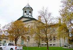 Kawartha Lakes city hall in Lindsay | |||
| |||
| Motto(s): "Catch the Kawartha Spirit" | |||
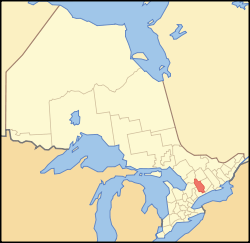 Kawartha Lakes' location within Ontario | |||
| Coordinates: 44°21′N 78°45′W / 44.350°N 78.750°WCoordinates: 44°21′N 78°45′W / 44.350°N 78.750°W | |||
| Country |
| ||
| Province |
| ||
| County (historical) | Victoria | ||
| Formed by political merger | January 1, 2001 | ||
| Seat | Lindsay | ||
| Government | |||
| • Mayor | Andy Letham | ||
| • Council | City of Kawartha Lakes Council | ||
| • MP | Jamie Schmale (CPC) | ||
| • MPP | Laurie Scott (PC) | ||
| Area[1] | |||
| • Land | 3,084.38 km2 (1,190.89 sq mi) | ||
| Population (2016)[2] | |||
| • Total | 75,423 | ||
| • Density | 24.5/km2 (63/sq mi) | ||
| Time zone | UTC-5 (EST) | ||
| • Summer (DST) | UTC-4 (EDT) | ||
| Postal Code | beginning with K and L | ||
| Area code(s) | 705 | ||
| Website | www.city.kawarthalakes.on.ca | ||

The City of Kawartha Lakes (2016 population 75,423) is a unitary municipality in Central Ontario, Canada. It is a municipality legally structured as a single-tier city; however, Kawartha Lakes is the size of a typical Ontario county and is mostly rural. It is the second largest single-tier municipality in Ontario by land area (after Greater Sudbury).
The main population centres are the communities of Bobcaygeon, Fenelon Falls, Lindsay, Omemee and Woodville.
History
The city's name is from the Kawartha Lakes. Kawartha is an anglicization of Ka-wa-tha (from Ka-wa-tae-gum-maug or Gaa-waategamaag, meaning), which was coined in 1895 by the aboriginal Martha Whetung of the Curve Lake First Nations. It meant "land of reflections" in the Anishinaabe language, according to Whetung. The word was later changed by tourism promoters to Kawartha, meaning "bright waters and happy lands."[3]
Prior to its restructuring as a city, the area was known as Victoria County. The city was created in 2001, during the ruling provincial Progressive Conservative party's "Common Sense Revolution". Through provincial legislation, the former Victoria County and its constituent municipalities were amalgamated into one entity named the City of Kawartha Lakes.
This act was implemented by the Victoria County Restructuring Commission, led by commissioner Harry Kitchen.[4] Despite a general opposition from residents of the area, the provincial government pushed forward with the amalgamation,[5][6] which officially came into effect on January 1, 2001.
By a narrow margin (51% for, 49% against), the citizens of Kawartha Lakes voted to de-amalgamate in a November 2003 local plebiscite, but the provincial and municipal governments have not taken any steps since the vote to initiate de-amalgamation.[6]
Demographics
Population trends
| Canada census – Kawartha Lakes community profile | |||
|---|---|---|---|
| 2016 | 2011 | 2006 | |
| Population: | 75,423 (3% from 2011) | 73,219 (-1.8% from 2006) | 74,561 (7.8% from 2001) |
| Land area: | 3,084.38 km2 (1,190.89 sq mi) | 3,083.06 km2 (1,190.38 sq mi) | 3,059.47 km2 (1,181.27 sq mi) |
| Population density: | 24.5/km2 (63/sq mi) | 23.7/km2 (61/sq mi) | 24.4/km2 (63/sq mi) |
| Median age: | 46.7 (M: 45.8, F: 47.6) | 48.4 (M: 47.6, F: 49.2) | 45.1 (M: 44.3, F: 45.9) |
| Total private dwellings: | 38,444 | 37,161 | 37,986 |
| Median household income: | $69,465 | $52,955 | |
| References: 2016[7] 2011[1] 2006[8] earlier[9] | |||
In the 2016 census, the population of the Lindsay urban area was 20,713, up from 20,291 in 2011.[10]
| Census | Population | Change (%) |
|---|---|---|
| 1991 | 16,696 | |
| 1981 | 13,596 | |
| 1971 | 12,746 | |
| 1961 | 11,399 | |
| 1951 | 9,603 | |
| 1941 | 8,345 | |
| 1931 | 7,505 | |
| 1921 | 7,620 | |
| 1911 | 6,964 | |
| 1901 | 7,003 | |
| 1891 | 6,081 | |
| 1881 | 5,080 | |
| 1871 | 4,049 | n/a |
Census Division rankings
National rank in terms of population (2016): 73
Provincial rank in terms of population (2016): 33
Ethnocultural and racial statistics
Only ethnic groups that comprise greater than 1% of the population are included. Note that a person can report more than one group[11]
- English: 45.2%
- Canadian: 35.0%
- Irish: 27.6%
- Scottish: 20.3%
- French: 10.4%
- German: 9.4%
- Dutch: 6.3%
- First Nations: 2.9%
- Welsh: 2.6%
- Polish: 2.2%
- Italian: 2.2%
- Ukrainian: 2.2%
- British Isles (other): 2.0%
- Hungarian: 1.0%
- Native: 2.9%
- Visible minority: 1.6%
| Canada 2006 Census | Population | % of Total Population | |
|---|---|---|---|
| Visible minority group Source:[12] | South Asian | 365 | 0.5% |
| Chinese | 95 | 0.1% | |
| Black | 250 | 0.3% | |
| Filipino | 55 | 0.1% | |
| Latin American | 70 | 0.1% | |
| Arab | 45 | 0.1% | |
| Southeast Asian | 20 | 0% | |
| West Asian | 0 | 0% | |
| Korean | 165 | 0.2% | |
| Japanese | 25 | 0% | |
| Other visible minority | 50 | 0.1% | |
| Mixed visible minority | 60 | 0.1% | |
| Total visible minority population | 1,195 | 1.6% | |
| Aboriginal group Source:[13] | First Nations | 805 | 1.1% |
| Métis | 420 | 0.6% | |
| Inuit | 0 | 0% | |
| Total Aboriginal population | 1,255 | 1.7% | |
| White | 70915 | 96.7% | |
| Total population | 73,365 | 100% | |
Communities
The following is a list of all the former incorporated villages, unincorporated hamlets and communities, rural post offices, and rural post offices abandoned after the start of rural mail delivery.
- Ancona Point
- Argyle
- Aros
- Avery Point
- Baddow
- Baker Trail
- Ballyduff
- Barclay
- Bellevue
- Bethany
- Bethel
- Birch Point
- Bobcaygeon
- Bolsover
- Brunswick
- Burnt River
- Burton
- Bury's Green
- Cambray
- Cameron
- Camp Kagawong
- Campbells Beach
- Coboconk
- Corson's Siding
- Cowan's Bay
- Crawfords Beach
- Cresswell
- Crosshill
- Cunningham's Corners
- Dalrymple
- Dartmoor (ghost town)
- Daytonia Beach
- Dongola
- Downeyville
- Dunsford
- East Emily
- Eldon
- Fairburn Corner
- Fee's Landing
- Feir Mill
- Fell Station
- Fenelon Falls
- Fingerboard
- Fleetwood (ghost town)
- Fleetwood Station
- Fowlers Corners
- Fox's Corners
- Frank Hill
- Franklin
- Gilsons Point
- Glamorgan
- Glandine
- Glenarm
- Glenway Village
- Grasshill
- Greenhurst-Thurstonia
- Hartley
- Head Lake
- Hickory Beach
- Hillhead Corners
- Horncastle (ghost town)
- Isaacs Glen
- Islay
- Janetville
- Joyvista Estates
- Kenedon Park
- Kennedy Bay
- Kenrei Park
- Kenstone Beach
- Keystone Beach
- King's Wharf
- Kinmount
- Kirkfield
- Lake Dalrymple
- Lancaster Bay
- Lifford
- Linden Valley
- Lindsay
- Little Britain
- Long Beach
- Long Point
- Lorneville
- Lotus
- MacKenzie Point
- Mallards Bay
- Manilla
- Manvers
- Mariposa Station
- Mariposa
- McCrackin's Beach
- McGuire Beach
- Mount Horeb (ghost town)
- Newmans Beach
- Norland
- Oak Hill
- Oakdene Point
- Oakwood
- O'Donnell Landing
- Omemee
- Orange Corners
- Palestine
- Pickerel Point
- Pleasant Point
- Pontypool
- Port Hoover
- Powles Corners
- Ragged Rapids (ghost town)
- Reaboro
- Red Cap Beach
- Rohallion
- Rokeby
- Rosedale
- Sadowa
- Salem Corners[14]
- Sandy Point
- Sebright
- Silver Lake
- Snug Harbour
- Southview Estates
- St. Mary's
- Sturgeon Point
- Sullivan's Bay
- Sylvan Glen Beach
- Taylor's Corners
- Tracey's Hill
- Union Creek
- Uphill
- Valentia
- Verulam Park
- Victoria Place
- View Lake
- Washburn Island
- Watson's Siding
- Woodville
- Yelverton
- Zion
Victoria County
Prior to 2001, Victoria County consisted of 13 separate townships and 6 incorporated villages with their own local governments:[15]
Townships
Population centres:
- Bexley (Victoria Road, Coboconk)
- Carden (Dalrymple)
- Dalton (Sebright, Uphill, Sadowa)
- Eldon (Glenarm, Kirkfield)
- Emily (Omemee, Downeyville, Fowlers Corners)
- Fenelon (Cameron, Cambray, Powles Corners)
- Laxton, Digby and Longford (Uphill, Norland)
- Longford (largely uninhabited)
- Manvers (Janetville, Bethany, Pontypool)
- Mariposa (Oakwood, Little Britain, Manilla)
- Ops (Reaboro)
- Somerville (Coboconk, Kinmount)
- Verulam (Dunsford, Bobcaygeon)
The township of Laxton, Digby and Longford is an amalgamation of the once individual townships of Digby and Laxton, and half of the original Longford Township. The separate township of Longford is uninhabited, though dotted with abandoned logging towns. In 2000, just prior to amalgamation into the city of Kawartha Lakes, the township of Verulam and the village of Bobcaygeon were amalgamated into the Municipality of Bobcaygeon/Verulam.[16]
Incorporated communities
- Town of Lindsay
- Village of Bobcaygeon
- Village of Fenelon Falls
- Village of Omemee
- Village of Sturgeon Point
- Village of Woodville
Transportation
Air transportation
Kawartha Lakes Municipal Airport, a Transport Canada certified airport, has 24-hour radio operated lighting and provides access to key points throughout Ontario. Kawartha Lakes Municipal Airport is located one nautical mile west north west of Lindsay. It offers a card lock fuel system and can be used by both private and commercial airplanes.
Water transportation
Towns and villages in City of Kawartha Lakes are interconnected by rivers, lakes and streams that can be best navigated May to October. The Trent-Severn Waterway, which extends from Bay of Quinte on Lake Ontario to Georgian Bay in the north, is part of the waterways in City of Kawartha Lakes. Five locks, Bobcaygeon 32, Lindsay 33, Fenelon Falls 34, Rosedale 35, and Kirkfield 36 are part of the Trent-Severn National HistoricSsite and operated by Parks Canada. Coboconk is noted as being Canada's fresh water summit with waters flowing two different directions. It is the highest navigable point in Canada from which it is possible to reach the world. There are no water taxis operating in City of Kawartha Lakes. Boat and houseboat rentals are available.
Land transportation
The following King's Highways pass through the city:
- Highway 7, part of the Trans-Canada Highway
- Highway 7A
- Highway 35
- Highway 115
- Highway 7B also exists entirely within the city, following the length of Kent Street through Lindsay, and cosigning with Highway 35 for 800 m.
The following multi-use trails pass through the city:
- Lindsay-Peterborough (east-west) rail line, part of the Trans Canada Trail
- Bethany-Haliburton (north-south) rail line, known as the Victoria Rail Trail [17]
Public transportation
Because of the largely rural composition of the City of Kawartha Lakes, there is limited public transportation. City of Kawartha Lakes has public bus transit in the town of Lindsay only (known as Lindsay Transit), running three lines of hourly service Monday-Saturday from 7am-7pm.[18]
On June 21, 2015 the pilot project rural bus route serving part of City of Kawartha Lakes ended service. The rural bus stopped in Lindsay, Dunsford, Bobcaygeon, Fenelon Falls, and Cameron.[19]
Most school children are bussed to elementary and high school.
Bus companies
CanAr Bus Lines offers service between Toronto and Haliburton with nine stops in City of Kawartha Lakes - Yelverton, Highway 7 and 35, Lindsay Inn, William and Kent in Lindsay, Cameron, Rosedale, Fenelon Falls, Coboconk and Norland.[20]
Train routes
The last Canadian National Railway (CN) train to run through City of Kawartha Lakes was on the Lindsay - Uxbridge line which ceased operation in 1991.[21]
The last passenger train to run through the City of Kawartha Lakes was No. 189 with Budd Car VIA 6104 from Havelock to Toronto Union Station over Canadian Pacific Railway (CP) lines on January 14, 1990.[22]
CP freight trains continue to operate through the City of Kawartha Lakes on the Havelock Subdivision (MP 133.23 - MP 143.22) which passes through Pontypool (MP 139.1)[23]
High-level discussions organized by the Shining Waters Railway continue about returning passenger rail-service to the Midtown Toronto to Havelock line with a stop in Pontypool.[24]
The Trans Canada Trail which is situated on the old rail line from Uxbridge, continues to be a possibility for commuter service to Toronto and Pearson Airport, from the Highway 7 bridge.
Taxi services
There are several private taxi services in City of Kawartha Lakes licensed by the local government.
Car/van pools
Several businesses and organizations offer car and van pooling through Car Pool World including Sir Sandford Fleming College.[25]
Attractions
- Academy Theatre
- Lindsay Little Theatre
- The Lindsay Gallery
- Maryboro Lodge: The Fenelon Museum
- Devil's Elbow Ski Area, Bethany
- Ganaraska Hiking Trail
- Trans-Canada Trail, and Doube's Trestle Bridge[26]
- Lindsay Airport, Lindsay
- Youngtown Rock and Roll Museum [27]
- Olde Gaol Museum,
- Victoria Recreation Corridor
- Highland Cinema and Museum, Kinmount
- Trent-Severn Waterway
- Lock 32: Bobcaygeon
- Lock 33: Lindsay
- Lock 34: Fenelon Falls
- Lock 35: Rosedale
- Lock 36: Kirkfield lift lock
Protected areas
- Queen Elizabeth II Wildlands Provincial Park
- Carden Alvar Provincial Park
- Balsam Lake Provincial Park
- Indian Point Provincial Park
- Emily Provincial Park
- Pigeon River Headwaters Conservation Area
- Fleetwood Creek Conservation Area
- Windy Ridge Conservation Area
- Ken Reid Conservation Area
- Gamiing Nature Centre
Media
- Kawartha Lakes This Week (established as Lindsay This Week in 1977)
- The Kawartha Promoter[28] (bi-weekly news magazine published out of Bobcaygeon)
- "Omemee Pigeon eFlyer" (established in 2011 to highlight rural news and events in the area between Lindsay and Peterborough) [29]
- 91.9 BOB FM (CKLY-FM) transmits from Lindsay
- CKLR - City of Kawartha Lakes Radio Broadcasts from Fenelon[30] Falls[31]
- CHEX-TV transmits on Channel 12 from Peterborough
- 100.3 LIFE FM, transmitting at 89.3 from Peterborough
- The Lindsay Post (established in Beaverton as The Canadian Post in 1857, moved to Lindsay in 1861. Ceased publication in 2013.)
- The Lindsay Advocate (online and print news magazine focused on social and economic issues.)
•Kawartha 411 News-Kawartha’s Source for Breaking News and Investigative Reporting
Surrounding counties
References
- 1 2 "2011 Community Profiles". Canada 2011 Census. Statistics Canada. July 5, 2013. Retrieved 2012-02-29.
- ↑ "Kawartha Lakes census profile". 2011 Census of Population. Statistics Canada. Retrieved 2012-02-29.
- ↑ Rayburn, Alan. Place Names in Ontario. University of Toronto Press. p. 176.
- ↑ "Municipal Government for Victoria County: A New Beginning - Final Report and Order" (PDF). ODW Ontario Government Documents. 2000-04-19. Retrieved 2017-06-07.
- ↑
- 1 2
- ↑ "2016 Community Profiles". Canada 2016 Census. Statistics Canada. February 21, 2017. Retrieved 2017-06-07.
- ↑ "2006 Community Profiles". Canada 2006 Census. Statistics Canada. March 30, 2011. Retrieved 2012-01-01.
- ↑ "2001 Community Profiles". Canada 2001 Census. Statistics Canada. February 17, 2012.
- ↑ "Lindsay, Ontario Census Profile". 2016 Census of Population. Statistics Canada. Retrieved 2017-06-07.
- ↑ Canada, Government of Canada, Statistics. "Statistics Canada: Ethnocultural Portrait of Canada Highlight Tables, 2006 Census". 12.statcan.ca. Retrieved 2017-06-07.
- ↑ Lakes&SearchType=Begins&SearchPR=01&B1=All&Custom=, Community Profiles from the 2006 Census, Statistics Canada - Census Subdivision
- ↑ Canada, Government of Canada, Statistics. "Statistics Canada: Aboriginal Peoples Highlight Tables, 2006 Census". 12.statcan.ca. Retrieved 21 October 2017.
- ↑ "Salem Corners". Geographical Names Data Base. Natural Resources Canada. Retrieved 2016-12-11.
- ↑ Algonquin Park and Kawarthas map. MapArt Corporation. 1998.
- ↑ Order of the Commission, (on Victoria County) (PDF), April 19, 2000, archived from the original (PDF) on May 9, 2008, retrieved 2009-08-05
- ↑ "Victoria Rail Trail Corridor (VRTC) — City of Kawartha Lakes". City.kawarthalakes.on.ca. Retrieved 2016-03-18.
- ↑ "Lindsay Transit — City of Kawartha Lakes". City.kawarthalakes.on.ca. Archived from the original on 2016-03-24. Retrieved 2016-03-18.
- ↑ "Archived copy". Archived from the original on 2013-12-31. Retrieved 2014-04-12.
- ↑ "Archived copy" (PDF). Archived from the original (PDF) on 2013-09-02. Retrieved 2014-04-12.
- ↑
- ↑ "6104". Cnrphotos.com. Retrieved 21 October 2017.
- ↑ "Archived copy" (PDF). Archived from the original (PDF) on 2014-10-18. Retrieved 2014-10-12.
- ↑ "Shining Waters Railway". Shiningwatersrailway.com. Archived from the original on 2013-05-04. Retrieved 2016-03-18.
- ↑ "Kawartha Lakes Car Pooling - Need A Ride?". Kawarthalakesmums.blogspot.ca.
- ↑ "Kawartha Trans Canada Trail - Kawartha Trans Canada Trail". Ktct.ca. Retrieved 2016-03-18.
- ↑ Krewen, Nick (26 March 2011). "Neil Young: take a look at his life" – via Toronto Star.
- ↑ "Magazine". Thepromoter.ca. Retrieved 2016-03-18.
- ↑ "Archived copy". Archived from the original on 2015-09-15. Retrieved 2013-03-14.
- ↑ "Archived copy". Archived from the original on 2014-10-16. Retrieved 2014-10-12.
- ↑ "All Southern half of the City of Kawartha Lakes including the communities of Lindsay, Omemee, Pontypool, Little Britain, Cameron, Woodville and Kirkfield Categories". Lindsaychamber.com. Retrieved 21 October 2017.
External links
| Wikimedia Commons has media related to Kawartha Lakes. |
Places adjacent to Kawartha Lakes | |
|---|---|
City of Kawartha Lakes | |||||||
|---|---|---|---|---|---|---|---|
| Towns |  | ||||||
| Villages and unincorporated communities |
| ||||||
| Former townships | |||||||
| Major lakes |
| ||||||
| Topics | |||||||
1) This area lies on the border of an adjacent region, but is part of the Kawartha Lakes census. | |||||||
| Regions | |
|---|---|
| Counties | |
| Districts | |
| Regional municipalities | |
| Single-tier municipalities | |
| Separated municipalities | |
| |