Quakertown, Pennsylvania
| Quakertown, Pennsylvania | |
|---|---|
| Borough | |
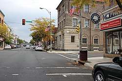 Broad Street in Quakertown | |
| Etymology: the "Quakers" | |
| Motto(s): "The Heart of Upper Bucks County!" | |
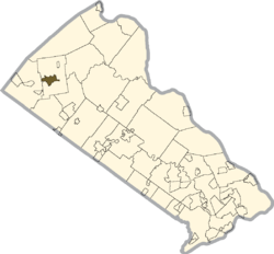 Location of Quakertown in Bucks County, Pennsylvania. | |
 Quakertown Location of Quakertown in Pennsylvania  Quakertown Quakertown (the US) | |
| Coordinates: 40°26′26″N 75°20′26″W / 40.44056°N 75.34056°WCoordinates: 40°26′26″N 75°20′26″W / 40.44056°N 75.34056°W | |
| Country | United States |
| State | Pennsylvania |
| County | Bucks |
| Government | |
| • Type | Council-manager |
| Area[1] | |
| • Total | 2.04 sq mi (5.27 km2) |
| • Land | 2.03 sq mi (5.26 km2) |
| • Water | 0.01 sq mi (0.01 km2) |
| Elevation | 505 ft (154 m) |
| Population (2010) | |
| • Total | 8,798 |
| • Estimate (2016)[2] | 8,798 |
| • Density | 4,329.72/sq mi (1,671.84/km2) |
| Time zone | UTC-5 (EST) |
| • Summer (DST) | UTC-4 (EDT) |
| ZIP code | 18951 |
| Area code(s) | 215, 267 |
| Website | www.quakertownboro.com |
Quakertown is a borough in Bucks County, Pennsylvania, in the USA. As of 2016, it had a population of 8,798.[3] The borough is 16 miles (26 km) south of Allentown and Bethlehem and 29 miles (47 km) north of Philadelphia, making Quakertown a border town of both the Delaware Valley and Lehigh Valley metropolitan areas. It is considered part of the United States Census Bureau's Philadelphia−Camden−Wilmington (PA−NJ−DE-MD) MSA and the Delaware Valley. Quakertown is surrounded by Richland Township.
History
Quakertown was originally settled by members of the Religious Society of Friends, or Quakers. The settlement was not officially known as Quakertown until its first post office opened in 1803.[4]
On September 18, 1777, during the American Revolutionary War, a convoy of wagons carrying the Liberty Bell from Philadelphia to Allentown, under the command of Col. Thomas Polk of Charlotte, North Carolina, stopped in Quakertown. The Liberty Bell was stored overnight behind the home of Evan Foulke (1237 West Broad Street), and the entourage stayed at the Red Lion Inn. The John Fries' Rebellion was also started in the Red Lion Inn in 1799.
In 1854, Quakertown elected its first Burgess. The North Pennsylvania Railroad caused a great increase in population, and by 1880, the population of Quakertown had almost reached 1,800.[4]
Liberty Hall, Quakertown Historic District, Quakertown Passenger and Freight Station, and Enoch Roberts House are listed on the National Register of Historic Places.[5]
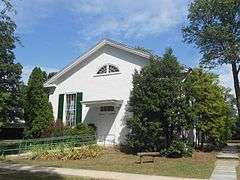 Richland Friends Meeting House, the Quaker meeting house in Quakertown
Industry and population
The American Civil War along with national economic expansion changed Quakertown from a tiny village to a commercial manufacturing center. In the nineteenth century, local industrial establishments included cigar and cigar box factories, silk mills, harness factories, and stove foundries. Until 1969, Quakertown generated its own electrical power. The population of Quakertown in 1900 was 3,014; it rose to 3,801 in 1910. By 1940, the population had reached 5,150 people. At the 2010 census, the borough's population was 8,979.
Today, Quakertown has several restaurants and businesses that line Pennsylvania Route 309.
Geography
According to the United States Census Bureau, the borough has a total area of 2.0 square miles (5.2 km2), all of it land.
Licking Run begins in passes through Quakertown from the west to the east and drains into the Tohickon Creek. Tohickon Creek, which drains into the Delaware River, flows past the northeastern edge of the borough.
Climate
Quakertown has a hot-summer humid continental climate (Dfa) and is in hardiness zone 6b.
| Climate data for Quakertown, Pennsylvania | |||||||||||||
|---|---|---|---|---|---|---|---|---|---|---|---|---|---|
| Month | Jan | Feb | Mar | Apr | May | Jun | Jul | Aug | Sep | Oct | Nov | Dec | Year |
| Average high °F (°C) | 33.0 (0.6) |
35.9 (2.2) |
46.1 (7.8) |
58.3 (14.6) |
69.3 (20.7) |
77.5 (25.3) |
81.5 (27.5) |
80.3 (26.8) |
73.3 (22.9) |
61.5 (16.4) |
48.8 (9.3) |
37.7 (3.2) |
58.6 (14.8) |
| Average low °F (°C) | 15.3 (−9.3) |
16.9 (−8.4) |
24.4 (−4.2) |
33.9 (1.1) |
44.2 (6.8) |
53.3 (11.8) |
57.1 (13.9) |
55.5 (13.1) |
48.3 (9.1) |
37.2 (2.9) |
29.9 (−1.2) |
21.0 (−6.1) |
36.4 (2.4) |
| Average precipitation inches (mm) | 3.1 (79) |
2.7 (69) |
3.7 (94) |
3.6 (91) |
4.0 (102) |
4.7 (119) |
4.5 (114) |
4.1 (104) |
4.0 (102) |
3.0 (76) |
3.7 (94) |
3.4 (86) |
44.6 (1,133) |
| Source: Weatherbase [6] | |||||||||||||
Demographics
| Historical population | |||
|---|---|---|---|
| Census | Pop. | %± | |
| 1850 | 242 | — | |
| 1860 | 528 | 118.2% | |
| 1870 | 863 | 63.4% | |
| 1880 | 1,769 | 105.0% | |
| 1890 | 2,169 | 22.6% | |
| 1900 | 3,014 | 39.0% | |
| 1910 | 3,801 | 26.1% | |
| 1920 | 4,391 | 15.5% | |
| 1930 | 4,883 | 11.2% | |
| 1940 | 5,150 | 5.5% | |
| 1950 | 5,673 | 10.2% | |
| 1960 | 6,305 | 11.1% | |
| 1970 | 7,276 | 15.4% | |
| 1980 | 8,867 | 21.9% | |
| 1990 | 8,982 | 1.3% | |
| 2000 | 8,931 | −0.6% | |
| 2010 | 8,979 | 0.5% | |
| Est. 2017 | 8,843 | [2] | −1.5% |
| Sources:[7][8][9] | |||
As of the census[8] of 2010, there were 8,979 people residing in the borough. The racial makeup of the borough was 90.6% White, 2.4% African American, 0.3% Native American, 2.0% Asian, 0.0% Pacific Islander, 2.7% from other races, and 1.9% from two or more races. Hispanic or Latino of any race were 6.0% of the population.
As of the census[8] of 2000, there were 8,931 people, 3,421 households, and 2,251 families residing in the borough. The population density was 4,424.7 people per square mile (1,707.1/km²). There were 3,631 housing units at an average density of 1,798.9 per square mile (694.0/km²). The racial makeup of the borough was 94.46% White, 1.20% African American, 0.13% Native American, 1.51% Asian, 0.06% Pacific Islander, 1.58% from other races, and 1.06% from two or more races. Hispanic or Latino of any race were 2.88% of the population.
There were 3,421 households, out of which 32.9% had children under the age of 18 living with them, 50.7% were married couples living together, 10.5% had a female householder with no husband present, and 34.2% were non-families. 28.3% of all households were made up of individuals, and 11.9% had someone living alone who was 65 years of age or older. The average household size was 2.52 and the average family size was 3.11.
In the borough the population was spread out, with 25.5% under the age of 18, 7.9% from 18 to 24, 32.2% from 25 to 44, 19.1% from 45 to 64, and 15.3% who were 65 years of age or older. The median age was 36 years. For every 100 females there were 95.9 males. For every 100 females age 18 and over, there were 92.1 males.
The median income for a household in the borough was $41,942, and the median income for a family was $51,194. Males had a median income of $33,697 versus $26,988 for females. The per capita income for the borough was $20,562. About 3.7% of families and 5.9% of the population were below the poverty line, including 7.0% of those under age 18 and 6.7% of those age 65 or over.
Government
Quakertown has a council-manager system of government. The borough has a seven-member Borough Council elected at-large to four-year terms. The council appoints a Borough Manager who manages the daily operations of the borough.[10] As of 2017, the members of Borough Council are President L. James Roberts Jr., Vice President Donald E. Rosenberger, Jon Roth, Michael Johnson, Douglas Propst, Lisa J. Gaier, Esq., and Jann Paulovitz.[11]
Legislators
- State Representative Craig Staats, Republican, Pennsylvania House of Representatives, District 145
- State Senator Bob Mensch, Republican, Pennsylvania Senate, District 24
- US Representative Brian Fitzpatrick, Republican, Pennsylvania's 8th congressional district
Police and fire
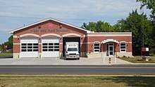
Police services in the borough is provided 24 hours a day, 7 days a week by the Quakertown Borough Police Department, which consists of a Chief, Detective Lieutenant, Administrative Sergeant, two Patrol Sergeants, two Detectives, twelve Patrol Officers, and three support staff.[12] Fire protection in Quakertown and surrounding areas is provided by the Quakertown Fire Department, a volunteer fire department which operates the Quakertown Fire Company #1-Station 17 on West Broad Street and the West End Fire Company-Station 18 on Park Avenue.[13]
Infrastructure
Transportation
Quakertown is directly served by four state highways. PA 309 passes through the western part of Quakertown as West End Boulevard and runs north to Allentown and south to Montgomeryville and Philadelphia. PA 313 begins at PA 309 in Quakertown and passes through the town on Broad Street, heading southeast to Doylestown. PA 663 heads west from Quakertown at the PA 309/PA 313 intersection and interchanges with I-476 (Pennsylvania Turnpike Northeast Extension) at the Quakertown interchange before heading southwest to Pottstown. PA 212 heads northeast from PA 313 in Quakertown and provides access to Riegelsville.[14]
Quakertown has intercity bus service provided by Trans-Bridge Lines from a stop on Broad Street in downtown to Bethlehem, Doylestown, and the Port Authority Bus Terminal in New York City;[15][16] by Bieber Transportation Group from a stop at a park and ride lot on PA 663 west of the borough near the interchange with the Northeast Extension to the Philadelphia Greyhound Terminal in Philadelphia, Bethlehem, Allentown, and Reading;[17] and by Fullington Trailways from a stop on West End Boulevard to the Philadelphia Greyhound Terminal, Hazleton, Williamsport, and several other places in northern Pennsylvania.[18][19][20][21]
Quakertown had passenger rail service from the Quakertown station along the Bethlehem Line to Bethlehem and Philadelphia until July 27, 1981, when SEPTA ended service on all its intercity diesel-powered lines.[22] Due to the numerous industrial complexes in Quakertown, the borough currently has freight rail service provided by a branch of the East Penn Railroad along the former SEPTA tracks.[23]
Quakertown has a public general aviation airport, simply named Quakertown Airport. The airport is not located in the Quakertown borough itself, but in neighboring Milford Township.[24]
Utilities
The borough of Quakertown provides various utility services to businesses and residents. The Borough of Quakertown Electric Department provides electricity to the borough. The borough has operated its own electric department since the early 1890s and generated its own electricity until 1969, with electricity now purchased wholesale.[25] The Borough of Quakertown Water Department provides water to the borough, operating ten wells and three storage facilities.[26] The Borough of Quakertown Sewer Department provides sewer service to the borough, operating a wastewater treatment plant.[27] Natural gas service in Quakertown is provided by UGI Utilities.[28][29] Trash and recycling collection in Quakertown is provided under contract by Advanced Disposal Services.[30]
Health care
St. Luke's University Health Network operates St. Luke's Hospital-Quakertown Campus in the borough, serving the northern portion of Bucks County.[31] The hospital was opened as Quakertown Community Hospital on June 5, 1930 and was acquired by St. Luke's University Health Network in August 1995.[32] St. Luke's Hospital-Quakertown Campus offers an emergency room and various inpatient and outpatient services including women's health services, surgical services, heart and vascular services, radiology services, and wound care.[33] Grand View Health and Lehigh Valley Health Network jointly operate the Health Center at Quakertown, which offers various outpatient services such as laboratory services, X-rays, and cardiac testing along with physician offices focusing on cardiology, orthopedics, primary care, speciality care, and pediatrics.[34][35]
Notable people
- Diane Bracalente, Olympic field hockey player
- Tim Lewis, former professional football player for the Green Bay Packers, assistant coach with Atlanta Falcons
- Louis Riddick, former professional football player for the San Francisco 49ers, on-air talent for ESPN
- Bill Mensch, microcomputer pioneer
- Ken Schroy, former professional football player for the New York Jets
- Hampton S. Thomas, Medal of Honor recipient in the American Civil War.[36]
- Jan Shepard, film and television actress.
References
- ↑ "2016 U.S. Gazetteer Files". United States Census Bureau. Retrieved Aug 13, 2017.
- 1 2 "Population and Housing Unit Estimates". Retrieved June 9, 2017.
- ↑ "Race, Hispanic or Latino, Age, and Housing Occupancy: 2010 Census Redistricting Data (Public Law 94-171) Summary File (QT-PL), Quakertown borough, Pennsylvania". U.S. Census Bureau, American FactFinder 2. Archived from the original on September 11, 2013. Retrieved August 11, 2011.
- 1 2 "History". Borough of Quakertown. Retrieved November 2, 2012.
- ↑ National Park Service (2010-07-09). "National Register Information System". National Register of Historic Places. National Park Service.
- ↑ "Weatherbase: Historical Weather for Quakertown, Pennsylvania". Weatherbase. 2011. Retrieved on November 24, 2011.
- ↑ "Census of Population and Housing". U.S. Census Bureau. Archived from the original on May 12, 2015. Retrieved 11 December 2013.
- 1 2 3 "American FactFinder". United States Census Bureau. Archived from the original on September 11, 2013. Retrieved 2008-01-31.
- ↑ "Incorporated Places and Minor Civil Divisions Datasets: Subcounty Resident Population Estimates: April 1, 2010 to July 1, 2012". Population Estimates. U.S. Census Bureau. Archived from the original on June 17, 2013. Retrieved 11 December 2013.
- ↑ "Borough Council". Borough of Quakertown. Retrieved June 29, 2017.
- ↑ "Council Members". Borough of Quakertown. Retrieved June 29, 2017.
- ↑ "Police". Borough of Quakertown. Retrieved June 29, 2017.
- ↑ "Quakertown Fire Department". Borough of Quakertown. Retrieved June 29, 2017.
- ↑ Google (November 21, 2013). "overview of Quakertown, Pennsylvania" (Map). Google Maps. Google. Retrieved November 21, 2013.
- ↑ "LVIP to New York" (PDF). Trans-Bridge Lines. Retrieved June 29, 2017.
- ↑ "New York to LVIP" (PDF). Trans-Bridge Lines. Retrieved June 29, 2017.
- ↑ "Daily Bus Service to Philadelphia, PA". Bieber Transportation Group. January 8, 2017. Retrieved February 6, 2017.
- ↑ "FAB 10 - Williamsport - Hazleton - Philadelphia". Fullington Tours. Retrieved October 21, 2017.
- ↑ "FAB 21 - Philadelphia - Hazleton - Williamsport". Fullington Tours. Retrieved October 21, 2017.
- ↑ "FAB 22 - Williamsport - Philadelphia". Fullington Tours. Retrieved October 21, 2017.
- ↑ "FAB 23 - Philadelphia - Williamsport". Fullington Tours. Retrieved October 21, 2017.
- ↑ Williams, Gerry (1998). Trains, Trolleys & Transit: A Guide to Philadelphia Area Rail Transit. Piscataway, NJ: Railpace Company. p. 83. ISBN 978-0-9621541-7-1. OCLC 43543368.
- ↑ East Penn Railroad Map (PDF) (Map). DeskMap Systems. 2011. Retrieved December 12, 2011.
- ↑ Quakertown Airport | Bucks County Airport Authority
- ↑ "Electric Department". Borough of Quakertown. Retrieved June 29, 2017.
- ↑ "Water Department". Borough of Quakertown. Retrieved June 29, 2017.
- ↑ "Sewer Department". Borough of Quakertown. Retrieved June 29, 2017.
- ↑ "Geographic Footprint". UGI. Retrieved October 4, 2017.
- ↑ "Gas Tariff" (PDF). UGI Utilities. July 7, 2017. pp. 5–6. Retrieved October 10, 2017.
- ↑ "Refuse & Recycling". Borough of Quakertown. Retrieved February 22, 2018.
- ↑ "St. Luke's Hospital - Quakertown Campus". St. Luke's University Health Network. Retrieved October 18, 2017.
- ↑ "St. Luke's Quakertown Campus - History". St. Luke's University Health Network. Retrieved October 18, 2017.
- ↑ "St. Luke's Quakertown Campus - Our Services". St. Luke's University Health Network. Retrieved October 18, 2017.
- ↑ "Health Center at Quakertown". Grand View Health. Retrieved October 18, 2017.
- ↑ "Health Center at Quakertown". Lehigh Valley Health Network. Retrieved October 18, 2017.
- ↑ "Hampton S. Thomas". Archived from the original on July 14, 2014. Retrieved July 4, 2014.
External links
| Wikivoyage has a travel guide for Quakertown. |
| Wikimedia Commons has media related to Quakertown, Pennsylvania. |
Places adjacent to Quakertown, Pennsylvania | ||||||||||
|---|---|---|---|---|---|---|---|---|---|---|
| ||||||||||
