Dolington, Pennsylvania
| Dolington, Pennsylvania | |
|---|---|
| Unincorporated community | |
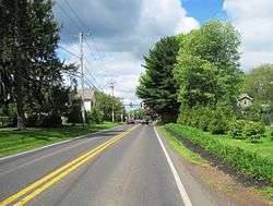 Southbound PA 532 approaching Lindenhurst Road | |
 Dolington  Dolington | |
| Coordinates: 40°15′54″N 74°53′44″W / 40.26500°N 74.89556°WCoordinates: 40°15′54″N 74°53′44″W / 40.26500°N 74.89556°W | |
| Country | United States |
| State | Pennsylvania |
| County | Bucks |
| Township | Upper Makefield |
| Elevation | 259 ft (79 m) |
| Time zone | UTC-5 (Eastern (EST)) |
| • Summer (DST) | UTC-4 (EDT) |
| ZIP code | 18940 |
| Area code(s) | 215 and 267 |
| GNIS feature ID | 1203431[1] |
Dolington is an unincorporated community in Upper Makefield Township in Bucks County, Pennsylvania, United States. Dolington is located at the intersection of Pennsylvania Route 532 and Dolington Road.[2]
See also
References
- ↑ "Dolington". Geographic Names Information System. United States Geological Survey.
- ↑ Bucks County, Pennsylvania (Map) (19th ed.). 1"=2000'. ADC Map. 2006. p. 3038. § G8. ISBN 0-87530-774-4.

This article is issued from
Wikipedia.
The text is licensed under Creative Commons - Attribution - Sharealike.
Additional terms may apply for the media files.