| [3] |
Name on the Register[4] |
Image |
Date listed[5] |
Location |
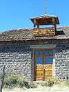
City or town |
Description |
|---|
| 1 |
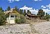
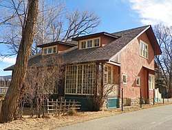
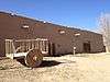
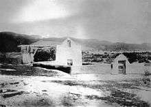
Bernard J. Beimer House |
|
March 22, 2006
(#06000156) |
215 Beimer Ave.
36°25′00″N 105°34′18″W / 36.416667°N 105.571667°W / 36.416667; -105.571667 (Bernard J. Beimer House) |
Taos |
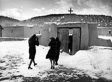
State Register of Cultural Properties (SRCP) |
| 2 |
Governor Charles Bent House |
|
November 16, 1978
(#78001831) |
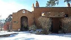
Bent St.
36°24′31″N 105°34′22″W / 36.408611°N 105.572778°W / 36.408611; -105.572778 (Governor Charles Bent House) |
Taos |
SRCP |
| 3 |
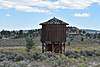
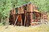
Black Copper Mine and Stamp Mill |
|
October 27, 2000
(#00000875) |
Black Copper Canyon Rd.
36°38′14″N 105°22′13″W / 36.637222°N 105.370278°W / 36.637222; -105.370278 (Black Copper Mine and Stamp Mill) |
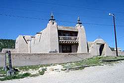
Red River |
SRCP |
| 4 |
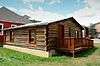
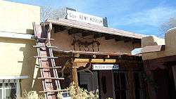
Ernest L. Blumenschein House |
|
October 15, 1966
(#66000495) |
Ledoux St.
36°24′21″N 105°34′34″W / 36.405833°N 105.576111°W / 36.405833; -105.576111 (Ernest L. Blumenschein House) |
Taos |
|
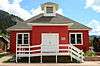
| 5 |
Carson School |
|
February 13, 1986
(#86000233) |
State Road 96
36°21′53″N 105°45′55″W / 36.364722°N 105.765278°W / 36.364722; -105.765278 (Carson School) |
Carson |
SRCP |
| 6 |
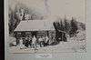
Kit Carson House |
|
October 15, 1966
(#66000948) |
Kit Carson Ave.
36°24′25″N 105°34′20″W / 36.406944°N 105.572222°W / 36.406944; -105.572222 (Kit Carson House) |
Taos |
|
| 7 |
Chapel of Santa Cruz |
|
April 14, 1975
(#75001174) |
Southern side of Plaza off U.S. Route 285
36°18′11″N 106°02′46″W / 36.303056°N 106.046111°W / 36.303056; -106.046111 (Chapel of Santa Cruz) |
Ojo Caliente |
SRCP |
| 8 |
Laureano Cordova Mill |
|
November 5, 1974
(#74001212) |
Off State Road 75
36°11′26″N 105°40′08″W / 36.190556°N 105.668889°W / 36.190556; -105.668889 (Laureano Cordova Mill) |
Vadito |
SRCP |
| 9 |
Eanger Irving Couse House and Studio—Joseph Henry Sharp Studios |
|
September 28, 2005
(#05001096) |
146 Kit Carson Rd.
36°24′29″N 105°34′18″W / 36.408056°N 105.571667°W / 36.408056; -105.571667 (Eanger Irving Couse House and Studio—Joseph Henry Sharp Studios) |
Taos |
SRCP |
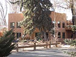
| 10 |
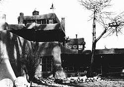
Nicholai Fechin House |
|
December 31, 1979
(#79001558) |
227 Paseo del Pueblo Norte
36°24′37″N 105°34′09″W / 36.410278°N 105.569167°W / 36.410278; -105.569167 (Nicholai Fechin House) |
Taos |
SRCP; Now the Taos Art Museum |
| 11 |
Leon Gaspard House |
|
February 23, 1979
(#79001559) |
Raton Rd / Kit Carson Rd.
36°23′45″N 105°33′54″W / 36.395773°N 105.564988°W / 36.395773; -105.564988 (Leon Gaspard House) |
Taos |
SRCP |
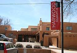
| 12 |
Harwood Foundation |
|
December 22, 1976
(#76001200) |
LeDoux St.
36°24′20″N 105°34′36″W / 36.405556°N 105.576667°W / 36.405556; -105.576667 (Harwood Foundation) |
Taos |
SRCP; now the Harwood Museum of Art |
| 13 |
E. Martin Hennings House and Studio Historic District |
|
July 5, 1990
(#90001028) |
Southeastern corner of the junction of Dolan St. and Kit Carson Rd.
36°24′01″N 105°34′03″W / 36.400278°N 105.5675°W / 36.400278; -105.5675 (E. Martin Hennings House and Studio Historic District) |
Taos |
SRCP |
| 14 |
Howiri-ouinge |
|
April 7, 1983
(#83001633) |
Intersection of U.S. Route 285 and State Road 96
36°18′11″N 106°02′48″W / 36.3030765°N 106.0466884°W / 36.3030765; -106.0466884 (Howiri-ouinge) |
Ojo Caliente |
SRCP |
| 15 |
La Loma Plaza Historic District |
|
July 8, 1982
(#82003339) |
State Road 240
36°24′23″N 105°34′50″W / 36.406389°N 105.580556°W / 36.406389; -105.580556 (La Loma Plaza Historic District) |
Taos |
SRCP; Aerial photo-map |
| 16 |
La Morada de Nuestra Senora de Guadalupe |
|
June 29, 1976
(#76001201) |
Penitente Road
36°24′23″N 105°33′47″W / 36.40635°N 105.56319°W / 36.40635; -105.56319 (La Morada de Nuestra Senora de Guadalupe) |
Taos |
SRCP |
| 17 |
Las Trampas Historic District |
|
May 28, 1967
(#67000007) |
On State Road 76
36°07′57″N 105°45′48″W / 36.1325°N 105.763333°W / 36.1325; -105.763333 (Las Trampas Historic District) |
Las Trampas |
|
| 18 |
D.H. Lawrence Ranch Historic District |
|
January 15, 2004
(#03001410) |
Lawrence Rd., approximately 2.75 miles east of State Road 522 on U.S. Forest Service Rd. 7
36°34′55″N 105°35′37″W / 36.581944°N 105.593611°W / 36.581944; -105.593611 (D.H. Lawrence Ranch Historic District) |
San Cristobal |
SRCP |
| 19 |
Mabel Dodge Luhan House |
|
November 15, 1978
(#78001832) |
Luhan Lane
36°24′29″N 105°33′52″W / 36.408056°N 105.564444°W / 36.408056; -105.564444 (Mabel Dodge Luhan House) |
Taos |
SRCP |
| 20 |
Orin Mallette Cabin |
|
February 23, 1984
(#84003055) |
West of Red River
36°42′28″N 105°25′34″W / 36.707778°N 105.426111°W / 36.707778; -105.426111 (Orin Mallette Cabin) |
Red River |
SRCP |
| 21 |
Sylvester M. Mallette Cabin |
|
February 23, 1984
(#84003056) |
River St. and Copper King
36°42′20″N 105°24′13″W / 36.705556°N 105.403611°W / 36.705556; -105.403611 (Sylvester M. Mallette Cabin) |
Red River |
SRCP |
| 22 |
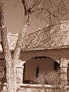
Severino Martinez House |
|
April 23, 1973
(#73001153) |
2 miles from Taos Plaza, on the Lower Ranchitos Rd.
36°24′04″N 105°36′29″W / 36.400980°N 105.607929°W / 36.400980; -105.607929 (Severino Martinez House) |
Taos |
SRCP; Hacienda de los Martinez -- Bird's-eye view |
| 23 |
Melson-Oldham Cabin |
|
February 23, 1984
(#84003057) |
Southeast of Red River
36°41′18″N 105°23′13″W / 36.688333°N 105.386944°W / 36.688333; -105.386944 (Melson-Oldham Cabin) |
Red River |
SRCP |
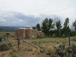
| 24 |
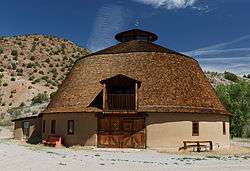
Ojo Caliente Hot Springs Round Barn |
|
October 6, 2003
(#03000996) |
500 yards north of the western terminus of State Road 414
36°18′37″N 106°02′48″W / 36.310278°N 106.046667°W / 36.310278; -106.046667 (Ojo Caliente Hot Springs Round Barn) |
Ojo Caliente |
SRCP |
| 25 |
Ojo Caliente Mineral Springs |
|
November 17, 1985
(#85003496) |
State Road 414
36°18′17″N 106°03′06″W / 36.304722°N 106.051667°W / 36.304722; -106.051667 (Ojo Caliente Mineral Springs) |
Ojo Caliente |
SRCP |
| 26 |
Picuris Pueblo |
|
August 13, 1974
(#74001211) |
South of Taos
36°12′05″N 105°42′32″W / 36.201389°N 105.708889°W / 36.201389; -105.708889 (Picuris Pueblo) |
Taos |
SRCP |
| 27 |
Pierce-Fuller House |
|
February 23, 1984
(#84003058) |
High St.
36°42′42″N 105°24′37″W / 36.711667°N 105.410278°W / 36.711667; -105.410278 (Pierce-Fuller House) |
Red River |
SRCP |
| 28 |
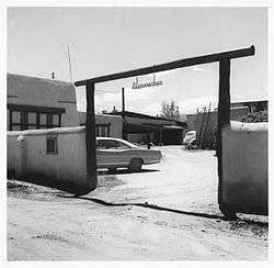
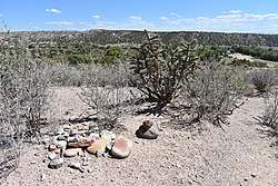
Posi-ouinge |
|
August 5, 1993
(#93000675) |
Access to the trail is behind the Ojo Caliente Mineral Springs Resort at 50 Los Banos Drive in Ojo Caliente
36°18′19″N 106°03′06″W / 36.30521389°N 106.0516036°W / 36.30521389; -106.0516036 (Posi-ouinge) |
Ojo Caliente |
Extends into Rio Arriba County. BLM public access info. |
| 29 |
Ranchos de Taos Plaza |
|
October 2, 1978
(#78001830) |
Off U.S. Route 64
36°21′30″N 105°36′28″W / 36.358333°N 105.607778°W / 36.358333; -105.607778 (Ranchos de Taos Plaza) |
Ranchos de Taos |
SRCP |
| 30 |
Red River Schoolhouse |
|
February 23, 1984
(#84003059) |
High St.
36°42′23″N 105°24′00″W / 36.706389°N 105.4°W / 36.706389; -105.4 (Red River Schoolhouse) |
Red River |
SRCP |
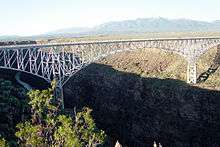
| 31 |
Rio Grande Gorge Bridge |
|
July 15, 1997
(#97000733) |
State Road 111 over the Rio Grande Gorge
36°28′34″N 105°43′56″W / 36.476111°N 105.732222°W / 36.476111; -105.732222 (Rio Grande Gorge Bridge) |
Taos |
SRCP |
| 32 |
San Francisco de Assisi Mission Church |
|
April 15, 1970
(#70000416) |
The Plaza
36°21′31″N 105°36′28″W / 36.358611°N 105.607778°W / 36.358611; -105.607778 (San Francisco de Assisi Mission Church) |
Ranchos de Taos |
|
| 33 |
San José de Gracia Church |
|
April 15, 1970
(#70000415) |
Northern side of the Plaza
36°07′53″N 105°45′28″W / 36.131389°N 105.757778°W / 36.131389; -105.757778 (San José de Gracia Church) |
Las Trampas |
|
| 34 |
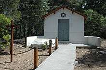
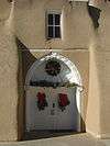
San Ysidro Oratorio |
|
January 5, 1984
(#84003060) |
State Road 240
36°23′12″N 105°37′41″W / 36.386667°N 105.628056°W / 36.386667; -105.628056 (San Ysidro Oratorio) |
Los Cordovas |
SRCP |
| 35 |
Taos Downtown Historic District |
|
July 8, 1982
(#82003340) |
State Roads 3 and 240
36°24′24″N 105°34′23″W / 36.406667°N 105.573056°W / 36.406667; -105.573056 (Taos Downtown Historic District) |
Taos |
SRCP |
| 36 |
Taos Inn |
|
February 5, 1982
(#82003341) |
Pueblo del Norte
36°24′28″N 105°34′20″W / 36.407778°N 105.572222°W / 36.407778; -105.572222 (Taos Inn) |
Taos |
SRCP |
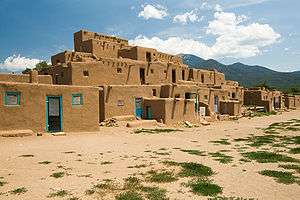
| 37 |
Taos Pueblo |
|
October 15, 1966
(#66000496) |
3 miles north of Taos
36°28′19″N 105°33′35″W / 36.47191°N 105.5597°W / 36.47191; -105.5597 (Taos Pueblo) |
Taos |
SRCP |
| 38 |
Tres Piedras Administrative Site |
|
August 5, 1993
(#92000341) |
West of U.S. Route 285, north of Tres Piedras
36°39′13″N 105°58′10″W / 36.653611°N 105.969444°W / 36.653611; -105.969444 (Tres Piedras Administrative Site) |
Tres Piedras |
|
| 39 |
Tres Piedras Railroad Water Tower |
|
February 2, 1979
(#79001560) |
Off U.S. Route 285
36°38′51″N 105°57′55″W / 36.6475°N 105.965278°W / 36.6475; -105.965278 (Tres Piedras Railroad Water Tower) |
Tres Piedras |
SRCP |
| 40 |
Turley Mill and Distillery Site |
|
November 16, 1978
(#78001833) |
11 miles (17.6 km) north of Taos
36°32′23″N 105°37′19″W / 36.539722°N 105.621944°W / 36.539722; -105.621944 (Turley Mill and Distillery Site) |
Taos |
SRCP |
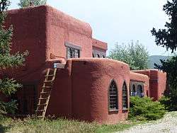
| 41 |
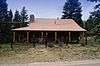
Brigham J. Young House |
|
February 23, 1984
(#84003063) |
Main St.
36°42′23″N 105°24′00″W / 36.706389°N 105.4°W / 36.706389; -105.4 (Brigham J. Young House) |
Red River |
SRCP |
.jpg)
.jpg)
.jpg)