National Register of Historic Places listings in Sandoval County, New Mexico
This is a list of the National Register of Historic Places listings in Sandoval County, New Mexico.
This is intended to be a complete list of the properties and districts on the National Register of Historic Places in Sandoval County, New Mexico, United States. Latitude and longitude coordinates are provided for many National Register properties and districts; these locations may be seen together in a map.[1]
There are 63 properties and districts listed on the National Register in the county, including 5 National Historic Landmarks. All of the places listed on the national register are also recorded on the State Register of Cultural Properties with the exception of Big Bead Mesa, Puye Ruins, and Sandia Cave. In addition to these, Jemez State Monument and Kuaua Ruin are New Mexico Historic Sites.
- This National Park Service list is complete through NPS recent listings posted October 11, 2018.[2]
| Bernalillo – Catron – Chaves – Cibola – Colfax – Curry – De Baca – Doña Ana – Eddy – Grant – Guadalupe – Harding – Hidalgo – Lea – Lincoln – Los Alamos – Luna – McKinley – Mora – Otero – Quay – Rio Arriba – Roosevelt – San Juan – San Miguel – Sandoval – Santa Fe – Sierra – Socorro – Taos – Torrance – Union – Valencia |
Current listings
| [3] | Name on the Register[4] | Image | Date listed[5] | Location | City or town | Description |
|---|---|---|---|---|---|---|
| 1 | Abenicio Salazar Historic District | June 6, 1980 (#80002569) |
U.S. Route 85 35°18′50″N 106°32′44″W / 35.313889°N 106.545556°W |
Bernalillo | ||
| 2 | Amoxiumqua Site (FS-530, LA481) |  |
May 21, 1984 (#84002979) |
Address Restricted |
Jemez Springs | |
| 3 | Archeological Site FS-18, LA-5920 | |
May 21, 1984 (#84002986) |
Address Restricted |
Jemez Springs | |
| 4 | Archeological Site FS-199, LA-135 | |
May 21, 1984 (#84002989) |
Address Restricted |
Jemez Springs | |
| 5 | Archeological Site FS-3 | |
May 21, 1984 (#84002982) |
Address Restricted |
Jemez Springs | LA 44000 |
| 6 | Archeological Site FS-535, LA-385 | |
May 21, 1984 (#84002991) |
Address Restricted |
Jemez Springs | |
| 7 | Archeological Site FS-554, LA-386 | |
May 21, 1984 (#84002993) |
Address Restricted |
Jemez Springs | |
| 8 | Archeological Site FS-574 | |
May 21, 1984 (#84002997) |
Address Restricted |
Jemez Springs | LA 24789 |
| 9 | Archeological Site FS-575 | |
May 21, 1984 (#84003001) |
Address Restricted |
Jemez Springs | LA 24790 |
| 10 | Archeological Site FS-580, LA-137 | |
May 21, 1984 (#84003002) |
Address Restricted |
Jemez Springs | |
| 11 | Archeological Site FS-647, LA-128 | |
May 21, 1984 (#84003005) |
Address Restricted |
Jemez Springs | |
| 12 | Archeological Site FS-688 | |
May 21, 1984 (#84003007) |
Address Restricted |
Jemez Springs | LA 44001 |
| 13 | Archeological Site FS-689, LA-403 | |
May 21, 1984 (#84003008) |
Address Restricted |
Jemez Springs | |
| 14 | Archeological Site FS-8 | |
May 21, 1984 (#84002984) |
Address Restricted |
Jemez Springs | LA 46341 |
| 15 | Archeological Site No. AR-03-10-03-620 | |
April 19, 1990 (#90000590) |
Address Restricted |
Jemez Springs | |
| 16 | Astialakwa Archeological District (FS-360, LA-1825) | |
May 21, 1984 (#84003010) |
Address Restricted |
Jemez Springs | |
| 17 | Bandelier CCC Historic District | .jpg) |
May 28, 1987 (#87001452) |
Off State Road 4 35°46′50″N 106°16′03″W / 35.780556°N 106.2675°W |
Bandelier National Monument | Extends into Los Alamos County |
| 18 | Bandelier National Monument | 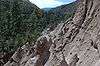 |
October 15, 1966 (#66000042) |
12 miles (19 km) south of Los Alamos on State Road 4 35°46′32″N 106°19′06″W / 35.775556°N 106.318333°W |
Los Alamos | Extends into Los Alamos and Santa Fe Counties; boundary increase December 10, 2014 |
| 19 | Big Bead Mesa | |
October 15, 1966 (#66000958) |
Address Restricted |
Casa Salazar | |
| 20 | Boletsakwa Site (FS-2, LA-136) | |
May 21, 1984 (#84003011) |
Address Restricted |
Jemez Springs | |
| 21 | Borrego Mesa Agricultural Site | |
April 19, 1990 (#90000591) |
Address Restricted |
Jemez Springs | |
| 22 | Cochiti Pueblo | 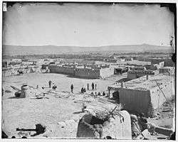 |
November 20, 1974 (#74001205) |
27 miles (43 km) southwest of Santa Fe on the Rio Grande 35°36′32″N 106°20′41″W / 35.608889°N 106.344722°W |
Cochiti | |
| 23 | Espinaso Ridge Pueblo | |
January 27, 1984 (#84003012) |
Address Restricted |
Budaghers | |
| 24 | Forest Service Archeological Site No. FS-7 | |
May 21, 1984 (#84003050) |
Address Restricted |
Jemez Springs | LA 483 |
| 25 | Guacamayo Site (FS0572, LA-189) | |
May 21, 1984 (#84003016) |
Address Restricted |
Jemez Springs | |
| 26 | Guadalupe Ruin | 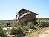 |
March 24, 1980 (#80002571) |
Address Restricted |
Guadalupe | |
| 27 | Hanakwa Site (FS-578) | |
May 21, 1984 (#84003019) |
Address Restricted |
Jemez Springs | |
| 28 | Holiday Mesa Logging Camp | |
September 11, 1992 (#92001181) |
Address Restricted |
Jemez Springs | |
| 29 | Hot Springs Pueblo (FS-505, Bj-73) | |
May 21, 1984 (#84003022) |
Address Restricted 35°49′42″N 106°38′37″W / 35.8283°N 106.6436°W |
Jemez Springs | |
| 30 | Jemez Cave | |
April 19, 1990 (#90000593) |
Address Restricted |
Jemez Springs | |
| 31 | Jemez Pueblo | 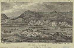 |
May 2, 1977 (#77000926) |
28 miles (45 km) north of Bernalillo on State Road 4 35°36′49″N 106°43′41″W / 35.613611°N 106.728056°W |
Jemez Pueblo | |
| 32 | Jemez State Monument | 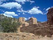 |
March 14, 1973 (#73001147) |
State Road 4 35°46′38″N 106°41′11″W / 35.777222°N 106.686389°W |
Jemez Springs | State Historic Site |
| 33 | Kiashita Site | |
May 21, 1984 (#84003023) |
Address Restricted 35°49′39″N 106°44′30″W / 35.8275°N 106.7417°W |
Jemez Springs | |
| 34 | Kiatsukwa Site (FS-31 and 504, LA-132 and 133) | |
May 21, 1984 (#84003026) |
Address Restricted |
Jemez Springs | |
| 35 | Kuaua Ruin |  |
January 1, 1976 (#76001199) |
Address Restricted 35°19′51″N 106°33′26″W / 35.3308°N 106.5572°W |
Bernalillo | Coronado State Historic Site |
| 36 | Kwastiyukwa Site (FS-11, LA-482) | |
May 21, 1984 (#84003029) |
Address Restricted |
Jemez Springs | |
| 37 | Nanishagi Site (FS-320, LA-541) | |
May 21, 1984 (#84003033) |
Address Restricted |
Jemez Springs | |
| 38 | Our Lady of Sorrows Church | 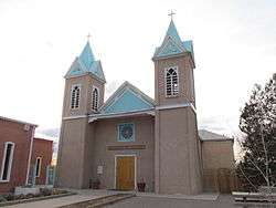 |
April 29, 1977 (#77000927) |
U.S. Route 85 35°18′55″N 106°32′48″W / 35.315278°N 106.546667°W |
Bernalillo | |
| 39 | Patokwa Site (FS-5, LA-96) | |
May 21, 1984 (#84003037) |
Address Restricted |
Jemez Springs | |
| 40 | Pejunkwa Site (FS-571, LA-130) | |
May 21, 1984 (#84003039) |
Address Restricted |
Jemez Springs | |
| 41 | Pueblo of Santo Domingo (Kiua) | 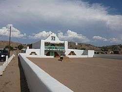 |
December 12, 1973 (#73001145) |
35 miles (56 km) northeast of Albuquerque, off Interstate 25 35°30′49″N 106°21′49″W / 35.513611°N 106.363611°W |
Albuquerque | |
| 42 | Pueblo Tuerto | |
January 19, 1984 (#84003042) |
Address Restricted |
Budaghers | |
| 43 | Puye Ruins | 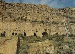 |
October 15, 1966 (#66000481) |
Address Restricted |
Espanola | Extends into Rio Arriba County |
| 44 | Roosevelt School | March 15, 1996 (#96000266) |
Calle Malinche 35°18′16″N 106°33′04″W / 35.304444°N 106.551111°W |
Bernalillo | ||
| 45 | San Jose de las Huertas | |
July 5, 1990 (#90001029) |
Address Restricted |
Placitas | |
| 46 | San Jose de los Jemez Mission and Giusewa Pueblo Site | 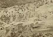 |
October 16, 2012 (#12001007) |
18160 New Mexico State Road 4 35°46′43″N 106°41′12″W / 35.778532°N 106.686571°W |
Jemez Springs | |
| 47 | San Juan Mesa Ruin | |
July 9, 1970 (#70000408) |
Address Restricted |
Jemez Springs | |
| 48 | San Ysidro Church | 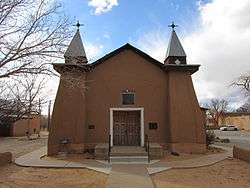 |
July 30, 1980 (#80002570) |
Church Rd. 35°14′01″N 106°36′53″W / 35.233611°N 106.614722°W |
Corrales | |
| 49 | Sandia Cave | 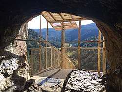 |
October 15, 1966 (#66000487) |
Address Restricted 35°15′17″N 106°24′22″W / 35.2546°N 106.4061°W |
Bernalillo | |
| 50 | Santo Domingo Indian Trading Post | January 9, 1998 (#97001592) |
Former U.S. Route 66 crossing of the Santa Fe railroad tracks at Domingo 35°30′41″N 106°19′14″W / 35.511389°N 106.320556°W |
Domingo | ||
| 51 | Tamaya | November 1, 1974 (#74001204) |
North of Bernalillo 35°25′41″N 106°37′03″W / 35.428056°N 106.6175°W |
Bernalillo | Santa Ana Pueblo | |
| 52 | Tonque Pueblo | |
January 12, 1984 (#84003045) |
Address Restricted 35°21′49″N 106°21′07″W / 35.3636°N 106.3519°W |
Tejon Grant | |
| 53 | Tostaskwinu Site (FS-579, LA-479) | |
May 21, 1984 (#84003047) |
Address Restricted |
Jemez Springs | |
| 54 | Tovakwa Site | |
May 21, 1984 (#84003049) |
Address Restricted |
Jemez Springs | |
| 55 | Unshagi Site (FS-337, LA-123) | |
May 21, 1984 (#84003051) |
Address Restricted |
Jemez Springs | |
| 56 | Virgin Canyon Logging Camp No. 1 | |
September 11, 1992 (#92001180) |
Address Restricted |
Jemez Springs | |
| 57 | Virgin Mesa Logging Camp No. 1 | |
September 11, 1992 (#92001182) |
Address Restricted |
Jemez Springs | |
| 58 | Virgin Mesa Logging Camp No. 2 | |
September 11, 1992 (#92001183) |
Address Restricted |
Jemez Springs | |
| 59 | Virgin Mesa Logging Camp No. 3 | |
September 11, 1992 (#92001184) |
Address Restricted |
Jemez Springs | |
| 60 | Virgin Mesa Rock Art Site | |
April 19, 1990 (#90000592) |
Address Restricted |
Jemez Springs | |
| 61 | Wabakwa Site (FS-400, LA-478) | |
May 21, 1984 (#84003052) |
Address Restricted |
Jemez Springs | |
| 62 | Wahajhamka (FS-573) | |
May 21, 1984 (#84003053) |
Address Restricted |
Jemez Springs | |
| 63 | Zia Pueblo | 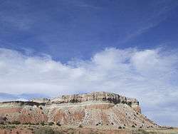 |
April 3, 1973 (#73001146) |
18 miles (29 km) west of Bernalillo on State Road 44 35°30′22″N 106°43′41″W / 35.506111°N 106.728056°W |
Zia Pueblo |
See also
| Wikimedia Commons has media related to National Register of Historic Places in Sandoval County, New Mexico. |
References
- ↑ The latitude and longitude information provided in this table was derived originally from the National Register Information System, which has been found to be fairly accurate for about 99% of listings. For about 1% of NRIS original coordinates, experience has shown that one or both coordinates are typos or otherwise extremely far off; some corrections may have been made. A more subtle problem causes many locations to be off by up to 150 yards, depending on location in the country: most NRIS coordinates were derived from tracing out latitude and longitudes from USGS topographical quadrant maps created under the North American Datum of 1927, which differs from the current, highly accurate WGS84 GPS system used by most on-line maps. Chicago is about right, but NRIS longitudes in Washington are higher by about 4.5 seconds, and are lower by about 2.0 seconds in Maine. Latitudes differ by about 1.0 second in Florida. Some locations in this table may have been corrected to current GPS standards.
- ↑ "National Register of Historic Places: Weekly List Actions". National Park Service, United States Department of the Interior. Retrieved on October 11, 2018.
- ↑ Numbers represent an ordering by significant words. Various colorings, defined here, differentiate National Historic Landmarks and historic districts from other NRHP buildings, structures, sites or objects.
- ↑ National Park Service (2008-04-24). "National Register Information System". National Register of Historic Places. National Park Service.
- ↑ The eight-digit number below each date is the number assigned to each location in the National Register Information System database, which can be viewed by clicking the number.
| Topics | |
|---|---|
| Lists by states |
|
| Lists by insular areas | |
| Lists by associated states | |
| Other areas | |
| |
Municipalities and communities of Sandoval County, New Mexico, United States | ||
|---|---|---|
| City | | |
| Towns | ||
| Villages | ||
| CDPs | ||
| Unincorporated community | ||
| Indian reservations | ||
| Footnotes | ‡This populated place also has portions in an adjacent county or counties | |